The Latest
— Third fire in Glacier prompts evacuation warnings on Canadian border
— Caribou Fire destroys at least 10 homes near Eureka
— West Fork Fire near Libby burns 3,600 acres
Updated: Sept. 5, 5 p.m.
The Flathead County Commission declared a state of emergency Tuesday as fires continue to rage across western Montana and the Pacific Northwest.
The declaration allows the county to access emergency funds to respond to fires and gives the sheriff the authority to close land access during times of extreme fire danger.
The last time the county commission declared a state of emergency was during the 2015 fire season.
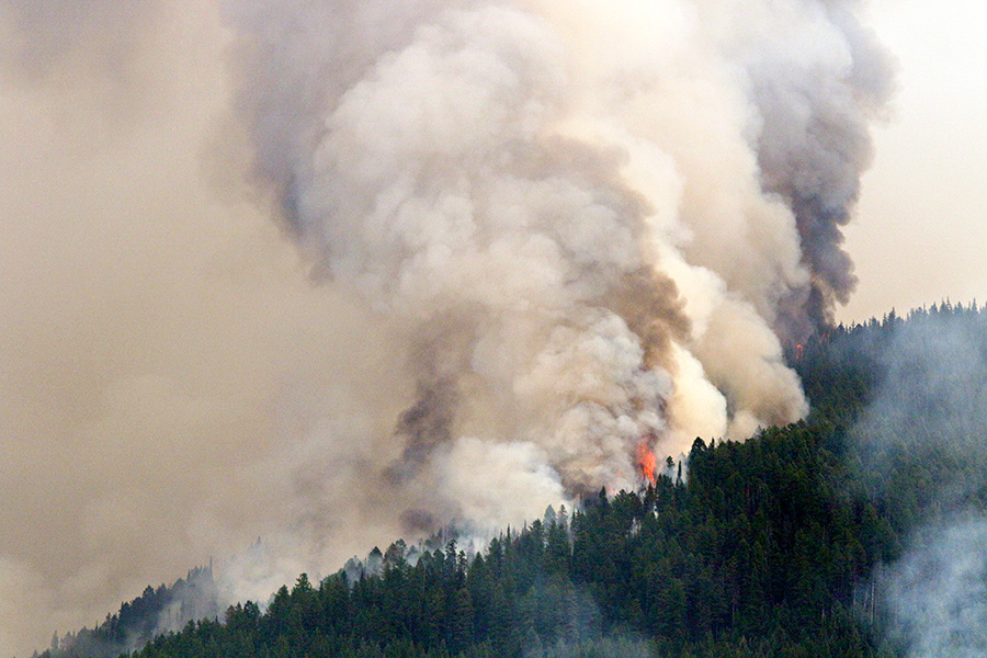
On Tuesday, three major fires were burning in Glacier National Park. The Sprague Fire has burned 13,343 acres just east of Lake McDonald, prompting the evacuation from the south end of Lake McDonald all the way to Logan Pass. The heavy smoke and calmer winds have significantly slowed fire activity. As of Tuesday morning, the fire was 35 percent contained. Fire managers are concerned that the fire could spread west toward Lake McDonald.
Fire managers and Glacier National Park officials will be hosting a public meeting on Wednesday, Sept. 6. The meeting will be at the Glacier Park Headquarters Community Building in West Glacier at 7 p.m.
The Adair Peak Fire has burned more than 1,300 acres near Logging Lake, just east of Polebridge, prompting the closure of the Logging Creek and Quartz Creek campgrounds and a number of area trails. Due to limited resources, only three firefighters were assigned to the blaze on Tuesday morning. The Elder Creek Fire prompted an evacuation warning in Moose City, a small community on the Canadian border north of Polebridge. The fire has torched 1,800 acres in British Columbia and crossed into the United States over the weekend, burning between 50 and 150 acres in Glacier Park, according to Sheriff Chuck Curry. That fire threatens about 20 structures.
On the Kootenai National Forest, the Caribou Fire has burned more than 19,000 acres on the west side of Lake Koocanusa, prompting the evacuation of the community of West Kootenai. Lincoln County Sheriff Roby Bowe said at least 10 homes have been lost to the fire. East of Eureka, the Gibralter Ridge Fire has burned 7,100 acres and is 27 percent contained.
The West Fork Fire is located in the Quartz Creek and Bobtail Ridge area on the Libby Ranger District and was estimated at 3,679 acres on Monday, prompting a number of evacuation warnings just north of Libby.
The Highway 200 Complex fires include the Readers Fires, Miller Fire, Moose Peak Fire and the Cub Fire on the Cabinet Ranger District and Deep Creek and Sheep Gap Fires on the Plains-Thompson Falls Ranger District on the Lolo National Forest. These fires are now estimated at 13,000 acres with zero percent containment.
Seven fires are currently burning in the Spotted Bear Ranger District on the Flathead National Forest and with active fire growth on several of the fires, district officials have closed trails for public safety. The fires are burning in the Bob Marshall and Great Bear Wilderness areas. Significant stretches of the Continental Divide Trail (CDT) are affected by the fires and trail closures.