Rising Waters
Widespread flooding hits Montana, including historic river levels in Missoula, while lingering snowpack and increasing temperatures will keep state on alert for weeks
By Myers Reece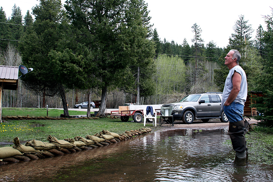
Floods have hammered Montana hard and early, from the northeastern plains across the Hi-Line into central and western municipalities, with other areas on alert as temperatures rise and snowpack persistently clings to mountaintops, containing significant amounts of yet-to-be-released water.
Gov. Steve Bullock declared a statewide flood emergency on May 2, which allows for the mobilization of state resources and the Montana National Guard to protect “life, health, and property.” That came on the heels of the governor’s April 18 state of emergency declaration for flooding in seven Hi-Line counties, the Fort Belknap Indian Reservation and town of Chester due to the potential for “widespread damage to farmland, private residences, and critical infrastructure.”
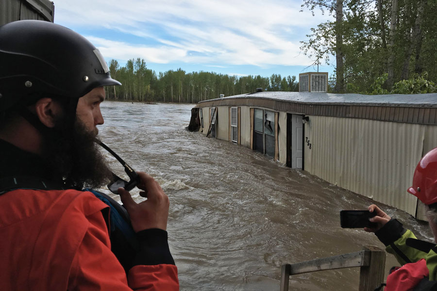
River levels have broken records as hundreds of homes have been evacuated or given evacuation notices, including more than 800 in the Missoula area alone, where the Clark Fork River crested over the weekend to its highest level since 1908, and has kept neighborhoods underwater since the beginning of May. Previous historic floods in Missoula typically didn’t peak until June.
The Clark Fork receded over the weekend due to cooler temperatures but was forecast to rise again to even higher levels by this upcoming weekend.
Low-elevation snowmelt and untimely rain were the early culprits, while warm weather will increasingly unleash water trapped in high-elevation snow. The question for forecasters, emergency services personnel and residents is how gradual or rapid the remaining snowmelt runoff proves to be, and whether rainstorms continue adding more water to the volatility.
No matter what happens, the consensus is that a long season of high water is in store for Montana, including in and around populous western towns and cities, with river levels likely not stabilizing until well into June in many areas.
“So much of it depends on the weather,” said Seeley Lake Rural Fire District Chief Mike Greer, whose daily routine in recent weeks has been consumed by monitoring flooded areas and speaking with property owners in his area.
“If we get a really big spurt of warm weather, enough to start that high-level melting, that’s where we could see real problems.”
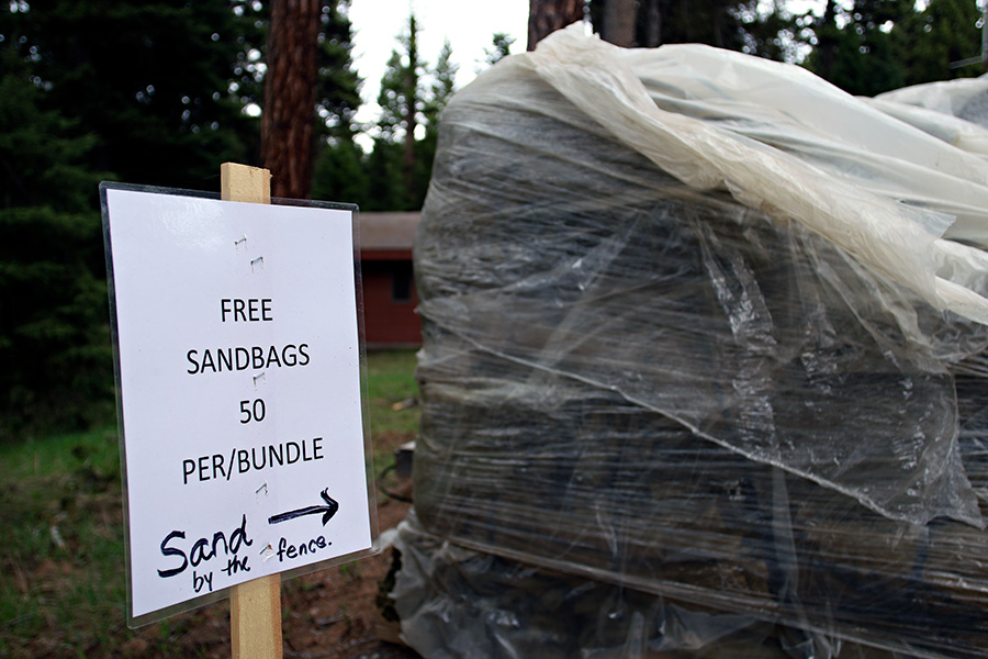
In Seeley Lake, up to 30 homes have been impacted during multi-week flooding. Most are unoccupied summer residences, but residents in a number of other houses are either staying with friends and family or sticking it out with the help of sandbags and preparation measures.
Missoula County’s disaster and emergency services department delivered sandbags, while its health department provided water test kits to identify potential contamination from flooding. American Red Cross set up a shelter at Mission Bible Fellowship. Last week four shelter workers deployed from Idaho were manning the church, although no residents had needed it yet.
American Red Cross also opened shelters in Missoula and Helena and deployed volunteers on standby in Ravalli County. Red Cross encourages residents affected or potentially affected by rising water to call a 24/7 hotline at (800) 272-6668.
On May 9, a few miles down the highway from the Seeley Lake shelter, Bruce Graham sat in a lawn chair leisurely reading a newspaper in his yard as floodwaters flowed around his feet.
Graham and his wife, Kathy, have lived on the property just south of Seeley Lake since the early 1980s, and Kathy said this year’s flooding is the worst they’ve seen, rivaled only by 1997. Their house was surrounded by sandbags, and they couldn’t use their toilet, but they weren’t too bothered by it all.
“We’re feeling lucky,” Kathy said. “It could be a lot worse. We’re still living in our house. That’s good, right?”
“If they said, ‘you have to go, you’re going to die,’ I’d go. But I don’t know about him,” she added, pointing to Bruce.
The Grahams’ stoic approach reflects the self-sufficient mindset of their community, which was hit hard by fires and hazardous smoke last summer and is now bracing for a prolonged flood season, yet residents so far seem content to deal with matters on their own without much assistance from outside emergency services.
“It’s Seeley Lake — people handle things pretty well,” Greer said. “It’s got to be pretty bad before people get too excited here.”
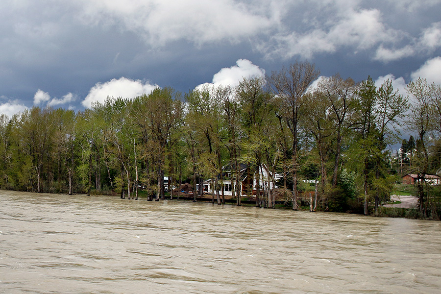
The Flathead River basin has largely been spared thus far, although the main stem, South Fork and Middle Fork all exceeded all-time high flows on May 9 and May 10, in terms of cubic-feet per second recorded on those dates, according to data from the U.S. Geological Survey.
The Flathead receded due to cooler temperatures over the weekend but is forecast to rise again this week to its highest level yet this year, well into minor flood stage.
Ample snowpack remains in the surrounding mountains, making the long-term outlook uncertain and weather dependent. The snowpack, or snow-water equivalent, was 134 percent of normal in the Flathead basin as of Monday and 213 percent of normal in the Sun, Teton and Marias area.
“Looking further out into the future is when we’ll possibly see more of the major issues in the Flathead,” said Travis Booth, a meteorologist with the NWS in Missoula.
Elsewhere in Montana, the Blackfoot River and tributaries were threatening 100 homes in Lincoln along Highway 200 late last week.
“It’s pretty ugly,” Zach Muse, fire chief of Lincoln Fire-Rescue, told the Great Falls Tribune, adding: “We’re just in the beginning of this.”
In north-central and northeastern Montana, the Milk and Marias river basins experienced significant flooding in April, leading to Bullock’s state of emergency declaration, and then receded in recent weeks, although not before impacting farmland and properties, including in the Glasgow area. As those rivers subsided, the Musselshell River near Shawmut rose to major flood stage over the weekend.
The Great Falls National Weather Service updated an advisory earlier this week stating that flooding will continue to affect portions of Broadwater, Jefferson, Meagher, Gallatin and Lewis and Clark counties. Although rivers receded over the weekend, the NWS said warm weather will likely increase flooding again in some areas.
“This is a long-term flood event,” the NWS stated.
In Sanders County, the Clark River is on the rise and expected to top out near moderate flood stage this weekend. The river hadn’t flooded any houses as of Monday, county emergency manager Bill Naegeli said, but was eroding banks near a few homes.
The river also eroded banks near the town of Plains’ wastewater treatment plant, threatening to collapse the sewage lagoons. The U.S. Army Corps of Engineers was dispatched to stabilize the banks.
“It’s looking like they have a good handle on it,” Naegeli said.
The National Weather Service in Missoula said slow-moving thunderstorms with heavy downpours were expected to hit Western Montana Wednesday afternoon and evening, causing rapid rises in small streams and creeks with localized flooding.
For updated flood and weather information, visit www.weather.gov/mso.
High Water by the Numbers
13.82 feet — Clark Fork River level on May 11, the second-highest on record, trailing only the historic flood of 1908
800+ — number of homes under evacuation notices in Missoula
47,400 cubic feet per second (cfs) — Flathead River flow near Columbia Falls on May 10, the highest recorded on that date, surpassing previous record set in 1958
5,730 cfs — Swan River flow near Bigfork, the highest recorded on that date, surpassing previous record set in 1947
20,800 cfs — South Fork Flathead River flow near Hungry Horse on May 10, the highest recorded on that date, surpassing record set in 1976
134 percent of normal — Flathead River basin snowpack as of May 14
213 percent of normal — snowpack in the Sun, Teton and Marias area as of May 14