It’s no secret why people keep flocking to Northwest Montana in record numbers every summer — just take a look outside on a sunny afternoon.
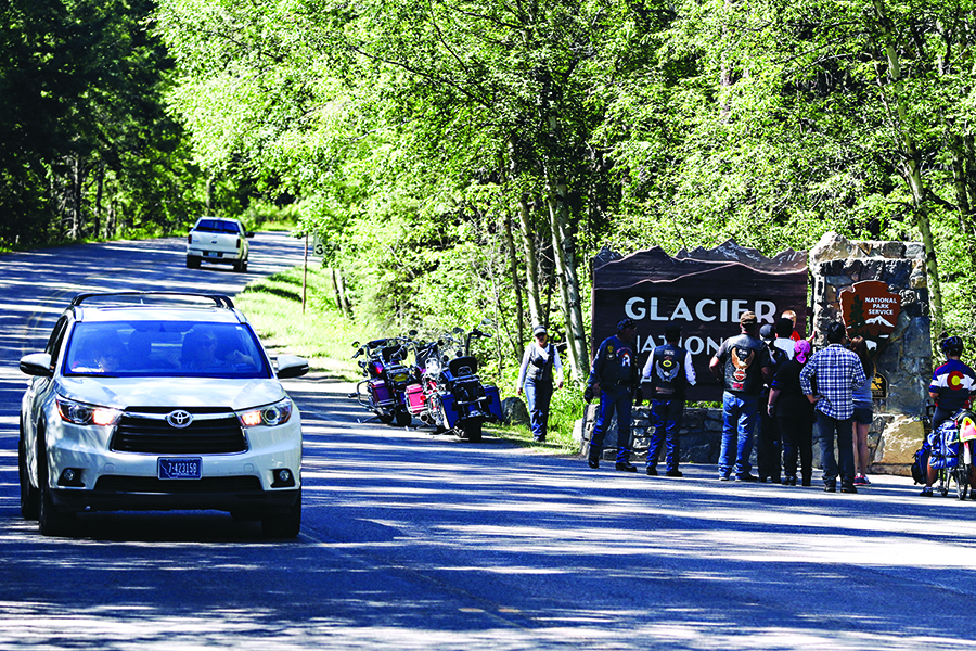
But as visitation records are broken with regularity at Glacier National Park, the park itself and other popular destinations are feeling the crunch from the unprecedented crowds and, as a result, more and more visitors are being met with closed gates, slow-moving traffic and jam-packed parking lots. So stuck balancing the economic boom tourism brings and preserving the serenity of nature, stakeholders from Glacier National Park, the Flathead National Forest, Montana Fish, Wildlife and Parks, and members of the local hospitality industry met last week at Flathead Valley Community College to try and solve an admittedly difficult conundrum.
The impetus for bringing everyone together was to stress improved communication amongst the groups and to show off some of the new tools being created to alert visitors and residents alike about where to escape the bumper-to-bumper backups.
Of course, no matter how hard other areas may be pushed, visitors are still going to pour into Glacier Park and Superintendent Jeff Mow said the park is encouraging visitors to “have a backup plan” this summer. In 2017, Glacier regularly had to put measures in place at locations like Logan Pass, Bowman Lake and Many Glacier to limit access due to overcrowding. Officials restricted access in some way on 53 different dates at the Logan Pass parking lot and on Bowman Lake Road in 2017, and at times had blockades in place in nine unique locations last summer. All affected areas, including the Avalanche parking lot, Kintla Lake Road and the Many Glacier Valley, were hit hardest last July, when Glacier drew more than 1 million visitors, exceeding even Yellowstone National Park.
“Glacier National Park is just not designed to carry more visitors than Yellowstone,” Mow said.
In response, Mow said his team will be regularly providing real-time updates via the park’s social media channels regarding closures and other restrictions in 2018. In addition, some parking spots in the Logan Pass lot will be converted to short-term (either one or two-hour) spaces in order to cycle visitors in and out, and the effort may be extended to other lots.
When restrictions were in place last year visitors generally were understanding, according to Mow, and would either return to the blocked location later, once restrictions were lifted, or find other ways to experience the park. That fits the “have a backup plan” idea Mow espoused, and is something that starts when out-of-town guests first arrive at area hotels or campsites.
“The first-time visitor is doing Going-to-the-Sun Road; that’s on their bucket list as it should be,” Diane Medler, director of the Kalispell Convention and Visitor Bureau, said. “We want to give them realistic expectations and let people know all the other wonderful things there are to do in this area.”
Those other things include lands within Montana State Parks and the Flathead National Forest, places that have experienced increased visitation in line with Glacier at their most-popular locations but still have plenty of open land and water where those recreating can stretch their legs.
Dave Landstrom, Region 1 park manager for Montana Fish, Wildlife and Parks, noted that while State Parks campgrounds are filled at 90 to 100 percent capacity through Labor Day and overall visitation in the region has shot up 28 percent in the last 10 years, there are underutilized locations like the Thompson Chain of Lakes and Lake Mary Ronan that can accommodate additional traffic.
Chip Weber, Flathead National Forest supervisor, likewise said that while millions of visitors travel through forest service land each summer, spots like the Hungry Horse Reservoir can provide a remote experience for visitors who seek them out.
In order to find some of those lesser-known places, Mow, Landstrom, Weber and officials with the Foys-to-Blacktail Trail, Whitefish Trails and many others have been working collaboratively as part of the PATHS committee to bring all of the available outdoor recreation together in one central place.
The group has created an in-progress map that is currently accessible online and, Medler said, down the road could be a place where real-time trail conditions and closures would be updated. That Geographic Information Systems map would also work in conjunction with a separate project being undertaken by the Crown of the Continent Geotourism Program and Project Coordinator Sheena Pate. On the Crown of the Continent’s website, visitors can browse through curated trip plans or build a custom trip themselves, using pre-loaded trails and other recreational activities. For example, a trip Pate created through Bigfork includes a stop at Wayfarers State Park, continues with a hike to Strawberry Lake and extends through the Jewel Basin. The 10-stop trip, according to the website, could be knocked out in a single day.
“What (Sheena)’s doing is the inspirational piece,” Medler said. “Particularly in talking to visitors, they want to get a sense of what’s out there for trails.”
The goal of the PATHS committee and the Crown of the Continent is to integrate the tools together, and create a one-stop spot for visitors and locals to go to see all there is in Northwest Montana, not just on Going-to-the-Sun Road.
“We all have the same goal, to protect our resources but to offer great adventures for our residents and visitors,” Medler said. “We just all need to communicate and have the good resources to send people to, to plan their day and plan their trip.”