This story was last updated on Aug. 15. Click here for the latest wildfire news from Northwest Montana.
— Evacuation warning issued for area near Essex
— Glacier fire crews expected more activity with Wednesday winds
— Optimism from officials on fires west of Eureka
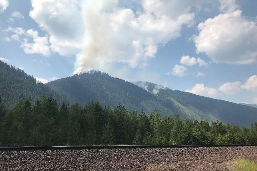
Flathead County Sheriff Chuck Curry issued an evacuation warning Wednesday afternoon to a small number of residents near Essex due to the possibility of the Paola Ridge Fire extending close to or into the community.
Curry’s 12:30 p.m. warning was based on the recommendation of the incident command and fire experts involved with the Paola Ridge Fire, according to a post on the Flathead County Office of Emergency Services’ Facebook page.
Sheriff deputies are directly notifying affected residents.
“Specific area under this evacuation warning is from mile marker 176 to mile marker 179, including Branch Rd, Bugling Elk Trail, Dickey Creek Loop, Eagle Haunts Run, and Lazy Moose Trail,” the warning stated.
People are advised to avoid this area and allow firefighters to operate safely. U.S. Highway 2 remains open, but motorists are advised to reduce speed throughout the area due to the presence of smoke and emergency vehicles. The most recent available data said the fire has burned 370 acres.
Meanwhile, crews in Glacier National Park continue protecting structures from the raging Howe Ridge Fire, which had burned roughly 2,600 acres near Lake McDonald as of Wednesday morning.
Glacier officials expected the lightning-caused fire’s activity to increase as winds increased. The fire, one of about a dozen burning in Northwest Montana, grew minimally on Tuesday.
Two CL-215 Super Scoopers had trouble with visibility in the smoky skies, officials said, though the Type I helicopter effectively cooled spot fires, slowing the overall growth. Ground crews continued to use existing trails as fire breaks, pumping water for sprinklers for structure protection, and cooled hot spots at the residences on North Lake McDonald Road.
As of Wednesday, 78 crew members were battling the blaze, and a Type I team from the Southwest arrived to assume control of the fire later in the week.
The evacuation orders put in place Sunday evening are still in place. The fire has burned at least seven private residences, the main building at Kelly’s Camp Historic District, and other historic buildings owned by the National Park Service.
Stage 2 fire restrictions are in effect in Glacier Park. The Flathead County Commission voted on Tuesday morning to implement Stage 2 fire restrictions at 12 a.m. Thursday. Stage 2 restrictions prohibit campfires and smoking outside.
Outside of Glacier Park, the Coal Ridge Fire continued burning on 331 acres west of Polebridge in the Flathead National Forest. A Type 3 incident management team is managing the fire, and a Type I team will take over management soon.
In the Kootenai National Forest, a Type II Northern Rockies Incident Management Team took over management of the Davis Fire, burning at 5,565 acres, on Wednesday morning. Crews were optimistic about the progress made on the Tenmile Fire, which had burned 681 acres east of Lake Koocanusa as of Wednesday morning. Full containment is expected by Saturday. Nearby, the Sterling Complex had burned 903 acres as of Wednesday.
On the Flathead Indian Reservation, the Garden Creek Fire near Hot Springs remains at 2,052 acres burned, with 210 crew members completing 35 percent containment as of Wednesday morning.
The Gold Hill Fire had burned 80 acres in the Noisy Creek Drainage north of Libby. The Highway 37 Fire was listed as 90 percent contained, and crews were in the process of decontaminating and demobilizing equipment and developing a rehab/repair plan for the incident.