Every year, boaters, floaters, swimmers and whitecap skimmers take to the waters of Northwest Montana. And sure, chugging around in a pontoon boat or firing up the motor to drag around water skiers can be a great source of summer solace, but nothing really beats bonding with the water by wielding a paddle.
Between the hundreds of lakes dotting the region and the alternating rapids and drifts of the Flathead River, it’s easy to find a watery surface to ply your paddle.
Do it for the thrill: Wild Mile Bigfork
In July and August, Wednesday evenings are paddle parties along the Class III and Class IV rapids of the Wild Mile, the lower section of the Swan River in Bigfork. PacifiCorp operates the Bigfork Hydroelectric Project and provides the water flows necessary for the intense whitewater this stretch of river is known for.
Normally spectators line the mile-long stretch for the Bigfork Whitewater Festival every May, but COVID-19 forced the closure of the 45th annual event.
Do it for days: Flathead Lake Marine Trail
There is a completely conceptual route that covers much of Flathead Lake’s 120 miles of shoreline and 188 square miles of water. The Flathead Lake Marine Trail is a network of waypoints, stopovers and access areas that allow for a variety of choose-your-own-adventure sculling sessions ranging from three to 11 miles per section.
The trail is anchored by the five state parks — Wayfarers, Big Arm, Yellow Bay, Finley Point and West Shore — that dot the shoreline of the lake. Each state park offers campsites reserved exclusively for visitors arriving via human-powered watercraft. In addition, the sixth state park, Wild Horse Island, is a staple stop for rowers, although it is day use only.
For a multi-day route with some biologically historical significance, retrace the steps of Lakeside Female, the grizzly sow whose claim to fame was swimming across Flathead Lake in 2015. Starting in Rollins, paddle along the shoreline up to Painted Rocks. Then set out to Cedar Island, and dream about living in the mansion on neighboring Shelter Island. From Cedar, it’s a three-mile paddle southwest to Wild Horse Island. After visiting with the local megafauna, it’s a seven-mile jaunt to Bird Island, just north of Finley Point. A final day paddling north to Yellow Bay will end the journey approximately at the same spot as the Lakeside Female. Trekking across the mountains to Swan Lake is optional.
Do it for the view: Lake McDonald
At 10 miles long, the glacially carved and serene Lake McDonald is the largest body of water inside Glacier National Park. Among the dozen peaks you can see from the lake are Stanton Mountain, the Garden Wall and the Little Matterhorn.
It also makes the ideal scene for paddleboard yoga. What better place is there to do Sun Salutations than next to Going-to-the-Sun Road?
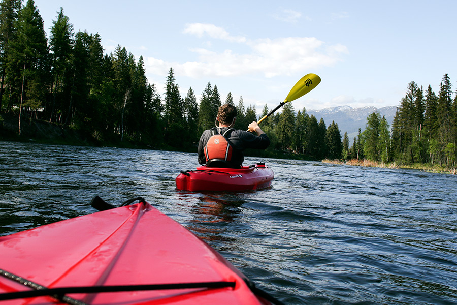
Do it for the wild: Flathead River
There are just five rivers in the state of Montana that are protected under the National Wild and Scenic Rivers System, despite two Montana wildlife biologists conceiving of the legislation while fighting a proposed dam along the Flathead River.
The three tributaries of the Flathead River were designated in 1976. The North and Middle forks form the western and southern boundaries for Glacier National Park, while the South Fork flows out of the Bob Marshall Wilderness and forms Hungry Horse Reservoir. With the designation, the river is protected from impoundments and most development along the shoreline.
Rafting is the best way to cover the 58 miles of the North Fork. Many commercial outfitters near West Glacier offer guided trips, and there are also many public access sites. This tributary is relatively low-key, with Class I-II rapids, but still offers a few chances to flip a boat.
The Middle Fork has its headwaters in the Bob Marshall Wilderness, traverses through the Great Bear Wilderness and then shadows U.S. Highway 2 starting in Essex. Packrafting from Schafer Meadows offers a once-in-a-lifetime 26-mile journey through gin-clear water in the heart of grizzly country.
For a less committed excursion, numerous outfitters guide whitewater trips trips on the Class II-III rapids through the John Stevens Canyon along the edge of the park or lead leisurely scenic floats into West Glacier,
The Lower Flathead, immediately below Kerr Dam, has a commonly run eight-mile stretch of river full of Class III and Class IV rapids. For a longer day on the water, floaters can continue along for 20 miles to Sloan Bridge. This section of river has almost no shore access, making it quiet and isolated. To float this pristine stretch of river along the Flathead Indian Reservation, a recreation permit from the Confederated Salish and Kootenai Tribes is required.