Primary Residences, Outbuildings Among Structure Losses Reported from Elmo Fire
A community meeting about the fire is scheduled for 7 p.m. Wednesday night at the Elmo Pow Wow Grounds off Highway 93
By Mike Kordenbrock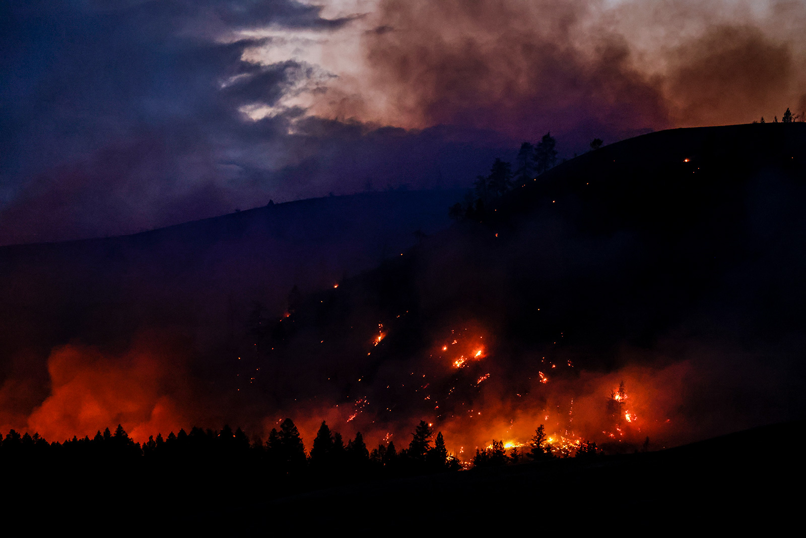
As of late Wednesday morning officials reported that the human-caused Elmo fire has led to the loss of four primary residences and four outbuildings, for a total of eight structures lost.
About 150 residences were under evacuation orders, and another 100 were in pre-evacuation status, according to Sara Rouse, a public information officer on the Elmo fire.
Evacuation orders are in effect for all residents north and south of Highway 352 (Lake Mary Ronan Road), and all residents who live along Lake Mary Ronan, according to a morning update on the fire’s InciWeb page. The same update states that all prior evacuation orders and pre-evacuation orders remained in effect. Lake Mary Ronan Road, Lake Mary Ronan State Park, and the boat ramp at the Elmo fishing access site are all closed.
Winds on Tuesday drove the fire to the north and expanded the fire’s perimeter toward Lake Mary Ronan and Big Meadows, according to InciWeb.
Rouse said she did not know when or where exactly the eight structures had been lost. The fire began burning at about 4:30 p.m. on July 29 between 4 and 8 miles west of Elmo off Highway 28 near mile marker 39 in the Big Draw area, and the most recent estimates put the fire’s size at 18,427 acres. Infrared mapping Wednesday morning showed an increase of 2,201 acres from the previous day. There have been no reports of injuries or loss of life caused by the fire, according to Rouse.
A community meeting about the fire is scheduled for 7 p.m. Wednesday night at the Elmo Pow Wow Grounds off Highway 93.
The fire began on Flathead Reservation land, and so the lead investigative agency on the fire is the Bureau of Indian Affairs. Robyn Broyles, a BIA spokesperson, said two investigators with the Confederated Salish and Kootenai Tribes have been on the ground, and that they do know it’s a human-caused fire. Broyles did not have additional information to share about the investigation, beyond confirming that the investigation remains ongoing. As of Tuesday, firefighting costs on the Elmo fire had reached $3.7 million.
Containment on the fire did increase from 10 percent on Tuesday to 16 percent Wednesday, but Rouse, the public information officer assigned to the fire, said people should expect that number to decrease over the next day. As Rouse explained, the increase actually came from more accurate mapping, but the containment percentage will fluctuate to some degree because of the changing size of the fire. The original 10 percent containment gains reported on the fire were along the fire’s southern edge along Highway 28.
Firefighters are expecting temperatures in the upper 80s to low 90s Wednesday, with low afternoon humidity and increasing, gusty west and southwest winds forecasted to continue into the evening. Forecasts heading into the day showed winds with the potential to push the fire from the southwest, which would test fire lines from a new direction, according to InciWeb.
Crews on the north side of the fire were planning Wednesday to try to improve direct lines on the edge of the fire. Near Lake Mary Ronan, firefighters and heavy equipment planned to continue working on constructing fire lines tying into roads that lead to the state-managed portion of land south of Lake Mary Ronan. Firefighters also planned to continue structure protection and fire mitigation efforts near Lake Mary Ronan.
Firefighting personnel was planning to reinforce fire line on the eastern and western sides of the fire Wednesday, while also extinguishing areas of remaining heat in an effort to better secure areas that have already burned around Chief Cliff and Highway 93 to the east, as well as Cromwell Creek Road to the west.
Speaking late Wednesday morning, Rouse said firefighters were already seeing activity picking up again on the north end of the fire. The fire was particularly active Tuesday on its northern end near Ronan Creek and west of there, but Rouse said the east and west ends of the fire lines held well.
Mid-Monday afternoon, aircraft on the fire were grounded for about an hour due to high winds. The incident management team on the fire had anticipated that winds on Tuesday could ground air resources again, but Rouse said she did not believe they had to ground any aircraft Tuesday.
The Type 2 Northern Rockies Team 7 incident management team on the fire reports that firefighters made progress constructing and reinforcing control lines on the eastern and western sides of the fire, and that with aviation support, improvements were also made on fire lines on the west side of the fire in the Cromwell Creek area. Firefighters also had air support on the north side of the fire, where they worked with heavy equipment on constructing fire line. Firefighters on the north side of the fire also worked to contain spot fires in hay fields. Fire engines patrolling the fire overnight reported that the fire stayed within its current footprint, according to InciWeb.
This story will be updated.