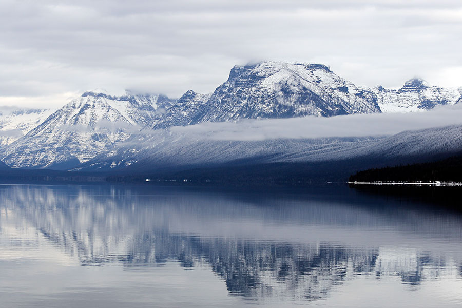
Despite early snowfall in autumn and a recent flurry that padded snowpack levels throughout Montana, regions such as Northwest Montana haven’t been able to overcome prolonged dry periods in December and January, leaving the Flathead River basin’s snowpack below average heading into winter’s stretch run.
The U.S. Department of Agriculture Natural Resources Conservation Service (NRCS) says at this point it’s unlikely basins such as the Flathead and Kootenai will reach average snowpack levels by runoff, barring significant snowfall.
According to a Feb. 6 press release from the NRCS titled “Too Little, Too Late,” periods of “high-pressure during January resulted in sunny skies and above average temperatures in Montana, causing snowpack percentages to decline in many river basins.” Late January storms provided a much-needed boost, particularly in western Montana, but not enough to make up for the preceding lack of snow it.
The Flathead had a higher snow-water equivalent measurement on Jan. 1 at 86 percent of normal, or average, than on Feb. 1, when it was at 83 percent, one of the lowest figures of any basin in the state. The Kootenai basin was at 81 percent on Feb. 1.
“The storms just weren’t enough in the western half of the state to make up for the deficits we’d experienced early in the winter,” said Lucas Zukiewicz, a hydrologist with NRCS. “Even with the impressive totals from the late-month storms, snowfall ended up being below normal for the month of January.”
River basins in Northwest Montana typically experience their “wettest” months of the year from early November through the end of January, the NRCS states. Below-normal snow totals in these areas at this time of year make recovery to normal snowpack conditions before runoff begins less likely.
“For example, the Flathead River basin would need to receive around 135 percent of normal snowfall between now and when the snowpack reaches peak accumulation, which typically occurs sometime in April,” Zukiewicz said. “While that’s not impossible, it would certainly take a major pattern shift from what we’ve seen so far this winter.”
There are a number of basins in Montana with above-average snow-water equivalents, including Gallatin, and several others at 90 percent of normal.
The NRCS measures snowpack in terms of snow-water equivalent, defined as “the amount of liquid water contained within the snowpack.”
“In other words, it is the amount of water that will be released from the snowpack when it melts,” the NRCS states.
Snow-water equivalent is used instead of snow depth because the primary interest is water supply during the spring and summer, when farmers are irrigating, outdoor recreationists are playing on rivers and lakes, water managers are monitoring reservoir levels and everybody is wondering about floods or droughts.
Similar to December, temperatures were above average in January. This weekend’s frigid “arctic event” notwithstanding, the National Oceanic and Atmospheric Administration’s long-range forecasts indicate the continuation of above-average temperatures for February through April.
“That’s something we’ll be keeping an eye on,” Zukiewicz said. “Early runoff doesn’t benefit anyone, so hopefully spring is cooler than anticipated.”