When Kalispell’s Jake Bramante became the first known person to hike all of Glacier National Park’s 734 miles of established trail in a single season, it was clear that the former network analyst had plans to parcel out the knowledge he gleaned from the outdoor feat.
And even though he exhaustively video-blogged the summer adventure and remained in the public eye even while trekking across remote corners of the park, details of the future of Hike 734 – the brand he attached to the hiking mission – were vague.
But in the three years since completing the harried summer of hiking, Bramante has transformed the video blogs into a comprehensive virtual guide to assist all visitors in their park peregrinations and wilderness wanderings, while also providing more traditional back-of-the-pocket resources.
Most recently, Bramante published a high-quality topographic map-guide, with one side featuring 15,000 words of text and the other a detailed map of the park, complete with a legend and color-coded, numeric key designating distances and regions of the park.
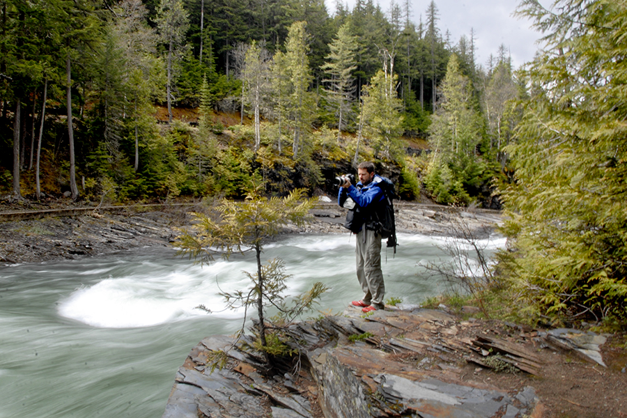
Glacier National Park’s 1 million acres of wild, rugged beauty are laced with 734 miles of trail, ranging rom dense forests to wind-scoured peaks, and marrying the right day hike to a hiker’s ability is a tricky endeavor.
Bramante’s hybrid map-guide uses distance, slope difficulty and personal recommendations to identify 88 hikes and sort them based on degree of difficulty and beauty.
Bramante said he created the map after so many people asked him where they should go hiking. Although most people advised him to publish a guidebook, he wanted something more original, and so he devised the map-guide.
“When I first got off the trail so many people said, ‘dude, if you wrote a guide I would totally buy it,’” Bramante said. “I didn’t want to compete with other guidebooks, so I sat on the idea.”
Last year, he published a Going-to-the Sun Road driving guide that provides interpretive information on more than two-dozen stops along the historic highway, and said the hiking map guide was a natural progression.
“When I came out with my driving guide I really liked the format and thought there’s not really a great marriage of a guide and a map,” he said. “It was the next logical step to go do a hiking guide map.”
Because Bramante obsessively documented his journeys through photographs and videos that he posted to Hike734.com, anyone wishing to follow in his footsteps has a virtual trail map to accompany them.
And that, in many respects, was the point – for the public to learn more about the park and “to be able to vicariously hike the park through Hike734.”
But unlike a smartphone application, Bramante’s map guide doesn’t run out of batteries or overheat in a backpack pocket.
Its synthetic paper is weatherproof, and its color-coded trail segments indicate trail steepness, while the intimately informed trail descriptions provide a good synopsis of the hike.
A former network analyst, Bramante is also technologically savvy, which helped him grasp GIS software in order to create the map himself.
His lifelong passion for Glacier National Park, peak bagging and backpacking led him to conceive of the idea for Hike734, and looking to the future, Bramante intends to begin work on a backpacking-specific guide.
His “Day Hikes of Glacier National Park” features 88 trips ranging from one-mile jaunts to 20-mile traverses. It is available at his website, hike734.com, and numerous western Montana retail outlets for $10.