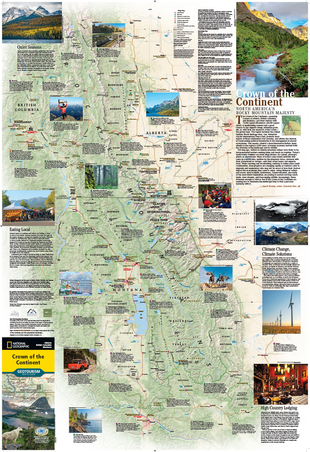
For long-time residents and tourists alike, there is a valuable new resource for exploring the region, a Crown of the Continent Geotourism MapGuide, developed by the Crown of the Continent Geotourism Council in partnership with the National Geographic Society, Montana, Alberta, British Columbia and many other regional partners.
Geotourism promotes a region to visitors while retaining the geographical character and integrity of the destination, and the new MapGuide seeks to do just that by providing a local guide to the more than 18 million acres that make up the Crown of the Continent.
“Geotourism is all-encompassing: it helps the environment, business and the community,” said Sheena Pate, project coordinator at the Crown of the Continent Geotourism Council.
The free map is based on sites nominated by locals, which gives visitors a chance to experience the region in an authentic way. Locals also submit stories about their favorite places, providing the first-time visitor a cultural and historical feel for the place before he or she even sets foot in the region. The map also includes a list of events in the area, so that tourists can plan visits to include Huckleberry Days in Whitefish or Fourth of July festivities in Polebridge.
In order for a submission to be considered for the map, it has to comply with the 13 principles of Geotourism. These principles try to give every tourist a memorable and authentic experience, while avoiding overdevelopment and degradation in the character of a region.
“We’re looking for the quality tourist … people who stay and embrace the region. We want them to go home with great stories and encourage their friends to come,” Pate said.
The physical map is slated to be published every two years, with new entries in every edition, but Pate says that the response from local communities has been so overwhelming that it’s impossible for every eligible entry to make it through. Recently, the MapGuide announced nine openings for its next edition, and soon had 35 entries, all of which would have made great additions, according to Pate.
Luckily for both locals and visitors, the physical map is complemented by an interactive online site, www.crownofthecontinent.net, which provides an exhaustive list of destinations and stories. The website allows visitors to plan their trip online, and is also a way to get the word out about the region. According to Pate, Canada, the U.S. and Europe bring in the most visitors, and it is especially important for potential tourists from the East Coast and Europe to explore the possibilities of the region before coming.
For locals, “we’re encouraging them to explore more, get the authentic experience,” Pate said. “Although most people just think of Glacier National Park when you say Crown of the Continent, we’re showing people that it’s much bigger than that. It goes all the way to Alberta and British Columbia, and in Montana all the way down to Missoula.”
In Waterton-Glacier International Peace Park and Head-Smashed-In Buffalo Jump near Fort McLeod, Alberta, the Crown of the Continent region has two World Heritage sites, which makes it perfect for Geotourism, according to Pate.
“It’s a unique part of the world, we have stuff here that most other states don’t have,” she said.
The Crown of the Continent region is a place that should be celebrated and shared with as many people as possible, but also a place that is particularly vulnerable to the ravages of overdevelopment, Pate noted.
With “quality” tourists spending their money in local establishments while remaining cognizant of the environmental and cultural heritage, the creators are confident the new map can be a win-win-win for locals, visitors and the environment.
“We want to highlight and preserve what makes the region unique,” Pate said.
Free maps can be found online at crownof thecontinent.net.