Updated Aug. 24, 1:45 p.m.
Heavy smoke is hampering aerial operations but ground crews have begun building containment lines around the Sheep Fire, a 581-acre blaze burning one mile from Essex.
Fire activity was moderate Sunday as an inversion settled in with cooler temperatures limited behavior, according to the latest updates from fire officials. The fire is burning in very steep, difficult terrain with limited access in the Great Bear Wilderness. Over 200 structures are at risk, according to fire managers.
Increased fire activity is expected Monday with warmer, drier conditions. Crews are being transported to the fire area on a BNSF work train. Crews will continue fuel break construction in the McDonald Creek Drainage to the north and create fireline from the railroad west up the Sheep Creek Drainage, supported by helicopters.
Air operations continue with two Type 1 helicopters, a Sky Crane and Chinook working on hot spots. A mobile fire retardant base is being used for helicopter bucket drops.
U.S. senators Jon Tester and Steve Daines and Congressman Zinke’s representative John Fuller attended the Sunday night briefing at the Incident Command Post in Coram. A public meeting was held at the Izaak Walton Inn in Essex that night as well.
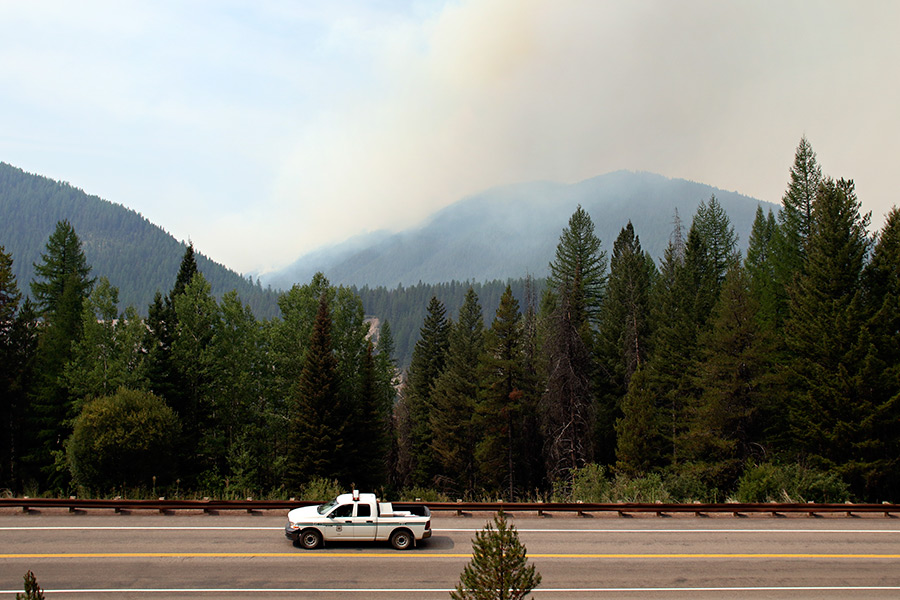
U.S. Highway 2 was reopened Saturday with pilot cars leading traffic in both directions. The pilot cars are running 24 hours a day, but the highway could be closed due to changing fire conditions, according to officials. Drivers should expect delays of 10-15 minutes. Call 511 or visit http://www.mdt.mt.gov/travinfo/alerts.shtml for an updated road status.
BNSF Railway and Amtrak trains have resumed running.
Air quality is “very unhealthy” across the Flathead Valley, according to state health officials. An air quality alert was issued for several counties across Montana, including Glacier, Flathead, Lake, Lewis and Clark, and Lincoln. When air quality is listed as very unhealthy, state and local health officials recommend that people with respiratory or heart disease, the elderly, and children should avoid any outdoor activity; everyone else should avoid prolonged exertion.
Residents in the Highway 2 corridor around Essex remain in the ‘Set’ stage of the “Ready, Set, Go” evacuation strategy. Residents have been advised that they may be evacuated if the Sheep Fire becomes an imminent threat. Fire managers say people should have critical property and needs loaded into their vehicles in preparation for evacuation.
Fire managers hope to keep the fire from growing north towards Essex and moving into the transportation corridor along the Middle Fork of the Flathead River.
Due to the fire’s proximity to the community of Essex, the U.S. Forest Service is allowing the use of fire retardant in the wilderness, as well as chainsaws.
The Granite Fire has burned 247 acres west of Marias Pass, south of Highway 2 in the Great Bear Wilderness. It is burning in very steep terrain in a mixed conifer forest below a ridge.
Crews have implemented structural protection measures on several backcountry cabins, trailhead structures, a wooden road bridge, and a radio repeater. On Monday, crews will look for opportunities to create fireline using access on roads #1651 and #569 and check fire spread into the drainage to the north. The Granite Creek Trail (#156) is closed.
The Thompson Fire has burned 16,515 acres in a remote south-central backcountry area of Glacier National Park. Crews are shifting into a monitoring status and working to finalize containment. It is burning about 15 miles east of the West Glacier entrance in the Thompson and Nyack drainage and west of the Continental Divide.
On Monday, a crew will be flown into the Nyack Creek Drainage and continue to mop up and control fireline as needed.
The fire remains west of the Divide and poses no threat to communities around East Glacier and St. Mary.
Most of Glacier National Park is unaffected by this wildfire complex and is available for recreational use. Limited backcountry closures are in place. For more specific visitor information, see the website http://www.nps.gov/glac/index.htm.
—
Several fires are burning in the Spotted Bear Ranger District, leading to the closure of several parts of the Bob Marshall Wilderness and other areas.
The Bear Creek Fire has burned 19,595 acres. Crews are wrapping several buildings with fire-resistant material, including the Black Bear Cabin, Spotted Bear Lookout and buildings at the Spotted Bear Ranger District compound. In coordination with Flathead County Office of Emergency Services, crews are assessing the three resorts in the area — Diamond R, Spotted Bear Ranch and Wilderness Lodge — for possible structure protection as well.
Wilderness rangers are staged at Black Bear Cabin in the Bob Marshall Wilderness to contact Wilderness users and advise of alternate exit routes.
Access to the Bob Marshall Wilderness will be via western and southern trailheads.
The U.S. Forest Service has closed all areas in the Spotted Bear River Drainage and Middle Fork Drainage. This includes access to and from the Spotted Bear River Road, South Creek Trailhead, Trail Creek Trailhead, Middle Big Bill Trailhead, Beaver Creek Trailhead and Campground, Silvertip Trailhead, Lower Twin Trailhead, and Upper Twin Trailhead.
A large area closure has been developed for the northern end of the Bob Marshall Wilderness for public safety. The closure includes the Meadow Creek Rd. #2826, the Gorge Creek Rd. #549, Meadow Creek and Gorge Creek trailheads, Meadow Creek Airstrip, Eastside South Fork Trail #80 from Meadow Creek Trailhead to Damnation Creek, Gorge Creek Tail #218.
The East Side Road and West Side Road are open and provide access to Spotted Bear Ranger Station, Diamond R Guest Ranch, Spotted Bear Guest Ranch and Wilderness Lodge. Trails are closed out of the respective trailheads listed.
Contact Spotted Bear Ranger District for more information 406-758-5376.
A trail closure is in effect for the Granite Creek Trail # 156. For further information contact Hungry Horse Ranger District 406-387-3800.
Trail closures are in place for the Three Sisters and Moose Ridge fires. This includes trails on the Rocky Mountain Ranger District; the Rock Creek Trail #111, North Fork Red Shale Trail #130, North Wall Trail #174, Gates Creek-Moose Creek Trail #166, Moose Creek Trail #131, and Moose Furman Trail #261. Contact Rocky Mountain Ranger District for more information 406-466-5341. This closure also causes users to alter their National Recreation Trail CDT route and there are several options to consider. Contact Rocky Mountain or Spotted Bear Ranger Districts.
Trail closures are in place in the Upper Middle Fork in the vicinity of Muskrat Pass, Cox Creek, Cap Mountain and Beaver Lake and within the Badger Two Medicine. As a result of these closures the National Recreation Trail CDT route is being rerouted at Gooseberry to Schafer Meadows to Lodgepole Creek and to Badger Creek. The Morrison Creek Trail #154 has been closed on the Hungry Horse Ranger District. Trail access to Schafer Meadows is limited although the airstrip is still open.
An Area Closure is in place on the Seeley Lake Ranger District that closes all access and use of the Pyramid Trailhead. Contact Seeley Lake Ranger District 406-677-2233. Spotted Bear Ranger District and Seeley Lake Ranger District can help with alternative routes.
The Flathead National Forest is in Stage II Fire Restrictions. All forest users are asked to comply and remain diligent on the risks that exist.
The Three Sisters Fire has burned 431 acres in very steep, rocky terrain at high elevation in the upper portions of Three Sisters Creek in the Bob Marshall Wilderness. The fire has crossed over onto the Lewis and Clark National Forest.
The fire is being managed to allow natural fire to play its ecological role in the Wilderness, but fire managers will take suppression action to protect Forest Service administrative sites if they become threatened. The Rock Creek administrative cabin has been wrapped with fire resistant material. Trails have been closed in the immediate area.
—
The Marston Fire has burned 3,300 acres about 3 miles southeast of Fortine. It is listed at 5 percent contained. On Monday, crews were building containment line around the western edge north into the Deep Creek drainage. Helicopters are dropping water on the active parts of the blaze. The fire could become more active Monday, according to fire officials.
No evacuation orders are in effect.
The Sunday Fire, located about four miles southeast of Stryker, is 60 acres with 90 percent containment. Fireline has been constructed around the fire perimeter, and a crew continues working on wetting the line and cooling hot spots within the fire’s perimeter. The population protection plan is still in place for local residents near the blaze.
The Barnaby Fire is located about 4 miles northeast of Eureka in very steep and rugged terrain. The fire is being monitored from the air. The fire has burned 42 acres with 0 percent containment. A helicopter will be available to drop water as needed.
A total of 292 people are fighting the Northeast Kootenai Complex, which encompasses the Sunday, Barnaby and Marston fires.
A community meeting is scheduled for 7 p.m., Aug. 24 at the Civic Center in Trego.
—
Six different fires burning near Noxon and Clark Fork, Idaho are part of the Clark Fork Complex.
The Napolean Fire is 5,894 acres near Noxon. Evacuation orders are in effect along Highway 56 from mile marker 14 extending south to mile mark 2.7, for both sides of the highway. The evacuation zone also includes all residences on the East Fork Bull River Road.
Pre-evacuation notices are in effect for all residences north of Highway 200 from mile marker 6 to the Highway 56 intersection, approximately 4 miles, for the residents on the Old Bull River Road and for residents on Highway 56 from approximately mile mark 14.5 to mile mark 14; and mile mark 2.7 south to the Highway 200 intersection.
The Idaho Panhandle National Forests and the Kootenai National Forest have instituted area and trail closures around many of the fires in the Clark Fork Complex.
Helicopter crews will be hoping for improved visibility that might enable them to support ground forces, according to fire managers.
Fire Behavior Specialist Risa Lange-Navarro expects the Napoleon Fire to continue to move toward Highway 200 on the southwest flank of the fire with the amount of growth regulated by the smoke cover.
Crews on the Scotchman Peak Fire contingency line expect to complete their work Monday and resources from that area will be moved to Divisions with greater needs.
The Scotchman Peak Fire has burned 2,876 acres.
Smokejumpers are hoping to achieve 100 percent perimeter control on the Marten Creek Fire, which has burned 5 acres, by the end of the day Monday.
Opportunities to conduct limited burn-out operations along the Pillick Ridge Trail, south of the Napoleon Fire, to secure the southeast flank will be investigated. Structure protection west of the Government Fire, a 203-acre blaze, will continue.
A new Temporary Flight Restriction for aircraft will be initiated centered on Whitetail Peak. Heavy equipment carries on the work of improving the 332 road to retard any northward advance by the Whitetail Fire, which is 739 acres.
–
On Sunday, the Rocky Mountain Incident Management team took control of the Goat Rock Complex, a group of eight fires that have burned a combined 1,000 acres near Libby. The largest of the fires, the Klatawa Fire, has torched 327 acres and forced the closure of more than a dozen trails in the Scotchman Peak Recommended Wilderness Area and Ross Creek area. On Monday, the incident management team was assessing the situation and developing a longterm management plan.
This story will be updated when more information is available.