Updated: Aug. 1, 9:30 p.m.
The Latest
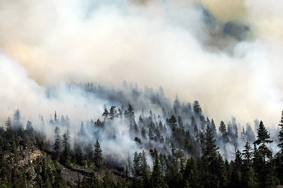
- — Copper King Fire burns 900 acres near Thompson Falls
- — 275 personnel, six helicopters on scene
- — Type II Incident Management Team took command of fire at 6 a.m. Tuesday
- — National Weather Service issues Red Flag Warning for fire area until 11 p.m.; Fire danger listed as ‘high’
Despite stiff winds, the Copper King Fire near Thompson Falls only grew by 100 acres on Tuesday.
The National Weather Service in Missoula issued a Red Flag Warning for most of western Montana, including Sanders and Lake counties and the extreme southwest corner of Flathead County, until 11 p.m.
Fire managers increased the fire danger to “high” on Monday, based on current conditions.
Officials predicted increased fire activity on both the Roaring Lion Fire near Hamilton and the Copper King Fire near Thompson Falls.
By Tuesday night, the Copper King Fire had scorched nearly 900 acres east of Thompson Falls, near Eddy. Thompson’s Eastern Montana Type II Incident Management Team took command of the fire at 6 a.m. and there were 275 firefighters on scene preparing to battle the blaze with additional resources on the way. Six helicopters were also in the area and were expected to use water from the Clark Fork River for bucket drops.
Due to steep terrain firefighters are having a hard time accessing the blaze.
While there were no structures directly threatened as of Tuesday, buildings along Montana Highway 200 were being prepared just in case the fire makes a run to the south. A fire lookout has also been wrapped as a precaution. Firehoses have been laid around the campground and structures in the Copper King area as well.
Forest Road No. 56 on the west side of the Thompson River is still open but Road No. 9991 on the east side has been closed. Road No. 5587 and forest trails No. 345 (Todd Creek), No. 368 (Big Hole Lookout), No. 370 (Spring Creek), No. 372 (Munson Creek), No. 445 (Kookoosint) and No. 1268 (Bay State) are closed. The Copper King and Clark Memorial campgrounds have also been closed.
Although the fire is just a mile away, Montana Highway 200 remains open, although officials are asking drivers not to stop in the area of the fire.
The Roaring Lion Fire near Hamilton forced additional evacuations on Tuesday morning. As of late Monday, the fire had scorched more than 4,300 acres on the Bitterroot National Forest. The Ravalli Republic reported Monday that one person died of a heart attack during Sunday’s initial evacuation and at least 14 homes have burned to the ground.
This story will be updated when additional information becomes available.