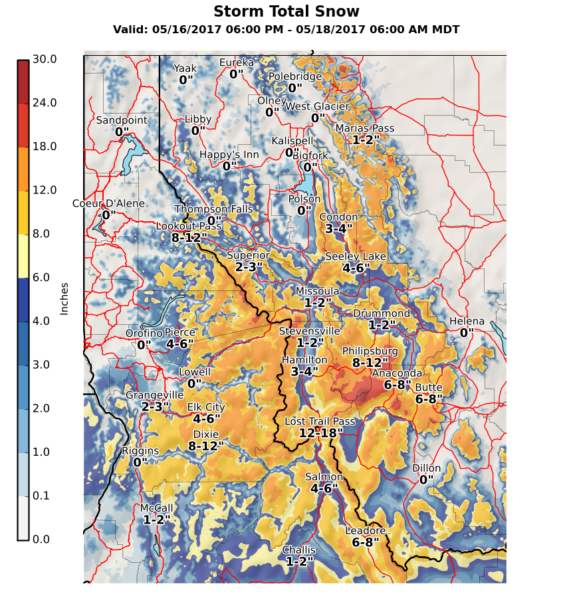
A significant snow storm is on track to hit parts of Western Montana tonight through Thursday, the National Weather Service announced Tuesday.
A cold front will push through the region Tuesday evening and bring widespread precipitation, the agency said. Snowfall is expected in higher terrain until Wednesday, when snow levels could descend to elevations of 3,000 feet, allowing for decent accumulations.
Locations in the Mission and Missoula valleys and the corridor between Condon and Seeley Lake could be impacted by tree damage due to hefty snow amounts, the NWS said.
Winter storm warnings and advisories have been issued for most locations throughout the Northern Rockies.
Temperatures in Kalispell are expected to dip into the 30s overnight.