Jewel Basin Hiking Area is, as its name suggests, a hiker’s paradise. Not only does it clock in at a whopping 15,349 acres, but all forms of motorized traffic, bikes, and horses are prohibited. All you’re left with is your feet, the trails, the wildflowers, and endless jaw-dropping views.
Jewel Basin is also an angler’s and a backpacker’s paradise. With over 20 lakes, the fishing opportunities are abundant, and westslope cutthroat trout fishing is particularly good. Furthermore, camping permits are not required, allowing respectful campers to set up shop wherever they so choose.
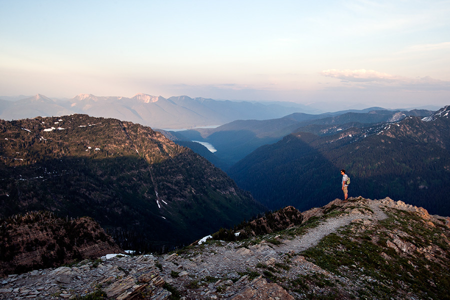
Many of the peaks in Jewel Basin are unnamed and require scrambling and bushwhacking to summit. Mount Aeneas offers beautiful views of the southwest portion of Glacier National Park and the northern part of the Bob Marshall Wilderness.
Be sure to get a map of Jewel Basin before embarking on your adventure. The National Forest Service also has a cabin at the Camp Misery Trailhead staffed with volunteers who can help point you in the right direction.
How to get there: Primary access is via Camp Misery, which can be reached from Forest Service Road 5392 east of Echo Lake. Jewel Basin can also be reached via Westside Hungry Horse Reservoir Road #895, which leads to trailheads in Wounded Buck, Clayton, Graves, or Wheeler Creeks. Questions? Call (406) 387-3800 or visit the highly informative website http://www.summitpost.org/jewel-basin-mt/448116.