The Great Rewilding
From ranches to refuges, dams to free-flowing fisheries, Montana’s landscapes have a legacy of environmental do-overs
By Tristan Scott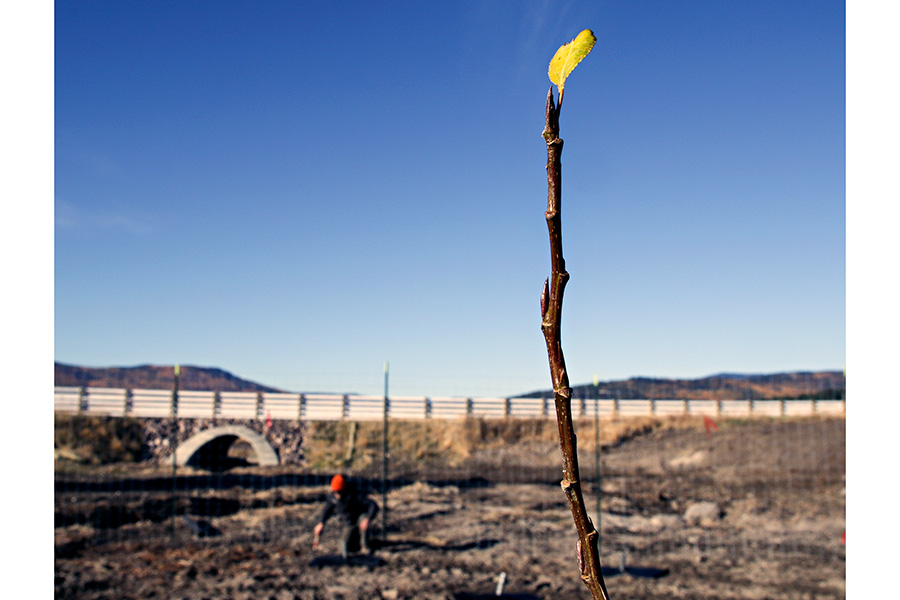
Nestled in the Pleasant Valley floodplain and flanked by rolling foothills, the fledgling creek channel navigates newly planted pods of native willow and dogwood trees. Its sculpted banks — supported by a tiered matrix of root balls, splintered spruce and mats of greenery — form calculated bends that meander across a denuded valley floor.
To the uninitiated, Pleasant Valley Creek near Marion appears raw and reconstructed, but close your eyes and turn time forward a decade, and the corridor radiates with plants, fish and wildlife.
The recently reconfigured creek is designed to serve as the lifeblood to this sprawling wetland, which was ditched and drained and desiccated over a century-long era of anthropogenic imposition. Its natural course was diverted to serve ranches and railroads instead of functioning as a plant-rich river system. It held space for homesteaders and heifers instead of howling wolves. It was over-grazed, overwhelmed and nearly overlooked.
But against all odds, the valley corridor has been given a second chance, and not unlike a parched sponge placed in a pail of water, it is gradually recharging.
It’s not an original story.
American landscapes in Montana and across the West share a legacy of environmental do-overs, a tradition born of mankind’s tendency to tame wild country and manipulate its natural functions to perform utilitarian tasks.
The Flathead Valley bristles with examples where ecosystems have been reduced and then restored en masse, and the little creek 20 miles west of Kalispell is the most recent example illustrating how decades of degradation can be reversed.
Twenty years ago, the nearly 8,000-acre Lost Trail Ranch was purchased by the Montana Power Company, which transferred ownership to the U.S. Fish and Wildlife Service (FWS) as part of a mitigation deal to offset wildlife impacts and habitat loss resulting from Kerr Dam and its damaging effects on the wetlands surrounding Flathead Lake.
In 1999, the property joined the roster of federally managed lands under the National Wildlife Refuge System and was officially designated the Lost Trail Wildlife Refuge, no small feat for a government agency entangled in red tape.
While the transition from ranch to refuge was a heavy bureaucratic lift, the mass restoration of an entire ecosystem — the rewilding of nature — presented another complex set of eco-engineering challenges.
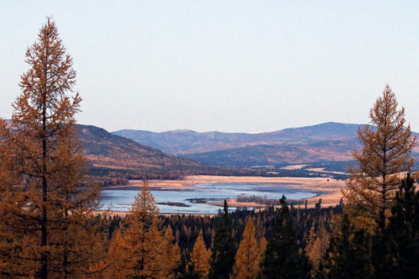
Located near the tiny community of Marion on U.S. Highway 2, the glacially carved refuge cuts a dramatic expanse. Its high mountain ridges subside to low-bottom wetlands of browsing moose and sweeping prairies of creeping coyote.
Its centerpiece is Pleasant Valley Creek, which drains a watershed that spans 53 square miles, originating in the Salish Mountains to the north. It is joined by Meadow Creek, which drains from Dahl Lake, and eventually meets the Fisher River at its headwaters.
It is home to boreal toads and bugling elk, trumpeter swans, sandhill cranes, massive flocks of mountain bluebird, and a diverse suite of waterfowl.
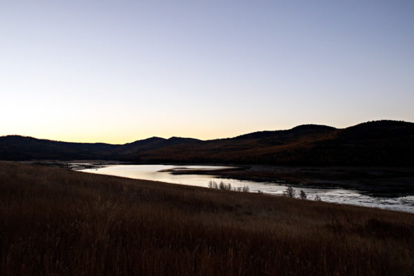
Dahl Lake spans more than 1,000 acres, having recently returned to its historic size after work crews filled a massive drainage ditch, which for 50 years reduced the lake to a mere 180 acres in order to supply the ranchers’ cattle with more grass to graze.
Once managed for livestock, Lost Trail is now managed for wildlife, and recharging Dahl Lake was the first order of business. On a recent autumn morning, rafts of ducks and geese drifted across the lake’s glassy surface, which reflected golden stands of larch on the ridge above.
The final phase of restoration wrapped up this fall with the work on Pleasant Valley Creek, which next spring will run swollen with snowmelt.
“If you can look out at this valley and imagine everything completely wet, that is how we envision the future looking,” said FWS’ Kevin Shinn, the refuge manager charged with overseeing the unlikely restoration. “Coming out here really makes you marvel at the fact that this is actually working, especially since it came so close to being lost. One-hundred years of cattle really takes a toll on a place.”
The cattle arrived when homesteaders settled Pleasant Valley in the late 19th century, arriving from Plains. The Great Northern Railway’s main east-to-west line served Kalispell and Libby from 1892 to 1904, running smack down the middle of Pleasant Valley Creek, which was straightened to make room for the rail line, and diverted for stock ponds and irrigation.
When the railroad built a separate track from Whitefish bypassing Pleasant Valley, homesteaders used the railroad ties to build fences for their cattle, while Flathead County converted the railroad bed into a road.
For Pleasant Valley Creek, the road to remediation, reclamation, restoration, and ultimately redemption would require moving the road altogether.
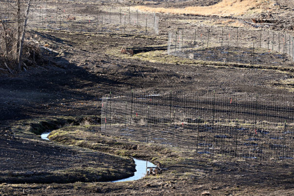
In 2013, the massive project to decommission and reroute a three-mile section of the Pleasant Valley Road out of the wetland’s historic creek channel got underway, thanks in large part to a $2.9 million grant through the Federal Lands Access Program.
The new section of county road tracks up and around the creek bed, which was excavated and engineered to mimic its natural ecology.
“That’s the desired future condition of this wetland,” said John Muhlfeld of River Design Group, the Whitefish-based restoration firm that engineered Lost Trail’s reboot. “We want to reset the system and put it on a trajectory to be self-maintaining and resembling what it did historically.”
“We are really taking a holistic approach to putting this landscape back together,” he added. “It starts at the ridge top and ends where the stream corridor meets the headwaters of the Fisher River. It is quite rewarding at the end of the day to put the pieces back together and help support the long-term recovery of these ecosystems.”
Not only did River Design Group draft the project’s environmental assessment and navigate the complex regulatory channels, but it applied for the Federal Lands Access Program grant money to relocate the road and applied its engineering expertise to strengthen the creek beds, promote natural regeneration and open fish passages to connect isolated fisheries.
“We opened up miles of fish habitat that were formerly fragmented,” Muhlfeld said.
Funding for the entire project, which totaled $4.5 million, including $1.2 million for the creek restoration, was contingent on cooperation among a multitude of cooperating agencies, including the Federal Highway Administration, the Fish and Wildlife Service, the state Department of Natural Resources and Conservation, the U.S. Department of Agriculture’s Natural Resources Conservation Service, and a host of private entities.
“I think what made this project so amazing from my perspective is that like any successful large-scale restoration project it required multiple committed partners,” Muhlfeld said. “Getting the funding to move Pleasant Valley Road out of the valley bottom was a pretty monumental effort. The grant was very competitive.”
By researching historic aerial photos, detailed maps and land-use reports, Muhlfeld and his team plotted out the creek’s perennial course through the refuge, which he’s eager to visit next spring in order to monitor the progress.
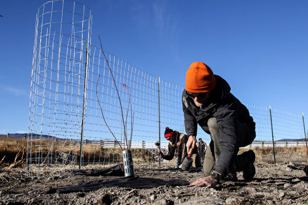
Crews from the Montana Conservation Corps crew and the Whitefish-based landscape restoration firm Forestoration planted 2,500 native plants and trees on 54 plots that pepper the creek’s newly installed banks, designed to replicate the floodplain’s natural roughness.
In scale, Muhlfeld said the Lost Trail project is on par with some of the firm’s most ambitious projects, including work on the removal of the Milltown Dam on the Clark Fork River near Bonner and restoration of the Kootenai River in Bonner’s Ferry, Idaho.
With its work complete at Lost Trail, the company is setting its sites on rewilding other open spaces, including an historic wilderness area outside of Missoula.
River Design Group’s Matt Daniels, who served as the design engineer on Milltown’s channel and floodplain drawings, is working with Montana Fish, Wildlife and Parks, the city of Missoula and Montana Trout Unlimited to remove the lower Rattlesnake Creek Dam and fully re-naturalize the site.
Last June, Daniels floated the section of the Clark Fork River that he helped rebuild after the dam was breached in 2008, and said the river is beginning to return to its natural state.
“It seems like the project has turned a corner and is really starting to mature,” Daniels said. “The line between engineering and a natural landscape is getting blurred, and it’s starting to look like a natural floodplain and exhibit the resiliency you would expect to see in the natural world. It’s always rewarding to reach that point on a project.”
________________________________
A Second Act for Montana’s Landscapes
In the Treasure State, ill-treated lands share a legacy of restoration and redemption
By TRISTAN SCOTT of the Beacon
Like many western states, Montana’s sprawling landscape and pristine waterways have been, in the name of industry, dumped on, dammed, drilled, over-grazed, and otherwise abused.
But some of those damaged parcels have since benefited from words like remediation, reclamation, restoration, redevelopment, and redemption.
Some of the conservation efforts have been undertaken at a scope and scale that can make the difference between survival and extinction for Montana’s suite of fish and wildlife species, restoring vital habitat connections and corridors, staving off threats of development, and holding the final toe.
Here are some examples of environmental do-overs in Montana.
Silver Bow Creek
For nearly two decades, efforts have been underway to restore the area around the mile-wide Berkeley Pit in Butte, one of the largest Superfund sites in the U.S., to its natural state.
The cleanup includes a 27-mile stretch of the once-toxic Silver Bow Creek, which began in 1999. Remediation work at the site has since led to the development of parks, trails, restored wetlands, and a cutthroat fishery.
Joel Chavez, the Montana Department of Environmental Quality’s project manager, said crews rebuilt the entire stream and floodplain, removing approximately 5.4 million cubic yards of contaminated soil.
The floodplain contained more than 1,600 acres of contaminated soil, including contaminants such as copper, lead, zinc, cadmium, mercury, and arsenic.
Restoration also included removing additional mine ore waste, called tailings, at Ramsay Flats, about 11 miles west of Butte. In places, the tailings were as deep as 13 feet.
Milltown Dam Removal
From 2003 to 2012, Whitefish’s River Design Group played an instrumental role in the planning, design and implementation phases for the multi-year restoration effort of the Clark Fork River following the removal of Milltown Dam.
The project included nearly 3 miles of channel restoration and approximately 200 acres of floodplain restoration. Designs addressed channel morphology, floodplain function and aquatic habitat within the context of site constraints.
Activation of the new river and floodplain occurred in 2010, with final restoration and project implementation completed in 2012.
A portion of the Milltown Reservoir Sediments site has been transferred to the state for development of a multi-hundred-acre state park as the cleanup continues.
Anaconda Smelter Site
The Anaconda Co. Smelter Superfund site is a former copper smelter in southwestern Montana, and includes the towns of Anaconda and Opportunity, where the smelter was the cornerstone of the local economy from 1884 to 1980, leaving behind 300 square miles of soil and water contaminated with heavy metals.
In 1983, the U.S. Environmental Protection Agency placed the site on the National Priorities List, working with the community, the site’s property owners, the state, and Deer Lodge County to clean up and redevelop the area.
Developers have since turned 250 acres of the site into a 21-hole golf course. Designed by golf legend Jack Nicklaus, the course combines landscaping with historic mining artifacts. Cleanup also addressed homes and commercial areas next to the golf course.
O’Dell Spring Creek
Historically, the O’Dell Spring Creek headwaters, located in the greater Madison River valley near Ennis, supported a complex and diverse mosaic of wetland and spring creek habitats. But since the late 1800s, anthropogenic alterations like ditching, draining and overgrazing shifted the natural hydrology, resulting in a significant loss of wetland habitat and ecosystem functions.
The channels no longer meandered, the riparian habitat disappeared, the banks eroded at an accelerated pace, and the system filled with gill-choking sediment.
To date, 11 miles of spring creek reconstruction, 580 acres of emergent wetland enhancement, and 35 acres of open water wetland development have been completed, with additional phases planned through 2020.
Mike Horse Dam Removal
Previously located in a floodplain at the headwaters of the Blackfoot River since the 1940s, Mike Horse Dam isn’t a dam anymore.
Truckload by truckload, the dam, built from mining waste and as tall as a six-and-a-half-story building, was dug up and hauled away in 2015 after decades of polluting the river made famous in print and film.
Shellie Haaland of the Montana Department of Environmental Quality calls it a milestone for the cleanup effort in the mining district and for returning the Upper Blackfoot River to its full fishery potential.
In 1975, heavy rains caused a partial failure of the dam, sending tons of contaminated waste into the river system and wiping out fish in the Upper Blackfoot River.
In subsequent years, the Mike Horse Dam remained a threat, Haaland said. A flood or earthquake could have caused another flush of pollution into the drainage.
That threat’s been removed now that the dam is gone.
And with the dam out of the picture, work can proceed on reconnecting four Upper Blackfoot River headwater streams and restoring habitat for native westslope cutthroat and bull trout.