Flooding Begins in Western Montana, Rivers Expected to Rise Next Week
Water flows into Missoula and Seeley Lake neighborhoods; Flathead River forecast to hit minor flood stage
By Myers Reece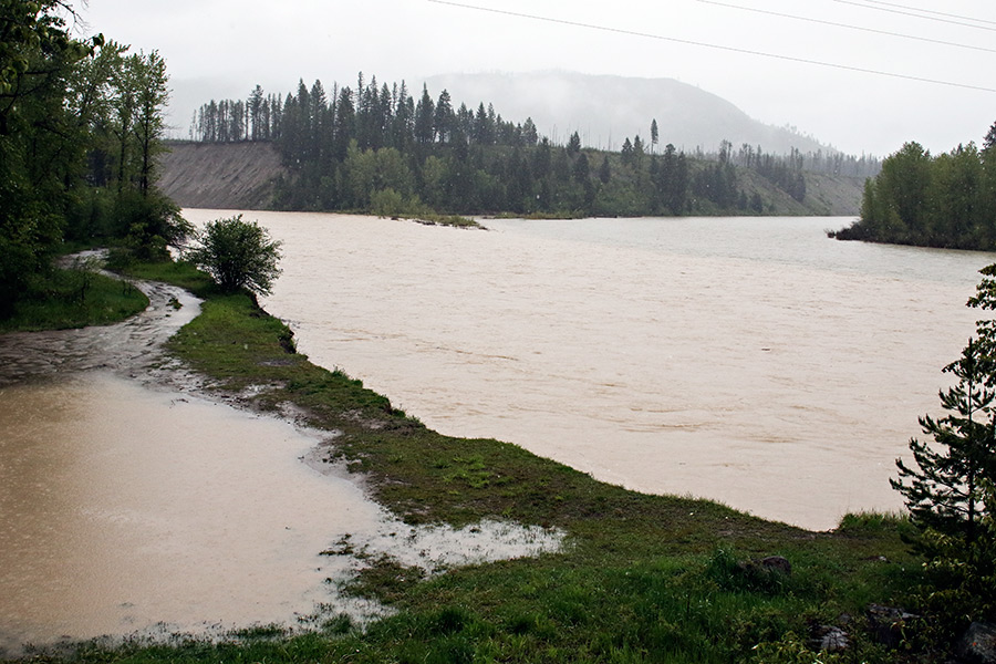
As temperatures rise, Western Montana is bracing for flooding.
Exactly when depends on location and weather factors, but some rivers have already spilled over their banks. The Clark Fork River flooded houses in Missoula earlier this week and, after a brief period of dropping levels, is expected to again send water into neighborhoods in the coming days. The Bitterroot is also forecast to hit flood stage next week.
In Northwest Montana, Missoula County Disaster and Emergency Services delivered sandbags to Seeley Lake following flooding there earlier this week. Forecasters will continue to monitor the Seeley-Swan area, as the North Fork Jocko Snotel showed 65 inches of water remaining in snowpack above 5,500 feet elevation as of Thursday.
The 65 inches refers to the amount of water that will be released from the snowpack when it melts, which is comparable to that much rain falling into streams and lakes throughout the remaining period of spring and summer runoff.
“We’re going to be monitoring that area for continued flooding issues most likely for the next week or so,” said Alex Lukinbeal with the National Weather Service during a May 3 flood-potential webinar.
Snowpack remains at high levels across Western Montana, with the Flathead Basin at 159 percent of normal on Thursday.
The Flathead River at its Columbia Falls gauge is forecast to reach minor flood stage by Wednesday or Thursday of next week. The Swan River at Bigfork is also expected to approach or reach minor flood stage around the same time next week.
Last week’s warm weather melted snow at low elevations, which combined with rains to cause the Clark Fork and Seeley Lake flooding. But the higher elevations remained largely untouched.
“The real runoff hasn’t even really begun yet,” said Genki Kino, also with the NWS in Missoula.
The Clark Fork is forecast to surpass 12 feet later next week, reaching well into moderate flood stage. By comparison, recent floods in 1997 and 2011 topped out at 12.6 and 12.72 feet.
“Right now the Clark Fork River is definitely running at an all-time high for this time of year,” Kino said, adding that numerous streets and homes are expected to be flooded in the Orchard Homes area along Kehrwald Drive, Channel Drive, Tower Street, Nancy Lou Drive, Keck Street and Stone Street.