The Latest
—Howe Ridge Fire has burned 11,172 acres
—Fire continues to inch toward Fish Creek, Apgar
—Fire north of Libby prompts pre-evacuations
Updated: Aug. 21, 1:55 p.m.
The Howe Ridge Fire, the largest of nearly a dozen fires currently burning in Northwest Montana, has grown to more than 11,000 acres on the west side of Glacier National Park.
Due to smoky conditions around Lake McDonald, officials were unable to get a plane into the air to map the fire since Sunday, when the lightning-caused fire measured in at 7,835 acres. Cindy Wolfe, public information officer for the Southwest Area Type 1 Incident Management Team that is overseeing the Howe Ridge Fire and three others on the Flathead National Forest, said the growth was due to windy conditions that have persisted in the area since Sunday.
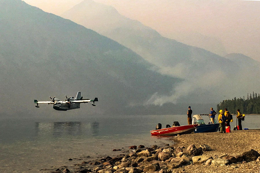
The fire continues to inch south toward the Fish Creek Campground and the Apgar Village. On Sunday, the Fish Creek Campground was evacuated and an evacuation warning was issued for the Apgar Village. As of Tuesday morning, the fire is burning less than a mile from the Inside North Fork Road.
The fire is 0 percent contained. Approximately 218 firefighters are assigned to the blaze.
Firefighters have been installing pump systems and water hoses around structures at the Fish Creek Campground and the Lake McDonald Lodge complex. Helicopters and fixed wing “Super Scoopers” are also being used to drop water on the fire, particularly its southwest flank.
As of Tuesday, the Howe Ridge Fire has cost $1.8 million to suppress.
The Southwest Area Type 1 Incident Management Team is also keeping a close eye on two fires near Polebridge and one near Essex. The Paola Ridge Fire near Essex has burned 364 acres and continues to creep toward the BNSF Railway tracks. The railroad has brought in a special firefighting train to protect its right-of-way should the fire get any closer. Last week, a pre-evacuation warning was issued for a number of homes west of Essex along U.S. Highway 2.
The Whale Butte Fire just north of the Polebridge area has burned 338 acres. Last week, the Flathead County Sheriff’s Office issued the evacuation warning for the area between Moose Creek Road and Whale Creek Road. The Coal Ridge Fire west of Polebridge did not grow in the last few days and so far has burned 280 acres.
About 13 miles north of Libby, the Gold Hill Fire has prompted a pre-evacuation warning along Pipe Creek Road, between mile markers 11 and 13. As of Tuesday afternoon, the fire was 1,166 acres. A Type 3 incident management team will be taking command of firefighting efforts tomorrow. More than 60 firefighters are currently battling the blaze.
Smoke from fires across the Pacific Northwest and western Canada continues to fill the Flathead Valley with smoke. An air quality alert has been issued for Flathead and Lincoln counties, the panhandle of Idaho and nearly all of Washington and Oregon. Air quality in the Flathead Valley was listed as “unhealthy for sensitive groups” as of 2 p.m. Tuesday. Earlier in the day, the air quality index was listed at 154, which is the equivalent of smoking seven cigarettes a day.
This story will be updated when additional information becomes available.