Change is brewing on the Flathead River’s three forks as officials tasked with managing the Wild and Scenic Rivers System chart a new course on 219 miles of the popular recreation corridors as well as its more primitive stretches.
The changes have been mounting on numerous fronts since 1980, which is the last time a comprehensive river management plan for the Flathead system was reworked.
On July 31, managers with the Flathead National Forest, in coordination and partnership with Glacier National Park, released a draft Comprehensive River Management Plan (CRMP) for the three forks of the Flathead River — the North, South and Middle forks, which all bear federal designations under the Wild and Scenic River Act.
Work began on the lengthy process in October 2017 and is scheduled for completion in 2020.
The Wild and Scenic Rivers System has three river classifications: wild, scenic and recreational. A single river or river segment may be divided into different classifications, depending on the type and intensity of the development and access present along the river at the time of designation.
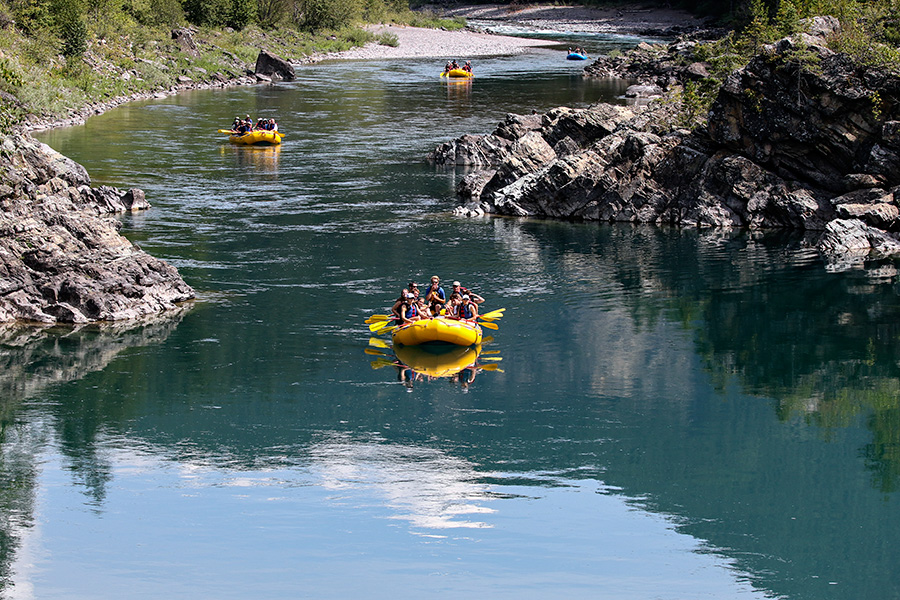
On the Flathead River system, all three levels of classification exist, and balancing them under the draft plan involves implementing “triggers” and “thresholds” that will prompt management actions, including permitting and limiting the sizes of float groups and restricting outfitters.
Managers use triggers and thresholds to help them set and evaluate levels of resource condition with a prescribed monitoring plan.
Before the plan is finalized, the agencies are conducting scoping and requesting public input on the proposed action, including the public’s desired river conditions and preferred markers indicating when officials will make a management decision or take action.
The three forks of the Flathead each possess unique characteristics that are considered in the management plan.
The North Fork separates the Flathead National Forest to the west from Glacier National Park to the east, running from the Canadian border to Columbia Falls. It’s also governed by divided management plans depending on which bank of the river you’re on.
The U.S. Forest Service side follows Montana state law, which allows camping anywhere below the high water mark. Glacier Park, however, only allows permitted backcountry camping.
Expectations by users differ between the 40-mile scenic portions of the North Fork, from the Canada border to Camas Bridge, and on the 19-mile recreational section from Camas to the confluence with the Middle Fork.
On the scenic section, where use has increased, the proposed management plan intends to preserve a more solitary experience.
“The desired recreation experience for this management unit includes a degree of solitude, which is affected by float parties encountered and party size,” according to the plan. Under the proposed action, managing floaters and shore party encounters with float parties will be addressed, including through group size limits, a permit system, outfitter restrictions, and other seasonal restrictions.
A “trigger” identified in the proposed plan would set a limit of encounters with other parties to no more than three per day during 60 percent of the peak use season between June and August. It sets a “threshold” of encounters with other parties at no more than three per day during 80 percent of the peak use season.
The Middle Fork springs out of the Bob Marshall Wilderness Area, where it’s reached by using a backcountry airfield or pack strings. When it departs the Bob Marshall and flows beneath U.S. Highway 2 east of Essex, its wilderness status changes to recreational. The change is noticeable as its day use explodes, and outfitters and floaters crowd the corridor, using multiple access points along the highway.
The proposed “trigger” for the remote 27-mile wilderness section of the Middle Fork limits encounters with other parties to no more than two per day during 60 percent of the peak use season, while the threshold calls for no more than two encounters with other parties during 80 percent of the peak use season.
However, on the 23-mile recreational segment from the confluence with Bear Creek to Cascadilla, the plan allows for encounters with five other parties per day during 60 percent of the peak use season, and the threshold calls for encounters with no more than five parties during 80 percent of the peak use season.
The 16-mile recreational segment from Cascadilla to West Glacier sets an even more liberal trigger of encounters with no more than 10 parties per day during 60 percent of the peak use season, and a threshold of no more than 10 encounters during 80 percent of the peak use season.
The South Fork also begins in that rugged chunk of Bob Marshall wilderness and flows into the Hungry Horse Reservoir. While a portion of its free-flowing section can only be accessed by aircraft or trail, another section can be reached by driving along the reservoir.
On the 38-mile wild and primitive segment from the confluence of Youngs and Danaher creeks to Mid Creek, the plan sets a trigger of encounters with no more than three parties per day during 60 percent of the peak use season, and a threshold of encounters with no more than three parties per day during 80 percent of the peak use season.
On the 9-mile recreational segment from the Swinging Bridge to Hungry Horse Reservoir, by contrast, the plan calls for a 60 percent chance of no more than 20 watercraft passing a certain point per day, and a threshold of an 80 percent of no more than 20 watercraft passing a certain point per day.
The public can provide comments by emailing them to [email protected].
Two informational meetings will be held on Aug. 13 and Aug. 20 from 6 p.m. to 8 p.m. at the Arts and Technology Building at Flathead Valley Community College.
More information on the Flathead Wild & Scenic River Comprehensive River Management Plan can be found at: http://www.fs.usda.gov/goto/flathead/crmp.