Hikers and bikers in Whitefish could find it much easier to connect with the Flathead National Forest under a proposal that would build an additional 28 miles of trail northwest of town, connecting existing networks between Whitefish Mountain Resort, the Whitefish Trail and a suite of local public land offerings.
The Tally Lake Ranger District of the Flathead National Forest announced the release of an updated environmental assessment of the Taylor Hellroaring Project and a finding of no significant impact on Aug. 9. Forest officials launched a 45-day objection period.
The updated environmental assessment comes on the heels of a previous assessment that drew formal objections from environmental groups and individuals. The Flathead National Forest withdrew the proposal and reanalyzed it to ensure compliance with the updated 2018 Flathead National Forest Plan, according to Project Leader Tami MacKenzie.
In addition to regularly scheduled logging projects within the 7,808-acre project area, the construction of some temporary roads drew public criticism, as did the potential for increased conflicts between mountain bikers and grizzly bears using Hellroaring and Taylor creeks as natural habitat corridors.
All total, the Flathead National Forest’s Tally Ranger District received 129 comments on the project prior to reaching its finding of no significant impact, even after acknowledging that the environmental assessment found that “some displacement or disturbance of grizzly bears can be expected.”
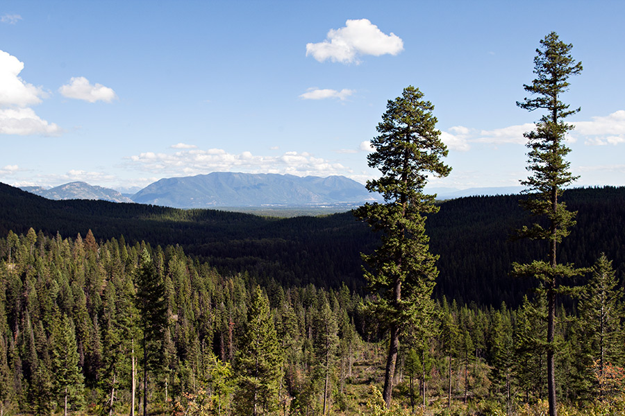
Located northwest of Whitefish, the Whitefish Face area is located in the Whitefish Range, from Haskill Basin to Werner Peak. The Whitefish Face Working Group began meeting in May 2014 and submitted the proposal in March 2015.
The Taylor Hellroaring Project is the result of U.S. Forest Service personnel working with the local group of citizens searching out collaborative forest management in the Whitefish Face area, including timber harvests and expanded recreation opportunities. The group identified the need to treat vegetation in the area (i.e., log) to increase resilience to insects and disease and to reduce the risk and severity of wildfires.
The updated environmental assessment responds to comments from a range of stakeholders with interests ranging from recreation to timber and wildlife management. The project includes some clear cutting, which numerous commenters raised as a concern.
Flathead Forest officials said they identified clear cutting as the most optimal method of logging because it will produce suitable conditions for planting whitebark pine trees. The parcels are currently dominated by mature subalpine fir, which compete with whitebark pine, which is an endangered species.
According to the environmental assessment, timber harvest is proposed on a total of 954 acres. The proposed vegetation treatments include 527 acres of commercial thin harvest; 82 acres of clearcut harvest; 28 acres of shelterwood harvest; and 317 acres of seedtree harvest. Harvest would be completed using skyline cable systems and ground-based (tractor) yarding systems. Slash would be piled with tracked excavators and then burned, or whole-tree yarded.
“The purpose of fuels management is to create forest stand conditions that lower the risk of future high-intensity and high-severity wildfire and to reduce the risk to essential infrastructure in and adjacent to the wildland-urban interface,” according to the environmental assessment.
In addition to receiving support from local timber interests, the project has garnered accolades from area mountain bikers, including members of the Flathead Area Mountain Bikers (FAMB), a group that works with local agencies to expand and maintain trail systems
“This area is appropriate for increased recreational use, and for good reason — the area is accessible, and its proximity to Whitefish Mountain Resort makes it a logical place for new trails, FAMB President Erin Bodman wrote. “Furthermore, this trail network helps replace access that was lost to mountain bikers via recommended wilderness designations in the Forest Plan. Mountain bikers are one of the fastest growing user groups in the valley, yet they are the only user group that has lost substantial access in the last decade.”
According to MacKenzie, the Flathead National Forest Plan identifies a connected trail network as a priority, including connecting to the Whitefish Trail, a growing network of trails designed to circumnavigate Whitefish Lake and link up to the summit of Big Mountain.
“This would provide opportunities for users to disperse into more remote and challenging trails with greater opportunities for solitude. The proposed trails would also provide opportunities for users to choose the length and challenge of their excursion and provide for progressively longer and more challenging excursions with its proposed loop trails,” MacKenzie wrote. “The loop trails would also reduce user conflict by providing separate opportunities for different user levels. For example, families or users with limited time would primarily use the lower elevation, shorter loops. Trail runners, beginner and intermediate mountain bikers, and more adventurous hikers would likely head for the middle loops. Advanced mountain bikers would likely use the longer loops. Looping trails such as these often develop a preferred direction of travel, which further reduces user conflict and improves safety.”
An alternative to the recommended proposal called for building 40 miles of new trail, while a separate alternative called for the construction of 26 miles of new trail.