Editor’s Note: This column was written before the land purchaser, Southern Pine Plantations, stated that it plans to continue Weyerhaeuser’s practice of allowing public access to hunters, anglers and other land users.
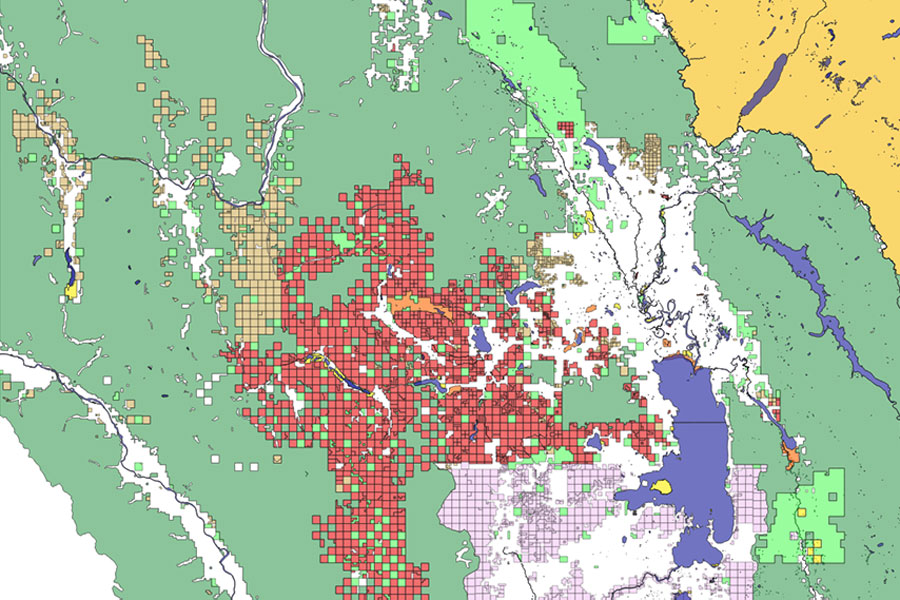
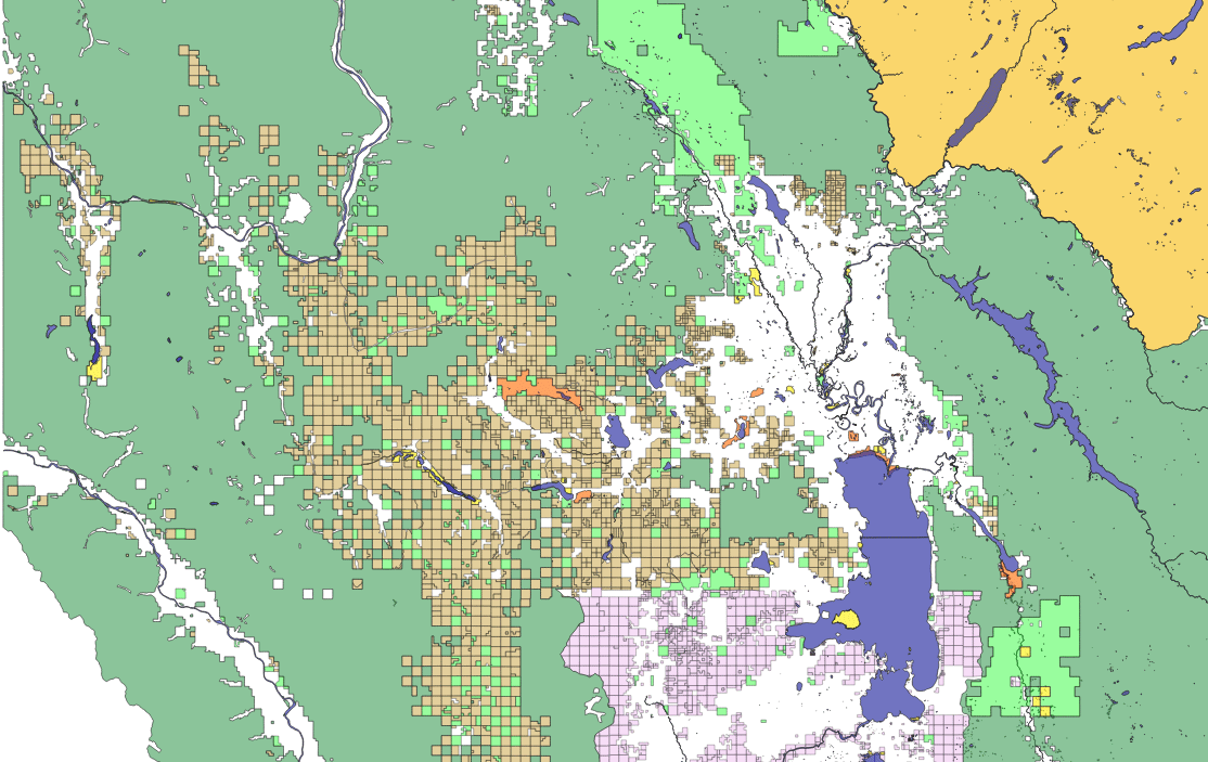
Paradigm Shift: a fundamental change in approach or underlying assumptions (from Oxford Dictionary). Given Weyerhaeuser’s announced sale of almost 1,000 square miles of local Montana land, here’s a graphic presentation of publicly available map parcel data from the state’s Cadastral system. A picture speaks a thousand words (square miles, too).
I made an animated GIF (at the end of this column), coloring parcels as identified in the state data (largest squares are square miles). Water features are blue; U.S. Forest Service lands are medium green; National Park Service is gold; Montana State Trust Lands are light green; U.S. Fish & Wildlife Service lands are orange; Montana Fish, Wildlife and Parks are yellow; American Indian reservation lands are purple; managed timber lands are light brown.
I am depicting state-data-identified Weyerhaeuser lands in red, without any specifics to what will be in conservation. Given that the blank spaces are basically private or corporate land, and the red is now in flux, does this qualify as a Paradigm Shift (in both public access and bulk real estate ownership) in your opinion?
Richard Dews is CEO of Glacier Flathead Real Estate, a Flathead-based real estate software and services company.