A dry spell in November and December decreased some of the autumn snowfall gains from September and October, but the early-season storms were still enough to provide a decent year-end snowpack in most mountains across Montana, even as many valley bottoms remained brown.
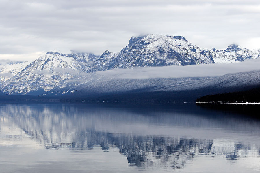
Early January snowfall is further boosting that base to above average in certain areas, with the Flathead River Basin’s snow-water equivalent registering 114 percent of normal as of Jan. 8 and most other basins in Central and Western Montana near or above normal as well, although a few are lagging considerably, especially the Lower Clark Fork and Madison, which sit at 86 and 85 percent of normal, respectively.
Snow-water equivalent, rather than snow depth, is the measurement used to gauge the amount of liquid water contained within snowpack, meaning the amount of water that will be released when the snowpack melts, which can play a key role in agriculture, hydropower production, water storage, aquatic ecosystem health and recreation such as boating and fishing, as well as flood and drought forecasting.
Winter weather advisories throughout Western Montana are calling for more snow throughout this week, with temperatures expected to plummet below zero beginning over the weekend in some areas and next week across the region.
The United States Department of Agriculture Natural Resources Conservation Service (NRCS) released its first water supply outlook report of the 2019-2020 winter on Jan. 8. In an accompanying press release, the NRCS noted that an early-season storm that dropped ample snow in Montana’s high country in September gave the impression that “the new 2020 water year was off to a strong start,” an outlook further strengthened by snowpack and precipitation gains in October.
“While we got off to a great start early in the year, the major change in weather patterns during November weren’t kind to the western half of the state with regards to precipitation or snowfall,” said Lucas Zukiewicz, a Montana water supply specialist for the NRCS. “While the eastern half of the state received above normal precipitation, the mountains were largely left high and dry.”
Zukiewicz said the dryness in Western Montana extended to Eastern Montana in December, resulting in a dearth of precipitation statewide.
“The first three weeks of the month were very dry in most locations across the state, but more favorable weather patterns began to emerge during final week,” Zukiewicz said.
Those favorable weather patterns have persisted into January, raising snowpack and precipitation measurements across the state from their totals in the water supply outlook report, which listed measurements as of Jan. 1. Between Jan. 1 and Jan. 8, the snow-water equivalent in the Flathead basin rose from 97 percent to 114 percent of normal, and other basins experienced similar gains, including a jump from 89 to 105 percent in the Kootenai.
Nearly every basin listed in the report was above last year’s measurements for snow-water equivalent, and although Zukiewicz acknowledged that the outlook for areas with lower levels wasn’t encouraging, he noted that the winter season was still young and that immediate weather forecasts, which have already been coming to fruition, provided optimism.
“The January 1 snowpack totals are more like a progress report than a report card,” Zukiewicz said. “Only 35 to 45 percent of the seasonal snowpack has typically accumulated at this time, meaning there is plenty of time for snowpack to make improvements by the time the final report card comes out in April. That said, as winter progresses, a close eye will be kept on the basins west of the Divide where snowpack and water year deficits are the largest.”