New Weather Station Installed in Flathead Range
Real-time weather data will now be available for better avalanche forecasting, public services along the Middle Fork corridor on U.S. Highway 2
By Maggie Dresser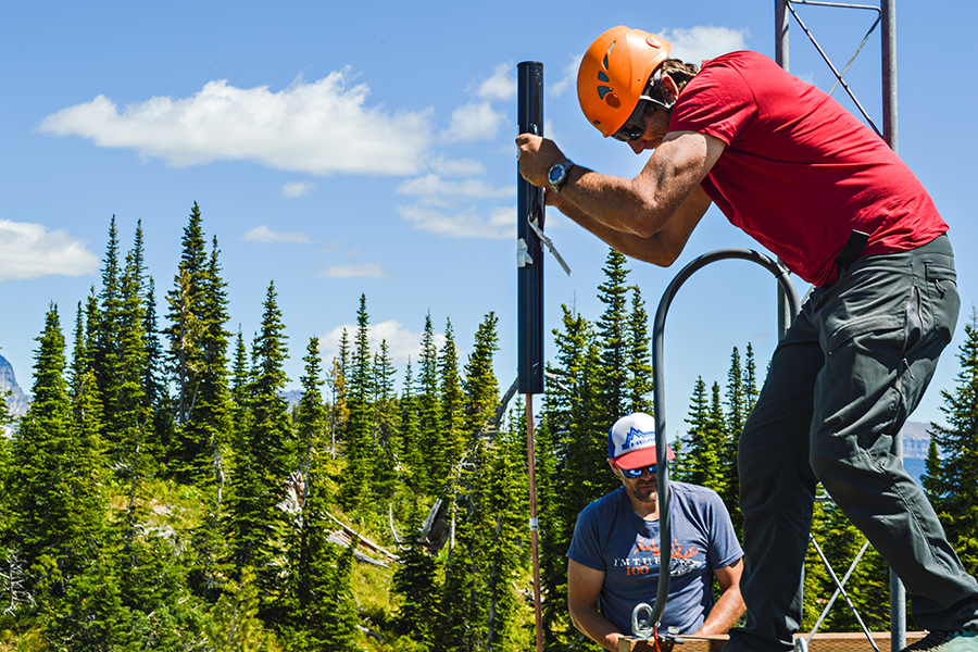
When a significant avalanche cycle triggered several slides in the Flathead Range onto U.S. Highway 2, the Burlington Northern Santa Fe (BNSF) railway and into John F. Stevens Canyon along the Middle Fork corridor in the winter of 2017, forecasters at the Flathead Avalanche Center (FAC) had little way of predicting the storm’s potential for destruction.
If forecasters had real-time weather data at the time to monitor the storm, transportation officials could have closed the highway and railway before the storm hit. However, emergency helicopter explosives were used to mitigate more slides after the storm already began and the BNSF railway was closed for more than a day.
Until July this year, there was a hole in the area’s weather data. With the nearest weather stations in the Swan Range and in Glacier National Park, forecasters were left guessing how much snow fell in the Flathead Range until they went out into the field.
“There are days when the weather forecast is two or three inches and it (ends up being) a foot in the Flathead Range,” FAC Director Zach Guy said.
But this summer, the FAC in partnership with the Friends of Flathead Avalanche Center (FOFAC), Flathead Electric Cooperative and BNSF raised $25,000 to install a weather station at Tunnel Creek, which is adjacent to John F. Stevens Canyon along the BNSF railroad corridor.
“We’ve known we have a big black hole in weather station data,” Guy said. “And time and time again, we’ve been surprised by snowfall events and activity.”
Partnering with the U.S. Forest Service, the FAC forecasters installed two separate weather stations in the Flathead Range, one on an exposed 6,800-foot ridgeline, which collects wind data, and another in a lower basin on top of Tunnel Ridge at 5,900 feet.
The stations will provide real-time weather data and create a better snowpack model for forecasters to predict avalanche conditions in one the Flathead’s most popular areas for backcountry travel, including Marion Lake, Rescue Creek and Wahoo Creek. The data will also be available for the public to view.
“That’s a very useful tool for forecasting,” Guy said. “It really helps hone down that accuracy.”
In addition to avalanche forecasting, the new weather station will also provide data for wildland firefighters and search and rescue aviation.
“Not only is it a great tool for avalanche forecasters, it’s great for different people in public safety,” Guy said.