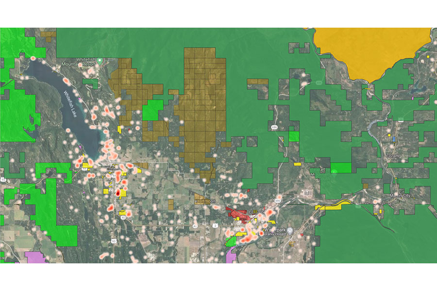
It’s been a while, since we looked at a map in this column. I’ve zoomed in to look at the northern Flathead Valley, from Whitefish to Columbia Falls and Coram. On top of the satellite basemap, I overlaid color masks denoting Forest Service (dark green), Montana State Trust (light green), city/county/local government and Montana Department of Transportation (yellow), Montana Fish, Wildlife and Parks (pink), timber plants (red), managed timber lands (brown), and Glacier National Park (gold).
Then I added light-to-dark magenta heatmaps, showing past year sales of single-family residences (900 square feet and above), having at least a $200,000 sold price. Darker magenta areas show greater quantity of sales within a given area. The printed Beacon has room for only one map, so we chose the combined map with all details. The online version, however, has room to also show an animated GIF which adds layers of complexity sequentially.
GIF:
Richard Dews is CEO of Glacier Flathead Real Estate, a Flathead-based real estate software and services company.