The Flathead Valley has its share of faults.
We’re not talking about people-related shortcomings but the cracks that run deep below the valley’s surface and make their presence known in earth-shaking fashion.
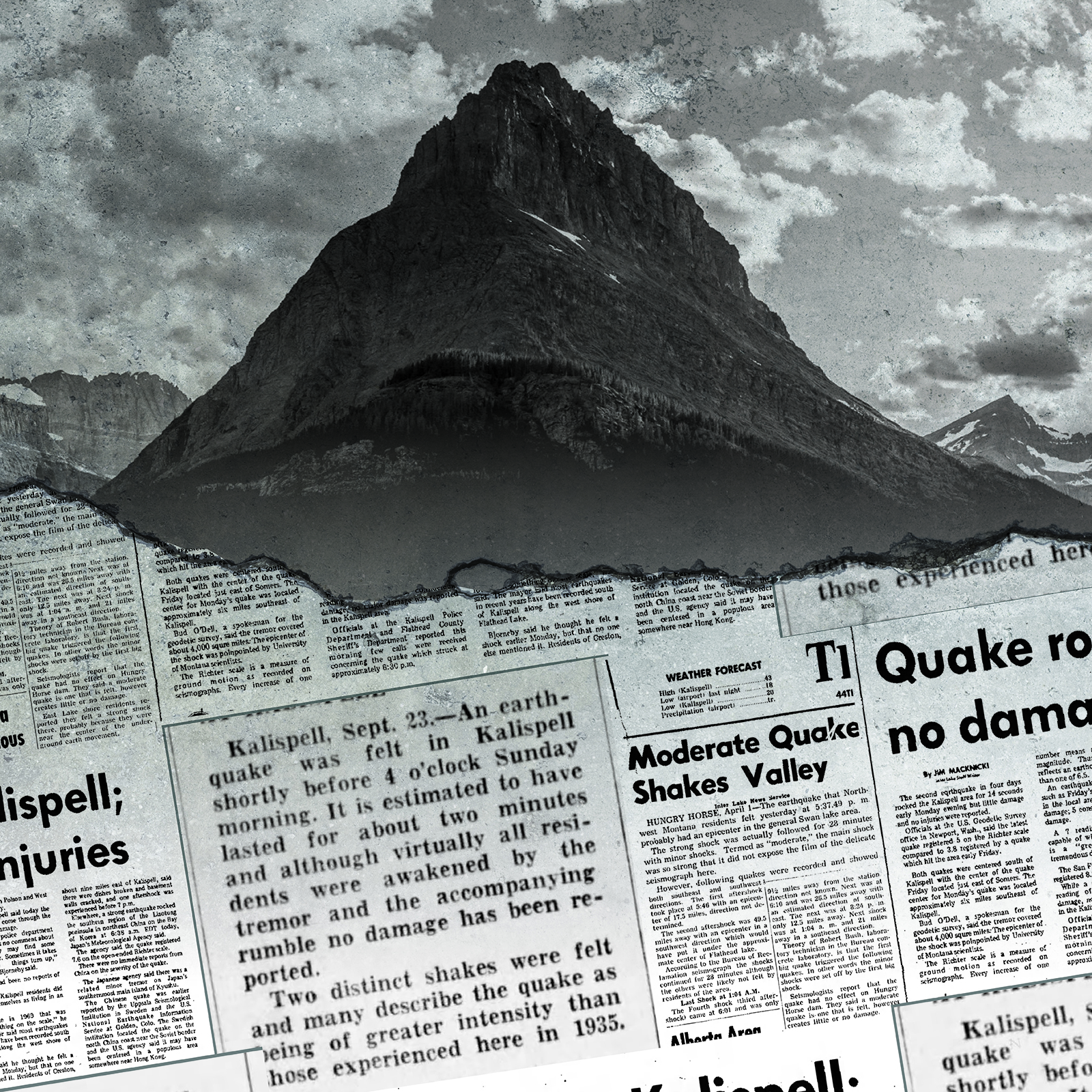
The front page of the Daily Inter Lake on April 1, 1952, along with the news of Joseph Stalin’s views on the potential for World War III, Midwest presidential primaries and flooding near Havre, noted that the Flathead Valley had experienced a dinner-time earthquake the previous day. Despite the delivery of the news on April Fool’s Day, the quake was no joke: The main shock was initially measured at magnitude 5.7 and was followed by a series of aftershocks that lasted nearly 30 minutes. The quake’s epicenter was near Swan Lake, although the aftershocks were more widespread, with one centered near the middle of Flathead Lake.
While seismologists have since reanalyzed the quake and reduced its estimated magnitude to 5.2, it remains one of the most powerful quakes to hit the Flathead. The 1952 quake had tongues wagging, at least in the Polson area, where the Flathead Courier reported this observation from a lakeshore resident: “If my house slides into the lake one of these nights, please throw me a rope. If that doesn’t work, throw flowers.”
The Flathead Valley is clearly an active seismic area and has seen plenty of earthquakes over its recorded history. But much of western Montana is on similarly shaky ground. A series of seismic monitors detects as many as 10 small earthquakes per day in the region. Many of the quakes are of less than magnitude 2.0, says Mike Stickney, director of the Earthquake Studies Office, part of the Bureau of Mines and Geology in Butte. These small quakes are rarely felt by humans. About 3.0 magnitude “is when people start to feel an earthquake,” he notes.
Lex Blood, a retired geology professor at Flathead Valley Community College, says it’s important to keep in mind the relatively minor scale of the area quakes.
“We do have earthquakes but not near as strong as some places,” he says, noting while quakes have been recorded during his 50 years in the Flathead, “in my recollection, I was never aware of them or felt them.”
Along with scientific instruments, seismologists have historically relied on reports from people who feel quakes to quantify intensity and scale. In earlier days, these “felt reports” reached researchers by telephone or even mail. More recently, quakes are social-media fodder. A quake in 2005 prompted a Flathead resident to exclaim: “Felt like someone was shaking my bed. Freaky!”
Certainly, none of the Flathead quakes measured over the last century have been of “California-is-going-to-fall-into-the-ocean” intensity. The Golden State has seen numerous major earthquakes of magnitude 7.0 or greater over the decades. Quakes in the Flathead in 1945 (5.3 magnitude), 1952 (5.2) and a 5.0 magnitude shaker in 1975 centered near Creston are considered “moderate” by seismologists.
“We have not historically seen anything larger than magnitude 5.0 to 5.5 in the Flathead,” Stickney says.
Stickney knows what lies beneath the Flathead as well as anybody. He completed a graduate-school dissertation on seismicity in the valley and Northwest Montana in 1980. He and others have noted the presence of significant faults — cracks in the earth’s crust where rocks slip and slide against one another. One, the Mission fault, runs along the base of the Mission Mountains from north of Missoula to Bigfork. Similarly, the Swan fault traces the western edge of the Swan Range. Other mapped faults include the Creston fault and the Kalispell fault.
Yet, none of the strongest quakes in Northwest Montana can be clearly attributed to activity along these known faults. The explanation for the Flathead’s biggest shakes appears to rest with a much larger web of faults known as the Intermountain Seismic Belt. While the seismic belt runs from southern Nevada north through Utah and Idaho, the northernmost portion of this subterranean maze, which can be up to 100 miles wide, stretches from Yellowstone National Park northwest to the Flathead Valley.
“There are lots of small earthquakes along that zone, and infrequently, the larger ones,” Stickney says.
While rare, Montana has experienced significant earthquakes. A 1925 quake near Three Forks damaged buildings and opened cracks in the ground. In Helena, the fall of 1935 brought a terrifying series of quakes that killed four people and destroyed or damaged dozens of buildings. But the most tragic seismic event in state history occurred late on the evening of Aug. 17, 1959 near West Yellowstone when a 7.5 magnitude quake brought the side of a mountain down along the Madison River, trapping campers and blocking the river to form what has become known as Quake Lake. At least 28 people died as a result of the quake, most of them in the massive rockslide.
The historic shaking was felt over much of Montana and into Canada and eastern Washington. Near Polson, residents were awakened by the quake that shook for more than a minute as dishes and other items toppled from shelves. The Flathead Courier said a patron at a drive-in movie theater near town reported that the quake “felt like someone was jumping on his car bumper.” In Kalispell, the Inter Lake published a photo of a local family posed with a bathroom mirror that had cracked in the nighttime quake.
While the most intense Flathead-area earthquakes have come with a main shock and aftershocks, there have also been “swarms” of smaller quakes without a main shock. In the 1990s, there was a series of small quakes centered in the Kila area, while the late 1960s and early 1970s saw the Big Arm, Dayton and Proctor areas endure a swarm of quakes that toppled chimneys, cracked windows and caused a bell to fall from a rural schoolhouse. Several of the quakes in that swarm were greater than 4.0 magnitude.
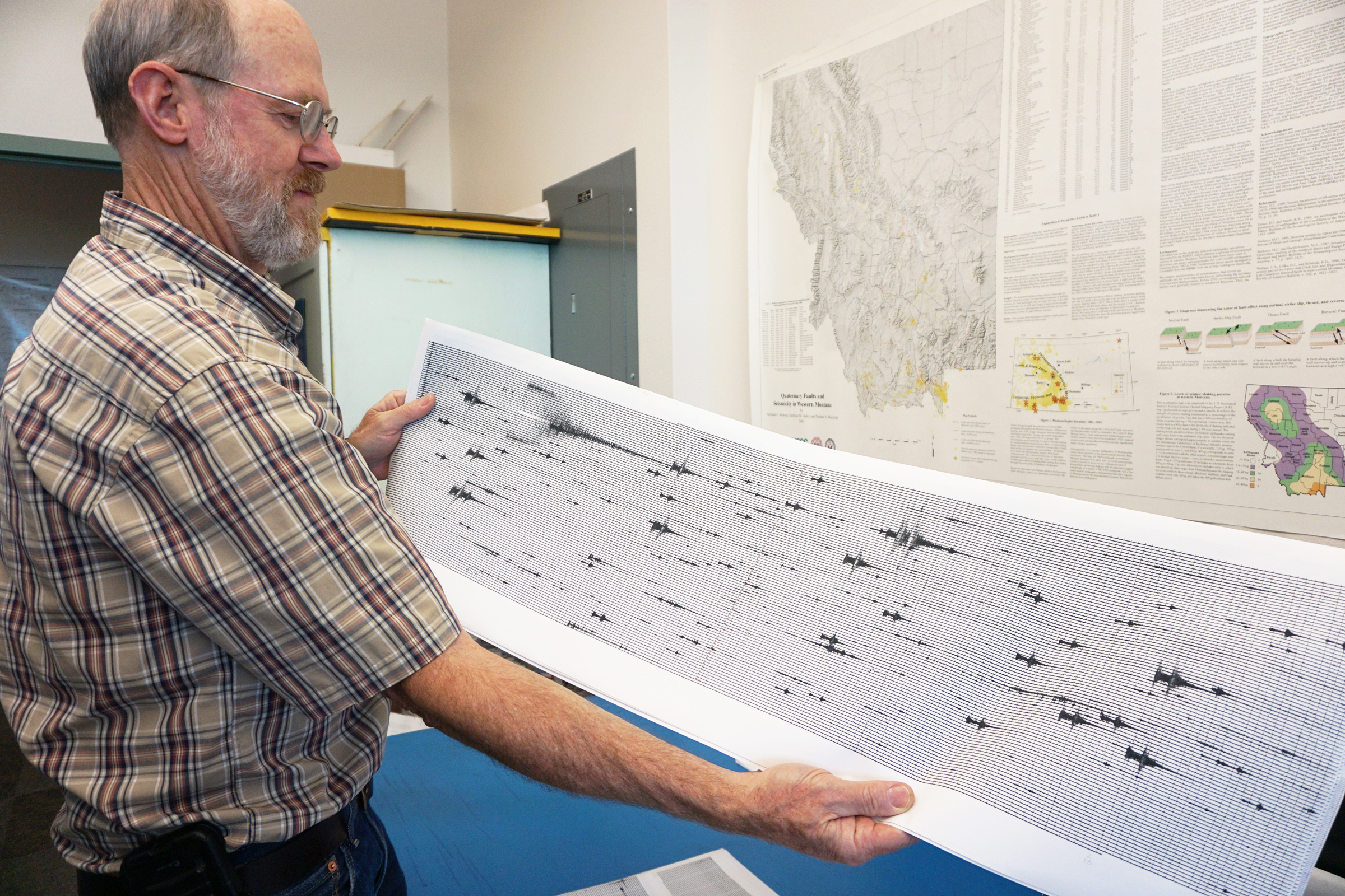
The Montana Regional Seismic Network is a system of seismometers that monitor seismic activity across the western flank of Montana and electronically relay the information to the Earthquakes Studies Office in Butte. Some of the stations measure just the up-and-down motion of the earth, while newer, more expensive broadband stations can additionally gauge vertical and side-to-side ground motion. The equipment helps locate the epicenter and magnitude of quakes.
Of the 42 sites in the network, several are in the Flathead. Most of these sites are operated in cooperation with the Confederated Salish and Kootenai Tribes and help keep tabs on the safety of several older dams on the reservation that could be prone to quake damage.
A looming question: Is Northwest Montana primed for a big earth-shaking event?
A seismic hazard map produced by the U.S. Geological Survey highlights two areas of Montana with the greatest risk of a major quake. One is in southwest Montana in the general area of the deadly 1959 Madison quake. The other is centered on the Flathead and Mission valleys.
Both Stickney and Blood, the retired Flathead geologist, point to a federal study that found significant earth movement thousands of years ago along the Mission Fault in the Pablo-St. Ignatius area. The study showed that an earthquake about 7,600 years ago in that area may have had a magnitude of 7.5.
“The fact that they have happened before indicates that they are likely to happen again in the future,” Stickney says, noting that Montana saw quakes of 6.0 or greater in every decade between 1920 and 1960 but hasn’t experienced one since. “Are we in an earthquake drought? We just don’t know.”
There is no uncertainty about the unpredictability of earthquakes. Dr. Francis Thomson, who was the head of the Montana Bureau of Minerals and Geology, told news reporters of that fact in 1945, following a significant quake.
“It cannot be too strongly emphasized,” Thomson said, “that no one knoweth the day or hour at which future shocks might occur, and that anyone who engages in such precise predictions must be written down as either a fool or charlatan.”
Butch Larcombe worked for three decades as a reporter and editor at Montana newspapers and was also editor of Montana Magazine.