*This story was updated at 7:20 p.m. on Saturday night.
The Hay Creek Fire near Polebridge quadrupled in size from roughly 250 acres on Friday morning to more than 1,000 today, prompting additional evacuation warnings on top of the pre-evacuation notices issued for 20 structures on Thursday.
The Flathead County Office of Emergency Services announced the expanded evacuation warning in a Saturday night press release.
The release didn’t cite a specific number of residences but said sheriff’s deputies were notifying the additional residents in the expanded area, which includes Moose Creek Road and all residents with driveway access from the road; Red Meadow Road and all residents with driveway access from the road; North Fork Road and all residents on both sides of the road between Moose Creek Road and Home Ranch Bottoms; and Polebridge Loop – 655, 700, 720 and 740 Polebridge Drive.
“At this time the community of Polebridge, residents of Glacier Drive, and the remainder of residents not previously identified for Polebridge Loop are not in the warning area,” the office of emergency services said.
The announcement noted that an evacuation warning means “there is a potential threat to life and/or property,” and the warning is issued to give residents time to prepare for a possible evacuation. Residents and visitors who require additional time to evacuate or need to move pets or livestock are advised to begin the evacuation process now.
For more information about the pre-evacuation notices, including a map of the affected area, visit the Flathead County Office of Emergency Services Facebook page.
Meanwhile, firefighters continue attacking the Hemlock Fire north of Whitefish Mountain Resort and south of Werner Peak following a heavy response last night that included a large air tanker, four helicopters and six engines. The fire, initially estimated to be 35 acres, has been updated to be approximately 16 acres.
Suppression efforts on the Hemlock Fire today involve 45 firefighters and seven engines, with aerial support from two helicopters and one aerial attack resource. Heavy equipment operators are continuing initial attack operations with the objective to build a line and lay hose around the fire perimeter.
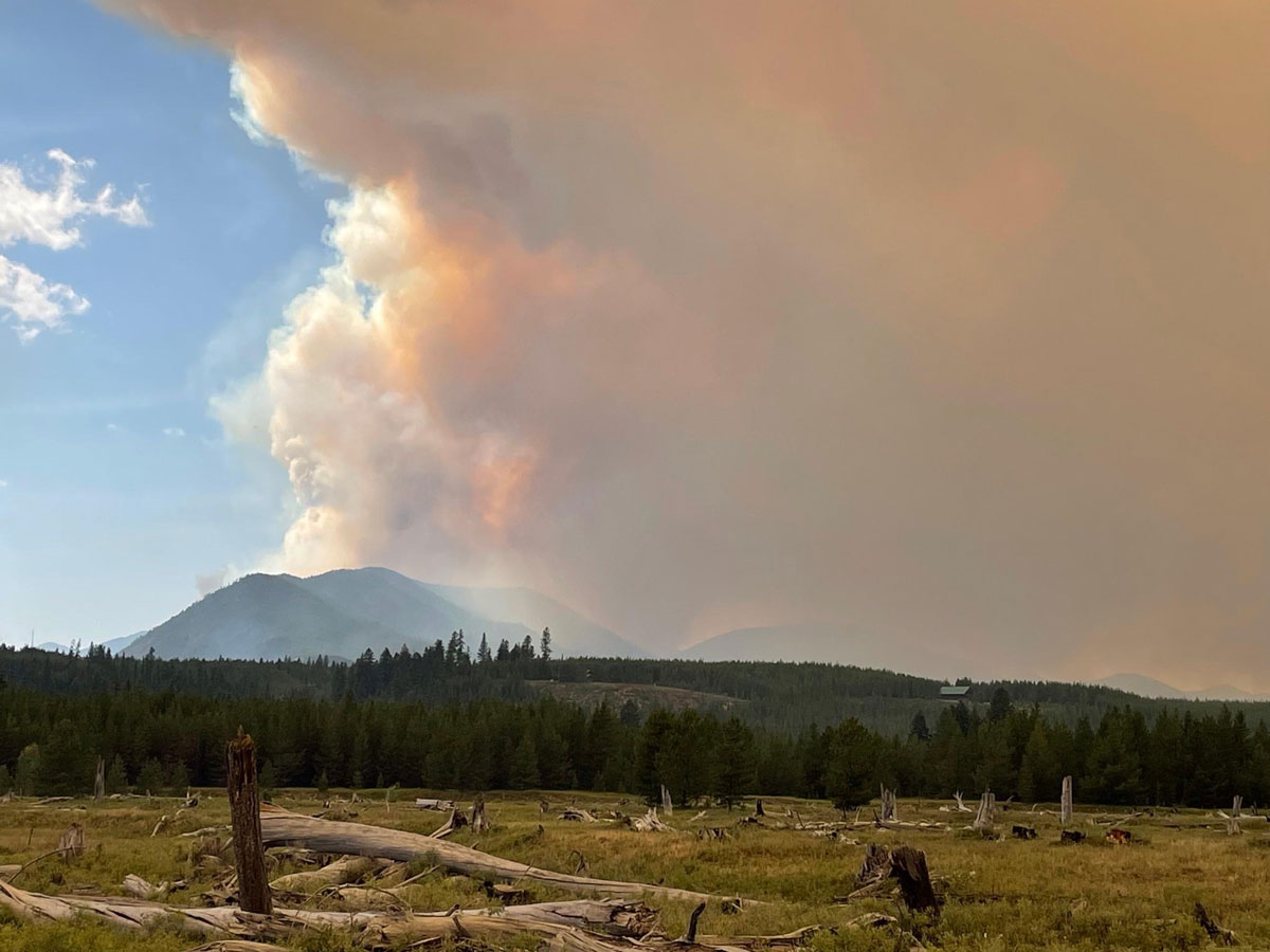
According to an incident update from earlier today, the Hay Creek Fire is currently four miles west of Polebridge and is burning in “heavy decadent timber on steep slopes of the Hay Creek and South Fork Red Meadow drainages.” Single and group tree torching, short-range spotting and short crown runs occurred throughout the afternoon yesterday.
The fire behavior combined with the heavy timber fuel type resulted in “substantial smoke production,” the update noted. The fire is currently at 0% containment.
Today’s firefighting resources include heavy equipment and hand-crews continuing to brush out roads and improve fuel breaks on Hay Creek, Red Meadow and Spruce Creek Roads.
The Northwest Montana Interagency Type 3 Team, led by incident commander Dave Poukish, is leading the attack on the Hay Creek Fire. Lightning is believed to have caused the fire.
Road and trail closures are in effect. Visit here for more information.
“Travelers are asked to SLOW DOWN and maintain safe distance in dusty or smoky conditions with low visibility,” the Hay Creek Fire incident report states. “Be aware of and stay clear of firefighting and heavy equipment operations.”
Contact information for the Hay Creek Fire is:
- Phone: (406) 219-1013, 8 am to 8 pm
- Email: [email protected]
- InciWeb: https://inciweb.nwcg.gov/incident/7712/
- Facebook: https://www.facebook.com/discovertheflathead
- Twitter: https://twitter.com/FlatheadNF
Stage II fire restrictions go into effect in Northwest Montana on Monday. Visit www.mtfireinfo.org for current fire restrictions.
“Fire restrictions help reduce fire risk and prevent wildfire during periods of HIGH to EXTREME fire danger,” fire managers say. “One less spark, one less wildfire.”
Clarification: The Hemlock Fire was initially estimated to be 35 acres but has been updated to be approximately 16 acres.