Hit the water this summer on a variety of lakes and rivers in a canoe, kayak, stand-up paddle board or even an innertube from the gas station.
With more than 250 lakes and hundreds of river miles in the Flathead Valley, there are numerous avenues to beat the heat and explore the various waterways winding through Northwest Montana.
Remember to carry a life jacket on board any type of boat.
Flathead Lake
With more than a dozen public access sites, Flathead Lake is the largest freshwater lake west of the Mississippi in the lower 48 states with more than 200 square miles of water and 185 miles of shoreline.
Popular public access sites include Sportsman’s Bridge and Wayfarers in Bigfork, Finley Point near Polson and there’s also a new Montana State Park located in Somers on the north shore.
Water sports on the lake includes sailing, paddling, fishing, power boating and more.
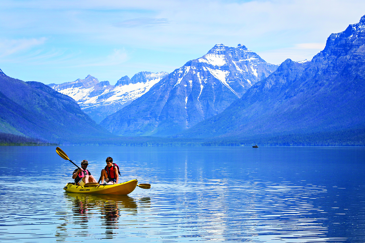
Bowman Lake
This body of water in Glacier National Park north of Polebridge offers beautiful mountain views for canoers, kayakers and stand-up paddle boarders. One mile wide and eight miles in length, there is a front country campsite at its head another backcountry site at its base.
Follow the North Fork Road for about 30 miles from Columbia Falls to Polebridge. Keep going to Glacier Route 7 north to junction with Bowman Lake Road and continue to Bowman Lake Road.
Stop at the Polebridge Mercantile for a bear claw on the way back to town.
New this year, visitors must obtain a ticket to access Glacier National Park via the North Fork. To get a ticket, set up an account on Recreation.gov. Although the park does not charge for the tickets, Recreation.gov charges a $2 nonrefundable service fee.
Hungry Horse Reservoir
Located 15 miles from the west entrance to Glacier National Park, the Hungry Horse Dam is on the South Fork of the Flathead River in Bad Rock Canyon.
The dam was completed in in 1953 to provide hydroelectric power to the area and is 564 feet high, the tenth highest dam in the United States.
The reservoir is about 34 miles long and 23,800 acres with many opportunities for boating, fishing, water skiing and swimming.
The Hungry Horse visitor center is open daily from Memorial Day Weekend through Labor Day from 8 a.m. to 3 p.m.
Lake Koocanusa
This 90-mile-long lake stretches from Rexford to the Libby Dam and offers several recreational areas, including the Rocky Gorge with 120 campsites and a boat ramp.
Whitefish, kokanee, burbot, rainbow and cutthroat trout inhabit the waters and provide ample fishing opportunities. Paddle or take a motorized boat to the Yarnell Islands, which also have campsites.
From Eureka, follow MT Highway 37 south for seven miles to Rexford.
Whitefish River
Launch a boat at City Beach to begin in Whitefish Lake, the mouth of the Whitefish River, to float 15 miles to take out at the MT Highway 40 bridge.
For a shorter float, put in at Riverside Park and paddle upstream to Whitefish Lake.
Tally Lake
At 492 feet, Tally Lake is the deepest lake in Montana at an elevation of 3,500 feet with a campground encompassing 23 acres.
Recreationists can enjoy paddling and swimming on Tally Lake, which has a boat launch and designated swimming area with a large grassy area and picnic sites.
Clearwater River Canoe Trail
Located north of Seeley Lake, the Clearwater Canoe Trail is a one- to two-hour paddle trip flowing on three-and-a-half miles of the Clearwater River in the Seeley Lake Ranger District.
Paddlers will flow through dense willow marsh with opportunities to view great blue herons, western painted turtles, muskrats, beavers and dragonflies. The final portion of the trip crosses the north end of Seeley Lake and a 30-minute return hiking trail winds up the river and wetlands.
From Kalispell, head south to MT Highway 83 and head west at the Clearwater Canoe sign, about four miles north of Seeley Lake. Proceed half-a-mile to the put-in.