As the Flathead Valley’s cool spring continues into June, water supply specialists with the United States Department of Agriculture (USDA) are forecasting above normal streamflows in northwest Montana as spring runoff continues.
Eric Larson, a hydrologist with the USDA Natural Resources Conservation Service, says the west side of the Continental Divide experienced a near-normal water supply this season, with significant precipitation in April and May but below normal moisture in January and February.
As of June 3, the snow water equivalent (SWE) levels in the Flathead River Basin were 146% of normal based on median percentage between 1991 and 2020. The Kootenai was 222%, the St. Marys River Basin was 140%, the Sun-Teton-Marias River Basin was 151% and the Lower Clark Fork River Basin was 191%.
“Those high percentages are partly driven by cooler weather in May,” Larson said. “That’s snow that would have been melting, so we are currently sitting with more snow than we typically have by June 1.”
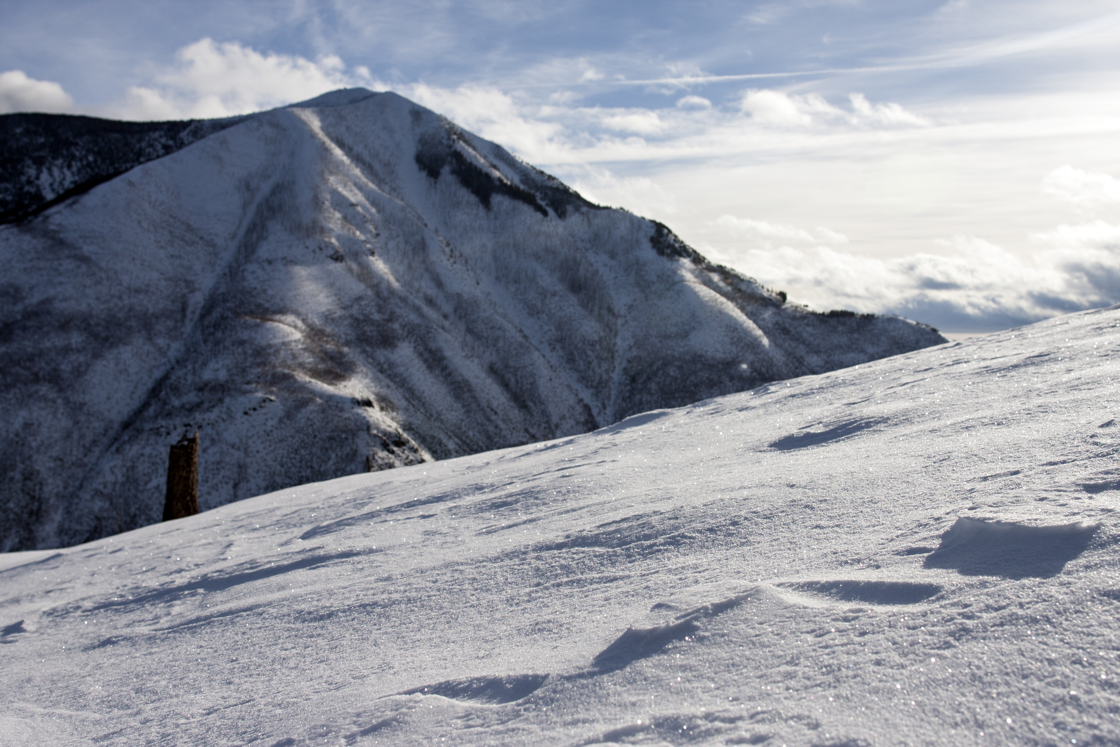
Larson says northwest Montana reached normal peak snow levels at high elevations this year and weather stations at elevations about 6,000 feet are still reporting several feet of snow. As of June 3, the Flattop Mountain weather station in Glacier National Park read 93 inches while Stahl Peak in the Whitefish Range read 91 inches.
With significant snow still in the high peaks, Larson predicts an above normal streamflow in the Kootenai, Flathead and Lower Clark Fork river basins this summer.
“The current water supply outlook for the summer is looking good,” Larson said.
Southwest Montana, however, will likely have a below average streamflow this summer, Larson says.
While the region recently received significant moisture in April and May, with four to five inches of precipitation in the Bighorn region at 9,000 feet, Larson says it didn’t make up for sparse snowfall that left the region dry from January to March.
As of June 3, the Gallatin River Basin SWE level was 195% of normal percentage and the Bighorn was 206%. Larson says these percentages are high right now because of the recent moisture and cool spring weather, and the percentages will likely drop.
“It doesn’t tell the whole story,” Larson said. “The big thing to remember is things normally melt quicker.”
Because of an unusually cool spring throughout the state, Larson says southwest Montana weather stations peaked 25 to 30 days later than normal and northwest Montana weather stations peaked 20 to 25 days later than normal.
According to the U.S. Drought Monitor, 94.7% of Montana is abnormally dry as of June 3 while 15.6% of the state, which includes the north central regions, is in an extreme drought. The northern portions of Flathead County are not in a drought.
“Near-normal precipitation would be welcome in Montana this summer,” Larson said.