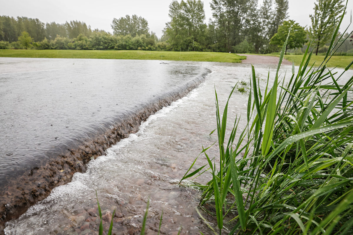
Even as Tuesday’s record rainfall abated early Wednesday morning, flood warnings and advisories remained in effect across portions of the Flathead Valley, impacting structures, roads and farmland along the Flathead River, according to local emergency officials and the National Weather Service (NWS).
Flooding in Columbia Falls, Kalispell, Creston and Foy’s Bend is “causing isolation of many homes within the valley” with some secondary roads becoming impassable and closures on U.S. Highway 93 still possible, according to the Flathead County Sheriff’s Office (FCSO), which on Tuesday evacuated residences on Rabe Road, Lake Drive and Bailey Lane in Columbia Falls, as well as in the Leisure Drive region of Kalispell.
The Montana Red Cross has opened an emergency shelter and evacuation center at Columbia Falls High School located at 610 13th St. W.
Flooding on farms adjacent to the Flathead, Stillwater and Whitefish rivers has been reported and the Steel Bridge Road is impassable in areas, according to the NWS Advanced Hydrologic Prediction Service.
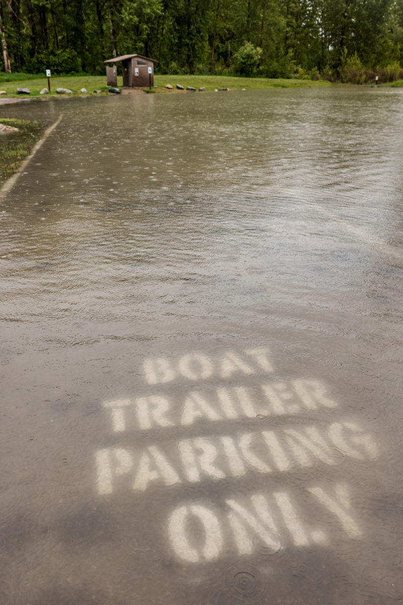
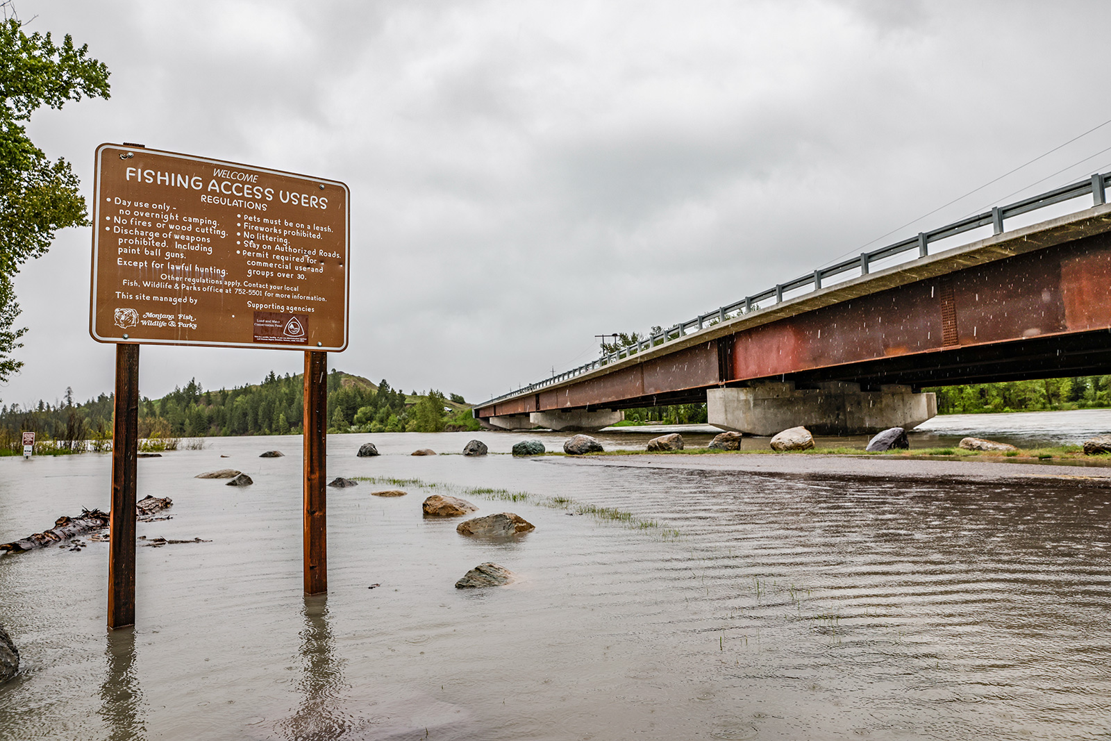
Citing “extremely high water levels” and public safety risks, Montana Fish, Wildlife and Parks (FWP) announced an emergency closure of the Old Steel Bridge fishing access site in Evergreen, with limited access at the Pressentine fishing access upstream as well as at Kokanee Bend fishing access in Columbia Falls.
For a current list of closures and restrictions, visit the FWP website here. Site closures in other areas of the state may be put in place as flooding occurs. An FWP spokesperson said the agency will work to reopen closed areas as soon as conditions allow.
Although the Flathead River wasn’t projected to peak for another week, Flathead County Sheriff Brian Heino on Tuesday issued a “precautionary evacuation” to residents in low-lying areas throughout the county. Heino said emergency personnel was on hand to provide “as much assistance as possible to help in pre-evacuation efforts.” The sheriff’s office and the Flathead County Office of Emergency Services are scheduled to hold a press briefing at 2 p.m. Wednesday at the Flathead County Search and Rescue building, located 525 Three Mile Drive.
A record amount of daily rain was measured Tuesday at 2.07 inches in Kalispell, surpassing the old daily rainfall record of 0.87 inches set in 1973. Nearly 40 inches of snow accumulated at the Noisy Basin SNOTEL site in the Swan Range, holding nearly nine inches of snow water equivalent (SWE).
As of June 14, water was flowing off Columbia Mountain into the Berne Roadside Park area across U.S. Highway 2 into the Flathead River and authorities urge drivers to use caution.
U.S. Forest Service officials on Wednesday announced a closure along the West-Side Hungry Horse Reservoir Road between Mazie Creek Road and Graves Road due to a rockslide and an unstable slump area and public safety concerns. The closure is between mile markers 29.7 and 33.4, according to a news release sent out on Wednesday.
Mazie Creek Road is planned to open on July 1. Graves Creek Campground and Handkerchief Lake Campground remain open but must be accessed via the East-Side Hungry Horse Reservoir Road.
Authorities also closed the Blankenship Bridge area on June 14 due to high water levels, saying it will remain closed until the water recedes.
“We encourage all forest users to contact a local forest service office to obtain current information about road and trail conditions, access, and ideas for alternate travel routes,” Flathead National Forest Spokesperson Tami Mackenzie said in a prepared statement. “Recreationists on or near rivers and streams should use extreme caution as water levels may fluctuate quickly.”
As water levels fluctuate, crews are surveying forestland and officials continue to find road damage.
“We will continue to monitor across the forest, and we anticipate additional damage and challenges as the heavy precipitation and high run-off occurs,” Mackenzie said.
Missoula-based NWS Meteorologist Jennifer Kitzmiller says widespread precipitation in northwest Montana has brought two inches of rain to valleys with three to four inches of rain above 5,000 feet.

“Due to rapidly changing conditions, large geographic size of the evacuation areas, and limited staff resources, emergency personnel may be unable to reach everyone,” according to a Tuesday Flathead County Sheriff’s Office press release. “As such, the Flathead County Sheriff’s Office urges residents to remain diligent and assess for high water levels and potentially dangerous situations. Individuals can monitor water conditions on the National Weather Service.”
“High river levels cause fast-flowing currents, unpredictable conditions, and very cold water with large amounts of debris,” Heino stated in the release. “Residents need to stay aware of current weather conditions and avoid low elevation areas when possible. Emergency staff are working to provide information as it becomes available. The safety of our community is our number one priority.”
According to U.S. Geological Survey (USGS) streamflow data, the Flathead River gauge in Columbia Falls was running at 49,100 cubic feet per second (CFS) on Wednesday morning, above the flood stage of about 42,000 CFS. The mean flow is typically around 25,600 CFS on this date.
The Flathead River’s historic flood in 1964 was 176,000 CFS and the most recent peak gauge height was about 54,000 CFS in May of 2013.
On June 13, the Yellowstone River flooded in southwest Montana, wiping out roads and bridges, and prompting Yellowstone National Park closures at all entrances. Residents in Livingston and Red Lodge were evacuated and inhabitants of Gardiner at the northern entrance of the park are currently trapped due to road damage.
The NWS predicts the Flathead River will rise to about 63,400 CFS by June 18. Precipitation is forecast to stop by midnight tonight, Kitzmiller said, but warm weather in the 80s and 90s will cause additional snowmelt.
“We will be on a bit of a rollercoaster ride,” Kitzmiller said. “It’s a bit of a whiplash from snow to warming to 90s in southwest Montana.”
The heavy rainfall has been the main driver of spiked river levels, Kitzmiller said, and rising temperatures will trigger more snowmelt.
Kitzmiller said there is a road closure on Highway 508 near Troy, but forecasts indicate the Yaak River will drop below flood stage tomorrow.
“Depending on that system and how heavy the precipitation is, we could see another round of flood concerns,” Kitzmiller said. “We recommend that people don’t let their guards down. There is some potential next week for issues.”
Additionally, mountain weather stations above 6,000 feet received widespread snow throughout northwest Montana, with Noisy Basin in the Swan Range receiving 36 inches of snow in 48 hours, boosting the total snow depth to 86 inches, according to SNOTEL data. Flattop Mountain in Glacier National Park received 17 inches and Stahl Peak in the Whitefish Range received 21 inches in the same timeframe.