Evacuation Orders Lift as Elmo Fire Slows
The Elmo Fire burning near Lake Mary Ronan has slowed as firefighters improve containment lines, allowing the state park to reopen; other wildfires in Lake and Flathead counties were more active Tuesday
By Micah Drew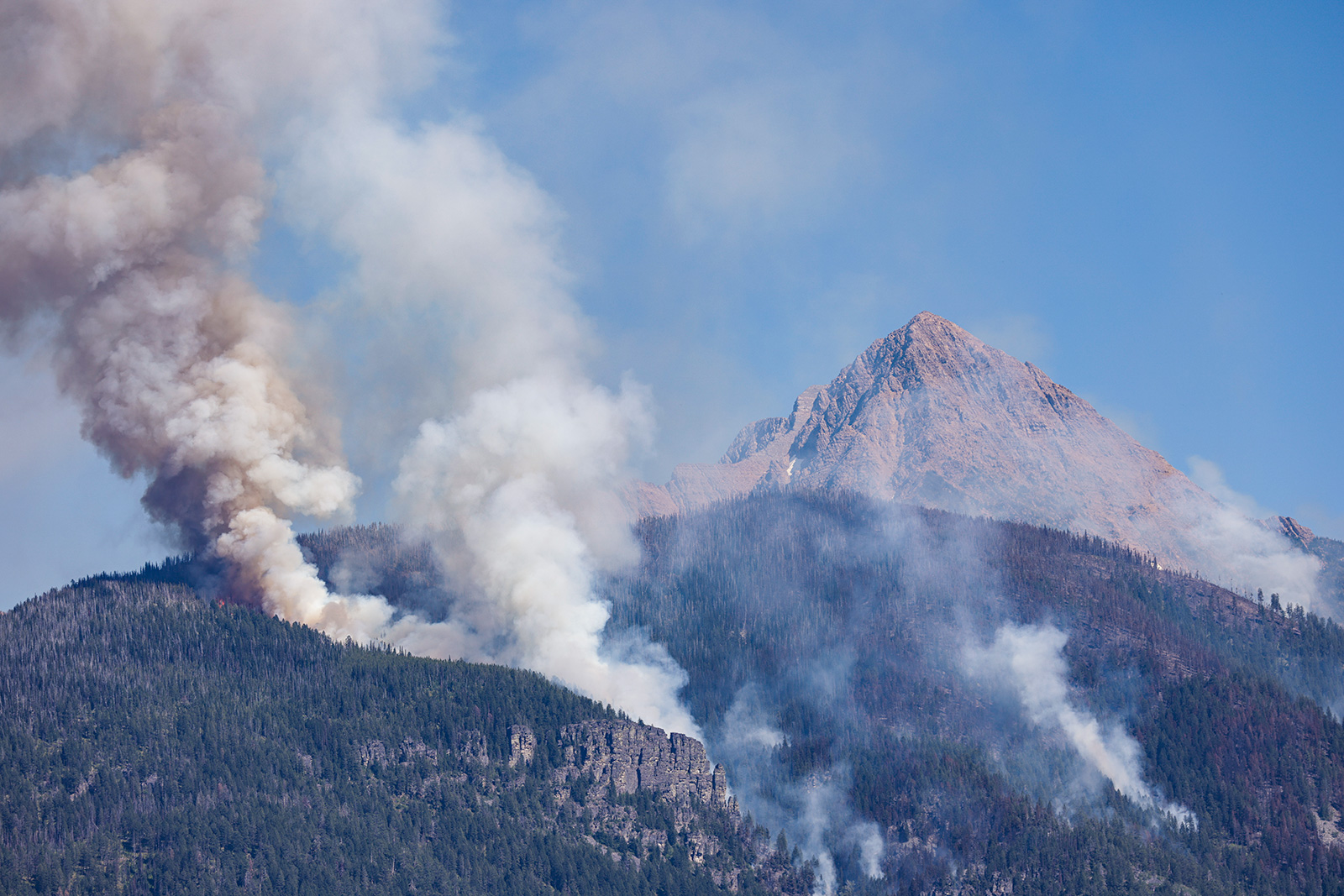
The footprint of the Elmo Fire burning southwest of Flathead Lake barely budged overnight with the fire only adding four acres of growth. The 21,349-acre fire is now 61% contained.
Following consultation with the Northern Rockies Incident Management Team, officials with Montana Fish, Wildlife and Parks announced that Lake Mary Ronan State Park will reopen to the public on Wednesday, Aug. 10 for normal activities including camping. The boat ramps at the park and the Elmo Fishing Access Site are open.
Evacuation orders for residents along Lake Mary Ronan Road west of Dayton Creek Road have been lifted and pre-evacuation warnings will lift at 12 a.m. Wednesday morning. Pre-evacuation warnings for residents of Chief Cliff Lane, Black Lake Road, Big Meadows Road and Dayton Creek Road will also lift Wednesday morning.
Camp Tuffit/West Shore Road remains under evacuation order and is closed to all traffic.
As firefighters worked on reinforcing firelines on Monday, firefighting resources and air assets were redirected to support tother fires in the area.
The Redhorn Fire, burning seven miles northeast of St. Ignatius in the Mission Mountain Tribal Wilderness, has grown to 483 acres above the south side of McDonald Lake. The lake is closed for recreation, and the area south of the lake is currently in its annual closure to all recreation due to grizzly bear habitat through Oct. 1.
Hand crews continued work building a fuel break above the canal at the base of the mountains on Tuesday. Air resources including helicopters and Super Scoopers from the Elmo Fire continued making water drops throughout the day, focusing on slowing downhill movement of the fire’s perimeter.
There will be a community meeting on Aug. 10 at 7 p.m. at the St. Ignatius Fitness Center. Lake County remains in Stage 1 Fire Restrictions.
The Weasel Fire, which was discovered burning in the Flathead and Kootenai National Forests on July 30, and which crossed the Canadian border on Aug. 4, has grown to just over 3,000 acres. Approximately half of the fire’s acreage is actively burning in British Columbia.
The lightning-cause fire is burning in remote, inaccessible wilderness and has become a “monitor only” fire, according to B.C. Wildfire Fire Service Incident Commander Scott Rennick. The fire is expected to continue pushing into the Canadian Flathead Valley, but fire officials said they do not predict it to “run in a big way” over the next few days.
On the U.S. side, road closures remain in place along National Forest System Trail #78 (Clarence/Rich) in the Kootenai National Forest and Forest Service Road #114A (Frozen Lake) in the Flathead National Forest.
In addition, portions of the Tuchuck Mountain Alternate and 10 Lake Alternate sections of the Pacific Northwest Trail have been closed. The Great Divide Mountain Bike Route is not currently affected by the fire.