Fire Danger Very High, Extreme in Northwest Montana
New fire starts detected in Northwest Montana as region enters peak wildfire season
By Micah Drew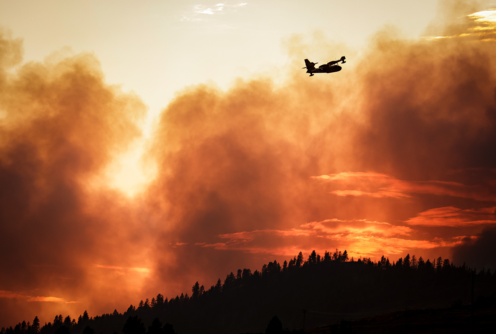
Interagency fire managers from northwest Montana declared most of the region to be in Very High fire danger following their latest meeting. Sanders County is now in Extreme fire danger and will enter Stage 1 Fire Restrictions beginning Aug. 15. Lake County and the Flathead Indian Reservation remain in Stage 1 Fire Restrictions.
The Northern Rockies Coordination Group (NRCG) Northwest Montana Area is made up of representatives from the U.S. Forest Service, National Park Service, Montana Department of Natural Resources and Conservation (DNRC), Montana Fish Wildlife and Parks (FWP), and Flathead, Lincoln, Lake and Sanders counties.
A fire danger rating of Very High indicates that fires may easily start from all causes and immediately after ignition can spread rapidly in size and intensity. Fire managers ask everyone to remain vigilant in preventing fires.
“Please use common sense and good judgement when out working or recreating this time of year,” DNRC Fire Management Officer Dylan Kopitzke said in a press release. “It’s hot, grasses are cured, forest fuels are dry, afternoons can be windy, and fires move surprisingly fast. Give us a hand in the coming weeks as we reach peak fire season.”
Burning of debris is not allowed from July 1 through the end of September. If recreating in Flathead or Lincoln counties, consider skipping a campfire or keep them small and contained within a fire ring and ensure they are out cold before leaving a campsite.
All trailer chains should be secured and avoid driving on dry grass where sparks could easily ignite roadside grassfires.
Firefighters continue to block growth on the Elmo Fire burning near Lake Mary Ronan. The fire is at 75% containment and remains at 21,349 acres.
Thursday evening thunderstorms resulted in a new lightning-caused fire one mile north of Lake Mary Ronan. The Silver City hotshots and engine crews responded to the fire and estimated it at three acres on Thursday evening. A helicopter was supporting firefighting efforts on Friday.
On the main Elmo fire, crews have begun to pull excess hoses from the western containment lines, but continue to patrol and monitor the area. Firefighters with helicopter support continue to locate pockets of interior heat on the northwest edge of the fire. The remaining uncontained section of the fire along the northern edge is estimated to require several days of work where the fire edge is uneven.
Camp Tuffit/West Shore Road remains under evacuation order and is closed to all traffic.
The Redhorn Fire, burning seven miles northeast of St. Ignatius in the Mission Mountain Tribal Wilderness, has grown to 515 acres above the south side of McDonald Lake. The lake is closed for recreation, and the area south of the lake is currently in its annual closure to all recreation due to grizzly bear habitat through Oct. 1.
There are currently 130 personnel assigned to the fire. Crews are continuing to construct a fuel break above the canal at the base of the mountains. Hand crews continued work building a fuel break above the canal at the base of the mountains on Tuesday.
Lake County and the Flathead Indian Reservation remain in Stage 1 Fire Restrictions.
Up in Canada, the Weasel Fire, which was discovered burning in the Flathead and Kootenai National Forests on July 30, has grown to just over 4,200 acres. Approximately 2,700 acres are actively burning in British Columbia.
The lightning-caused fire is burning in remote, inaccessible wilderness and has seen steady growth on the American side to the west, as well as northeast into the Canadian Flathead Valley, according to B.C. Wildfire Fire Service Incident Commander Scott Rennick. In his latest update, Rennick said they will be watching weather over the weekend for potential lightning strikes and increased winds, which could push the fire northeast further into the Flathead.
Vast recreational restrictions are in place in B.C. through Oct. 15 to protect the public where fire suppression activities are taking place.
On the U.S. side, the fire has crossed Road 114A and is burning south towards a fire scar from a 2017 fire in the same area. Crews have applied protective wrappings to the historic Weasel Cabin and the Wam Fire Tower. Road closures remain in place along National Forest System Trail #78 (Clarence/Rich) in the Kootenai National Forest and Forest Service Road #114A (Frozen Lake) in the Flathead National Forest, though access to Polebridge via Grave Creek Road (Road 114) remains open.
Another fire, first detected on Aug. 7, is burning in the Spotted Bear Ranger District of the Bob Marshall Wilderness. Dubbed the Cannon Fire, the lightning-caused blaze is burning in the Cannon Creek drainage and is estimated at 18 acres.
So far no actions are being taken on the fire but the Forest Service continues to monitor it from the Spotted Bear and Jump lookout, as well as through aerial reconnaissance.