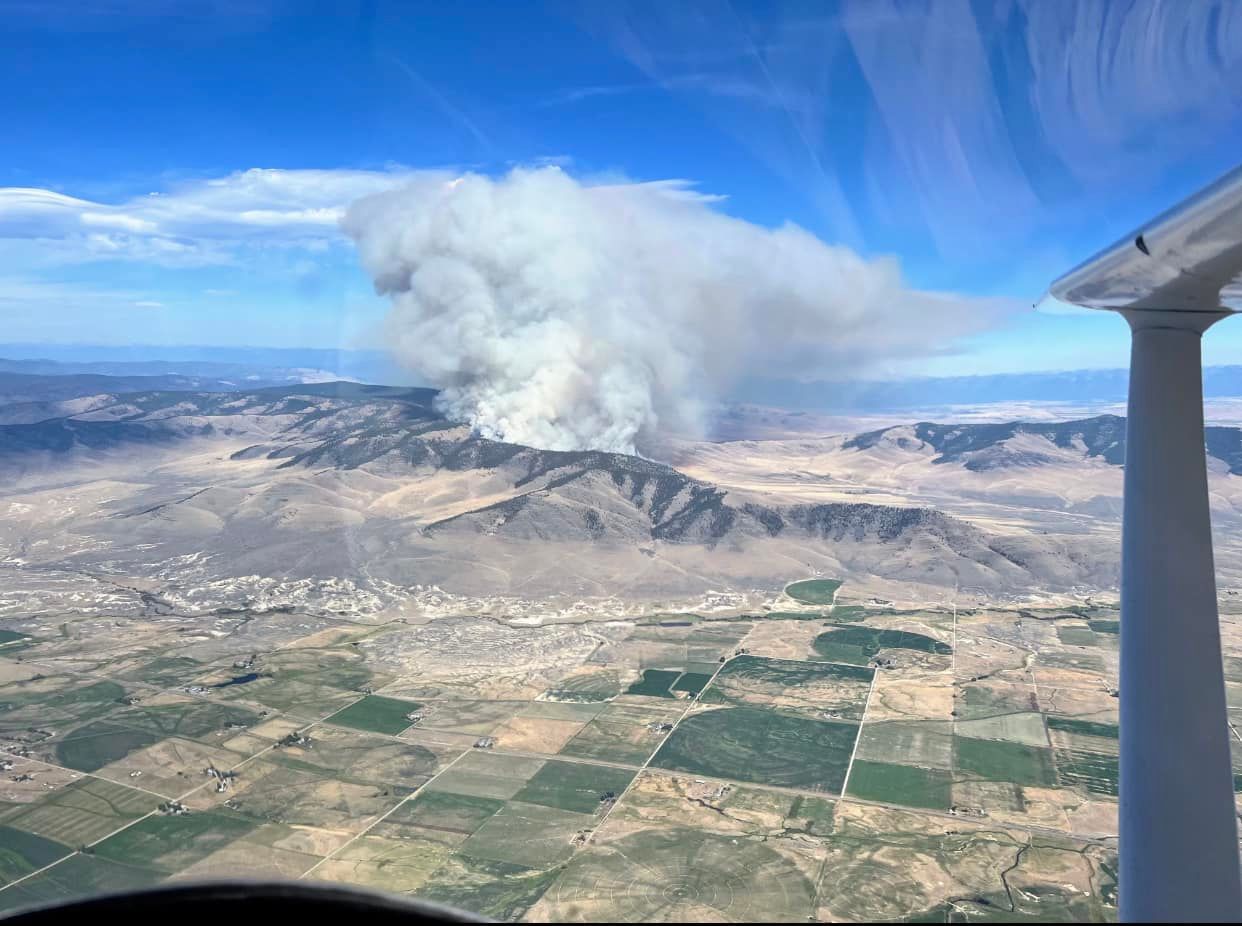
The Garceau Fire burning 10 miles west of Polson and about 7 miles northeast of Hot Springs was estimated by late Tuesday evening to be 1,500 acres in size and zero percent contained.
A Wednesday morning report from the Northern Rockies Coordination Center describes the fire has human-caused. Wednesday afternoon the Confederated Salish and Kootenai Tribes Division of Fire reported that the fire was caused by an electric fence.
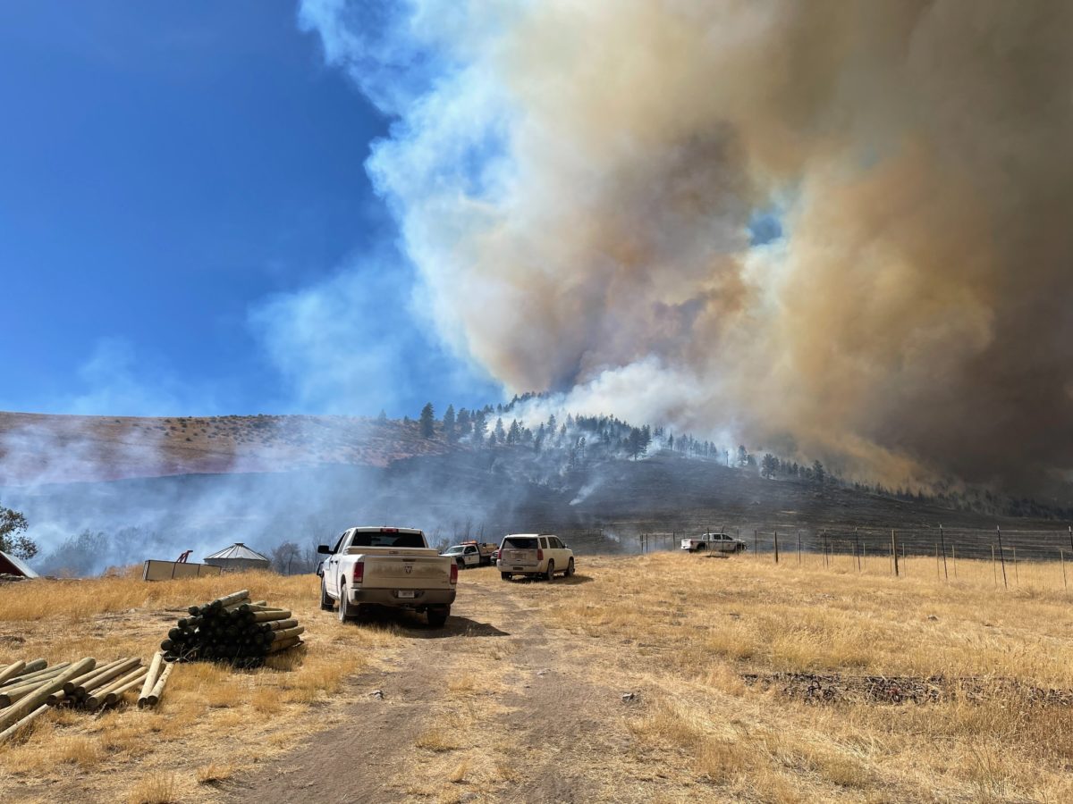
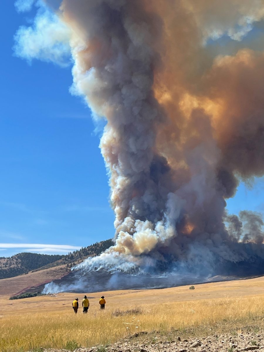
The fire began burning sometime Tuesday afternoon. According to CSKT Division of Fire 110 personnel have been assigned to the fire, and a local Type 3 incident management team has been given incident command. C.T. Camel, a fire information officer for CSKT Division of Fire, said firefighters were on the fire until 2:30 a.m., and that more personnel have continued to arrive on the fire.
Speaking late Wednesday morning, Camel said fire activity had slowed, but that he couldn’t offer any predictions about what the rest of the day could bring.
“We still got the heat of the day this afternoon,” he said.
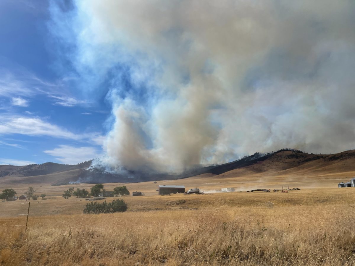
Most of the fire growth on Tuesday had been to the northeast, Camel said. The fire initially started down in a valley in grass and from there began to burn away from structures in the area.
A Tuesday evening update from CSKT Division of Fire stated there were no evacuations and no structures threatened. Irvine Flats Road as it goes up to Windy Gap was closed to through traffic until further notice.
During the initial attack on the fire a variety of air resources were used, including single engine air tankers, heavy air tankers, and helicopters. Bulldozers and skid engines have also been used to build control lines around the fire.
By Wednesday morning, firefighting costs had reached an estimated $300,000.
A situation report from the National Interagency Coordination Center published Wednesday morning stated that extreme fire behavior had been observed, including uphill runs, group torching and short-range spotting.
The Garceau fire is burning in a similar area to the West Garceau fire of 2012, which began in mid-August of that year. The West Garceau fire grew to over 9,000 acres and led to structure losses and evacuations.
Last week interagency fire managers in northwest Montana declared most of the region to be in “Very High” fire danger, indicating that fires could easily start from all causes, and could spread rapidly in size and intensity. Sanders County, Lake County and the Flathead Indian Reservation are all in Stage 1 Fire Restrictions.