The Art of Cartography
Professional cartographer Ryan Dalton was inspired by his bird dog to create custom maps depicting public land in Montana. He’s since built dozens of GPS smartphone maps for a host of Flathead Valley organizations, and has captured the region’s most iconic landscapes in large-format wall art.
By Tristan Scott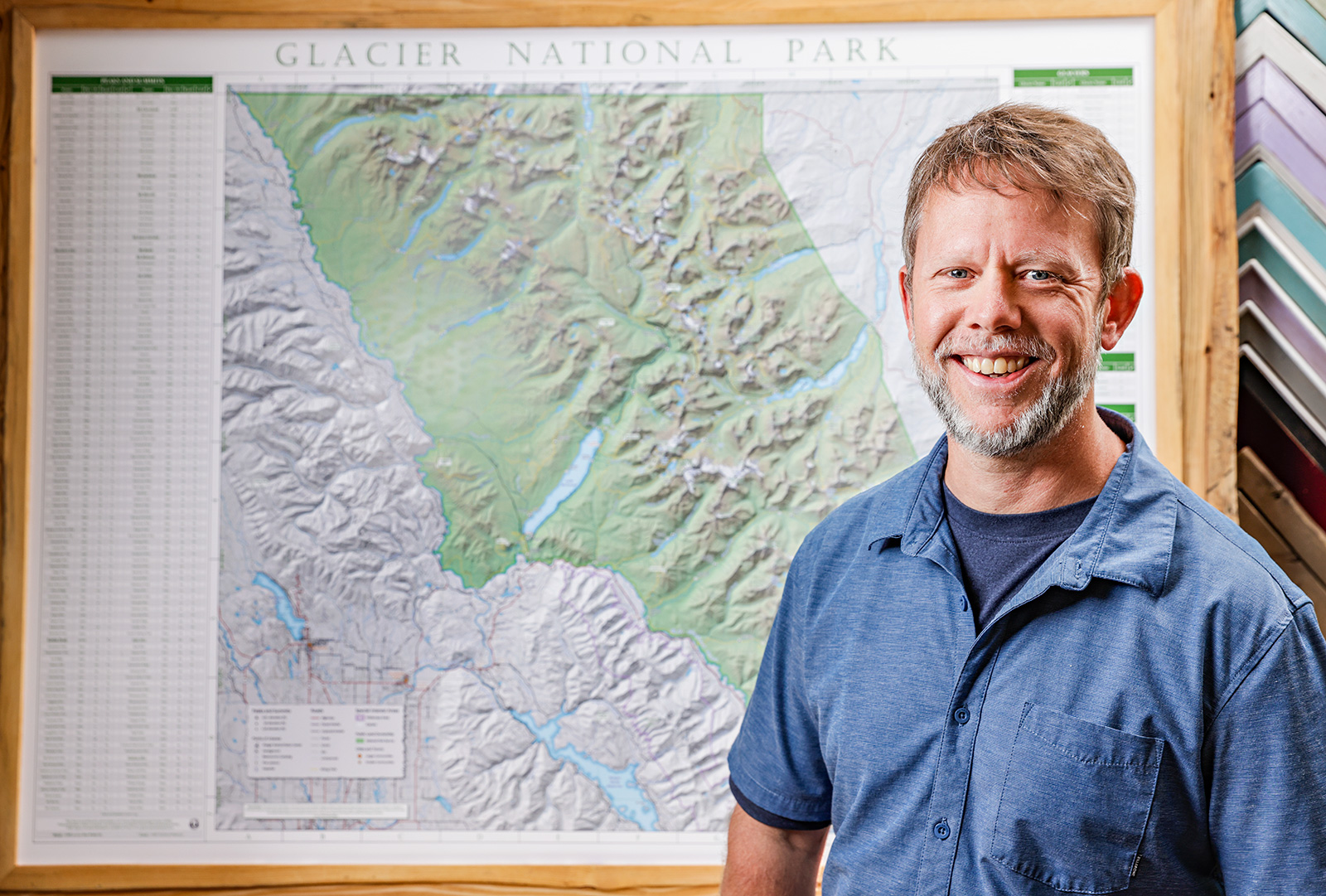
Back in 2015, Ryan Dalton and his bird dog, Driggs, were novice hunters trying to learn the lay of the land, but they both had the instincts of experts.
For Driggs, it was his pedigree as an American Brittany that gave him his field savvy, while Dalton applied his talents as a mapmaker to navigate the checkerboard divisions of land ownership in Montana, using custom-built GPS-enabled maps to gain valuable information.
“After I got Driggs, on our very first hunting trip, we were on Block Management land in central Montana, and there were these brochure boxes with paper maps with the most basic information — here’s where you are, this is where you can hunt, everything else is private,” Dalton said. “It didn’t really give me the information I wanted. But Montana Fish, Wildlife and Parks is pretty awesome because they provide really good access to their geographic data. You just have to know how to use it.”
Fortunately, knowing how to use it was right in Dalton’s wheelhouse as a Geographic Information Systems specialist, or GIS for short.
Not only did he start building his own maps and navigation technology to assist him and Driggs on those early hunting excursions, but he developed maps catered to the Dalton family’s outdoor lifestyle — maps for river rafting and fly fishing, hiking and disc golfing, and more, each one layered with information relevant to a given activity.
“The way I always describe GIS is by comparing it to those old-school overhead classroom projectors with the transparent film sheets,” Dalton said, evoking the image of a schoolteacher with a marker-stained rag on hand to wipe the sheets clean. “Except with GIS, one sheet might have rivers on it, which doesn’t give you a lot of context on its own. Until you layer another sheet over it, and that sheet might have roads on it. And then you layer public land over that. And fishing accesses. And points of interest. And the names of summits. And pretty soon you’ve built a complete story.”
By 2016, the personal hobby project transformed into an enterprising business when Dalton launched OffTheGridMaps, inking a deal with his first customer, who he still counts among his best more than a half-decade later.
Hilary Hutcheson, owner of Lary’s Fly and Supply in Columbia Falls, agreed to work with Dalton on a map depicting public access sites along the North and Middle forks of the Flathead River, as well as its main stem.
“Her staff had been hand drawing simple maps to get their clients on the water,” Dalton said. “They were our first and still our best customer. They’ve sold hard-copy maps in the shop for over five years now. And their customers love the maps, because when they buy the printed map in the shop, they get to download the GPS-enabled map for free.”
Working with a third-party smartphone app, Avenza Maps, OffTheGridMaps allows users to integrate custom maps with their devices for free using the app’s standard version.
In the last half-decade, Dalton has worked with nearly 20 organizations in the Flathead Valley to tell their stories, publishing over 80 GPS-enabled smartphone maps, including a kayaking map of Flathead Lake, hiking trails in the Jewel Basin, and destination fishing rivers across Montana.
Dalton jokes that OffTheGridMaps began as a “poor man’s OnX,” a reference to the Missoula-based tech company founded in 2009 when it developed an app allowing users to download topographical maps with customized layers before trekking into the backcountry.
However, OffTheGridMaps is unique in that each map is tailored to a very specific user group.
“I like to design every map to tell a story that is interesting to that one viewer, as opposed to designing a map that is interesting to every viewer,” Dalton said.
OffTheGridMaps is also unique in that it allows users to carry a printed version of a map in addition to the digital companion map — a distinction in which Dalton takes pride.
“I’ve had people tell me that paper maps are dead,” Dalton said. “But paper maps allow you to really explore an area as opposed to just access a destination. If you really just want to get to a trailhead or stay within a public land perimeter, your phone is pretty handy. But if you want to know what’s on the other side of that ridge, or what a wilderness area looks like, a tiny screen isn’t very helpful. That’s when a paper map is your best friend.”
And if this all sounds too technical for consideration as an artistic craft, Dalton explains how he puts the “art” in cartography.
“When I started designing maps, I started with a blank slate and got to choose every color, every line thickness, every icon and every font. Over the past five years, I’ve spent thousands of hours changing the shade of a color ever so slightly, changing the line width of a road, picking out new icons or changing font sizes a half-point bigger or smaller so they would all work together better. In most cases, no one but me will ever notice a specific change. But when all those changes are brought together on a new map, my goal is to create a map that is intuitive enough that the design stands on its own, even without a map legend explaining what each feature or color represents.”
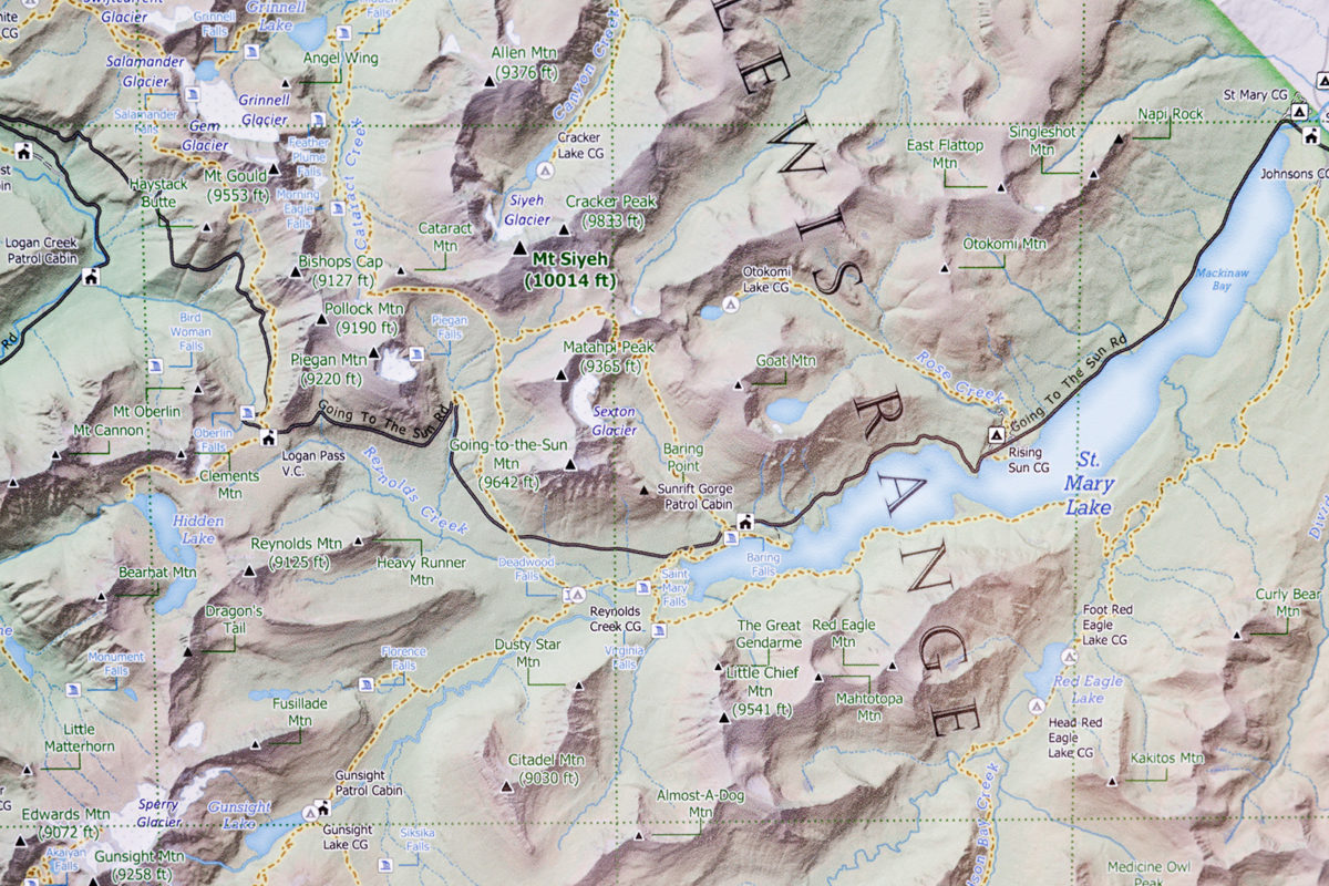
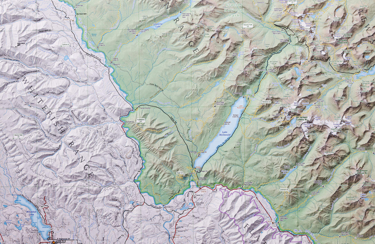
Dalton has also created a series of large-format wall maps of popular Montana destinations and hidden gems, including a map of Glacier National Park’s peaks and summits. Created in cooperation with the Glacier Mountaineering Society, the map has a list of all 234 named peaks in Glacier, their locations as well as a list of all the park’s glaciers, waterfalls, fire lookouts and campgrounds.
That map has gained such popularity that it’s available for sale at both REI and Rocky Mountain Outfitter in Kalispell, as well as at Walking Man Frame Shop and Gallery in Whitefish, where it can be purchased with a custom frame. The large-format maps are available in a range of sizes, from 18-inch-by-24-inch prints to 36-inch-by-48-inch prints. Maps are also for sale through Dalton’s online shop at OffTheGridMaps.com, and he’s available at [email protected] to create custom maps designed for a specific business or event.
Although Dalton is thrilled that the hobby project he and Driggs cooked up back in 2015 has grown into a business, he’s heartbroken that Driggs isn’t around to bask in the accomplishment — he died this summer due to intestinal lymphoma.
As Dalton says, maps tell stories, and sometimes the stories are sad. But he hopes that through OffTheGridMaps, he and Driggs can help others embark on the adventure of a lifetime.