Increased Wildfire Activity Keeps Crews Busy
Northwest Montana had more than a dozen new fire starts over the weekend including three large fires on the Flathead Indian Reservation
By Micah Drew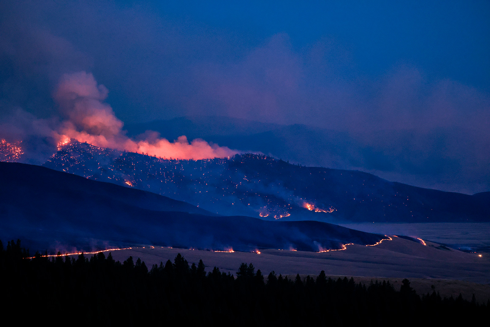
On Monday morning fire officials in the Northern Rockies Geographic Area, which covers Montana, North Dakota, northern Idaho and Yellowstone National Park, responded to 41 new fire starts reported in the last 24 hours, including three on the Flathead Indian Reservation that have collectively burned more than 11,000 acres.
The three major incidents — the Niarada, Middle Ridge and Communication Butte fires — are all located on the Flathead Reservation and being managed by the Confederated Salish and Kootenai Tribes (CSKT) Fire Division. In addition, the Mill Pocket Fire west of the Niarada Fire is estimated at 100 acres. Evacuation orders and warnings are in place for the Niarada and Middle Ridge fires, where structures, cultural resources, timber and grazing areas are threatened by the blazes (see below for detailed information).
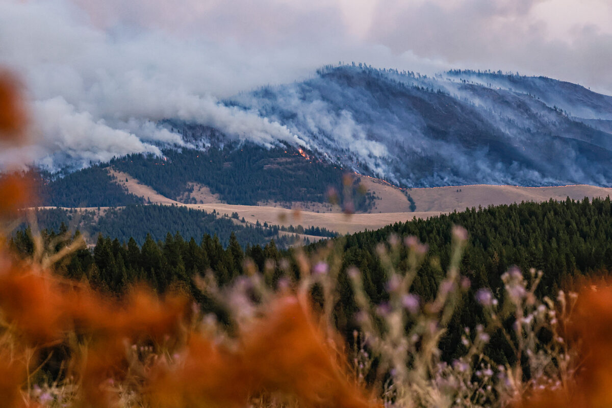
Across the Flathead National Forest, a dry lightning storm Saturday night caused an increase in fire starts with 15 fires reported across the Spotted Bear, Hungry Horse-Glacier View and Swan Lake Ranger Districts. Flathead National Forest Deputy Forest Supervisor Tami MacKenzie said firefighters are continuing to investigate smoke reports as well as assess all fires as they are reported to determine operational plans. All fires are managed with firefighter safety as a priority.
“We’re still working on assessing all of the fires that have started and determine the critical priorities with each fire,” MacKenzie said. “Hopefully we’ll have enough resources to allot to everything we need.”
The largest new fire is burning near Kah Mountain on the Spotted Bear Ranger District. A Type 3 Incident Management Team has been ordered for the fire, which had burned more than 100 acres by Monday morning.
The Hungry Horse-Glacier View Ranger District currently has six fires, one of which is controlled and one of which is contained, according to forest officials. A fire on the Swan Lake Ranger District has been contained.
MacKenzie said there are currently no road closures anywhere in the Flathead National Forest due to wildfire activity, and that while all reported fires were started by lightning, fire danger is ‘very high’ and extreme caution should be exercised by anyone recreating in the area. Under the current Stage 1 Fire Restrictions, no campfires are allowed anywhere on Forest Service land.
“It’s pretty early in the fire season, so it’s good for us to start taking these precautions now,” MacKenzie said.
A visible fire sparked on Saturday afternoon north of Whitefish Lake is currently 80% contained. The North Lake Fire has remained at 17 acres over the last 24 hours and crews continue to mop up spot fires. There will be no more updates on this fire unless conditions change.
Major Wildfire Incidents
Colt Fire
Location: 12 miles northwest of Seeley Lake
Size: 6,177 acres
Containment: 8%
Personnel: 589 firefighters, 5 helicopters
Current Cost of Operations: $11,325,000
Evacuation Warnings/Orders: Mile marker 31 (Beaver Creek Road at the intersection of Highway 83) south towards Seeley Lake to mile marker 27, and including residences in Rovero Flats, are under an Evacuation Order. Residents on Beaver Creek Road (near the summit) are under an Evacuation Warning. Residences beginning at mile marker 27 (south end of Rovero Flats) to mile marker 25.5 (the intersection of the West Fork of the Clearwater Road and Highway 83) are under an Evacuation Warning. Residences on the north and south ends of Lake Inez are under an Evacuation Warning.
Operational Updates: Fire crews will continue work on the control line to the south of the fire to keep the fire north of the Clearwater River, as well as seek opportunities to construct additional control lines on the southwest and west sides. On the north, crews will continue constructing fire lines from Colt Lake to Beaver Lake, and patrol and begin mopping up the fire edge along Forest Road 4356. Aerial support will be utilized for water and retardant drops when available.
Big Knife
Location: 5 miles east of Arlee
Size: 2,982 acres
Containment: 0%
Personnel: 126 firefighters, 2 helicopters
Current Cost of Operations: $1,300,000
Evacuation Warnings/Orders and Road Closures: No mandatory evacuations at this time. The Canal Road, from Mountain Home Road to the Jocko Canyon Road, is closed.
Operational Updates: Extreme fire activity on Sunday night more than doubled the size of this fire. Crews are focused on securing lines on the western edge of the fire near threatened structures. A Complex Incident Management Team has been ordered and will assume command of the fire Aug. 1.
Niarada Fire
Location: 12 miles west of Elmo
Size: 4,275 acres
Containment: 0%
Personnel: 66 firefighters
Current Cost of Operations: $1,000,000
Evacuation Warnings/Orders and Road Closures: Residents along Browns Meadow Road from Highway 28 to the top of the pass, including Kofford Ridge Road, are under an Evacuation Order. Hubbart Dam Road/NF-544 from the intersection of Crossover Road south to Highway 28 are under Pre-Evacuation Warnings. Montana Highway 28 remains closed from its junction with U.S. 93 at Elmo
Middle Ridge Fire
Location: 15 miles west of Ronan
Size: 7,071 acres
Containment: 0%
Personnel: 58 firefighters, 1 helicopter
Current Cost of Operations: $750,000
Evacuation Warnings/Orders: None
Communication Butte Fire
Location: 2 miles north of Dixon
Size: 400 acres
Containment: 0%
Personnel: 21 firefighters, 2 helicopters,
Current Cost of Operations: $200,000
Evacuation Warnings/Orders and Road Closures: The Bison Range at Moiese is currently closed.
Kah Mountain
Location: 12 miles northwest of Seeley Lake
Size: 928 acres
Containment: 0%
Personnel:
Current Cost of Operations:
Evacuation Warnings/Orders and Road Closures: None
Operational Updates: A Type 3 incident Management Team has been ordered.

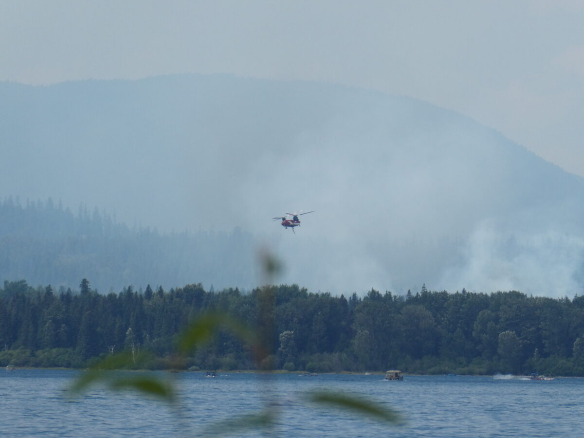
Temporary flight restrictions are in place near all wildfire activity which includes unmanned aircraft such as drones. If drones are spotted in the area of wildfire activity, aerial firefighting operations are forced to cease.