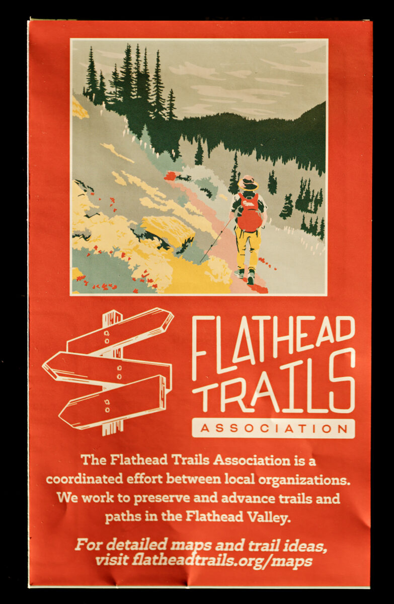
Flathead Trails Association Unveils New Illustrated Map
The new map designed by Allie Maloney weaves together more than 26 partner organizations to showcase recreational opportunities in the Flathead Valley
By Micah Drew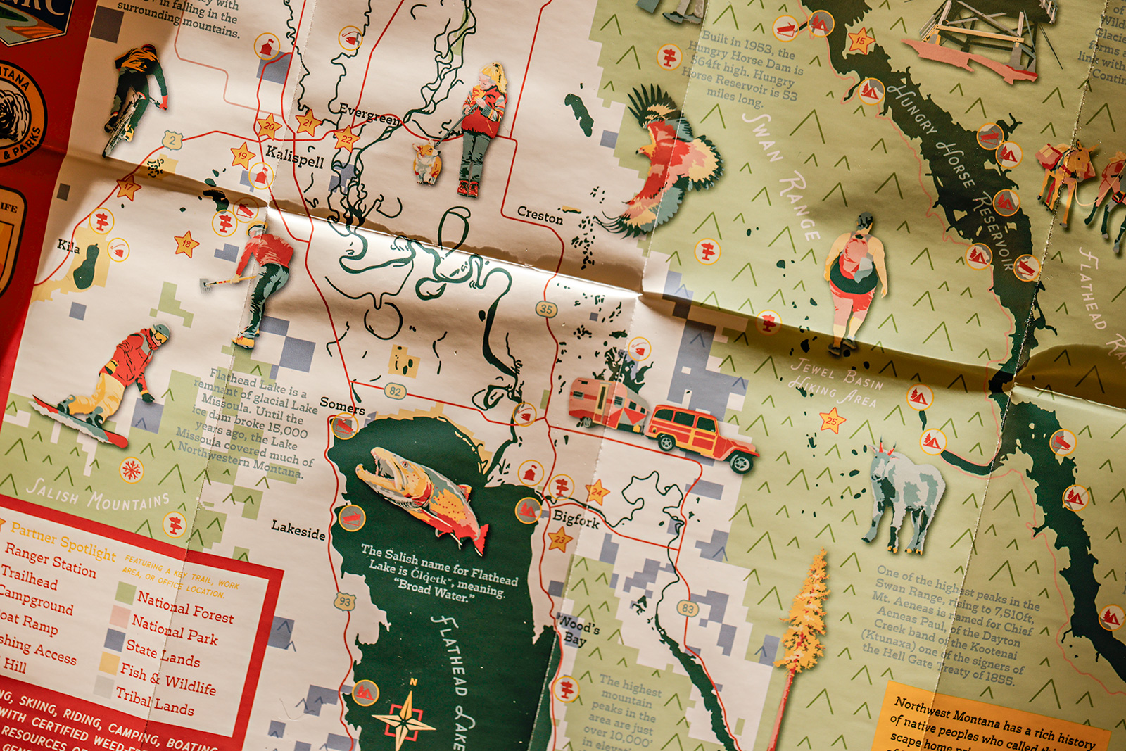
For an outdoor enthusiast in northwest Montana, opting for a trail-based adventure brings myriad options for choosing a map to help plan your outing.
A hike around Kalispell? Grab a Montana State Parks trail map to go to Lone Pine, or a map of the Jewel Basin to head east.
Up for a bike ride? Grab a map for the Whitefish Trail, or one for Foys to Blacktail, or any of the Forest Service ranger district maps.
Not sure where to go? There’s more than 15 different organizations and land management agencies that can provide direction, but they each have their own niche in the valley, with little overlap.
Now, however, there’s a comprehensive guide to the Flathead Valley’s recreational opportunities, a long-time-coming initiative by the Flathead Trails Association (FTA) that locals and visitors alike can use to plan, discover and learn about the outdoor scene in our own backyard.
“There’s so many different land owners and stakeholders across the Flathead, there aren’t any individual maps that bring them all together,” said Jedd Sankar-Gorton, program director for the Whitefish Legacy Partners and a member of the FTA steering committee. “You can have a Forest Service map, a Glacier Park map, a Whitefish Trail map, a Kalispell city map, but you couldn’t really show them all in one spot. Now you can.”
The FTA maps aren’t wayfinding maps but are intended to orient people to the outdoors community at large. Among the illustrated version of the Flathead Valley, designed by Allie Maloney, are markers for the various trailheads maintained and operated by more than a dozen different nonprofit and government organization, educational factoids about the region and insights into how the various groups’ visions are woven together.
“The Flathead Trails Association as a group is trying to raise awareness and connect people in this space we live and play in. It’s equally about people who are new to the area as to those who have lived, for example, in Bigfork for 10 years, but haven’t really explored the trails near Columbia Falls,” Sankar-Gorton said. “It’s not something you’ll be using to wayfind on the trails, but it’s an educational piece that helps people engage further with their community and their landscape.”
The Flathead Trails Association formed in 2017 as a loose coalition of like-minded groups that wanted an umbrella organization to share resources, ideas and a vision. In recent years, the group has worked on increasing its public-facing visibility and impact by hosting the Flathead Trails Fair, launching a website and contracting with Maloney as a part-time coordinator.
One of Maloney’s goals during her time as the FTA coordinator was to take an often-shared idea for a comprehensive trail map and bring it to fruition — a task that took the better part of a year.
“I knew that anywhere we started with this idea was better than not getting around to it. In the future, if it becomes more navigational that’s excellent, but I wanted to start with something mission focused in a beautiful and inspiring way,” said Maloney, who authored and illustrated the Northwest Montana Field Journal.
Maloney said she drew inspiration from old tourist maps from the ’50s and ’60s, “hidden fun illustrated maps where the more you look the more you see.”
The FTA map features nearly 30 illustrations of flora, fauna and recreational users scattered around a regional map color-coded by land management agencies. Trailheads, campgrounds, boat ramps, ranger stations and fishing access points are all marked, and historical facts and educational notices — such as bear aware principles — are scattered throughout. The back of the map includes mission statements of FTA’s 26 partner organizations, many of whom publish detailed trail maps for various regions, and QR codes that link directly to their respective websites.
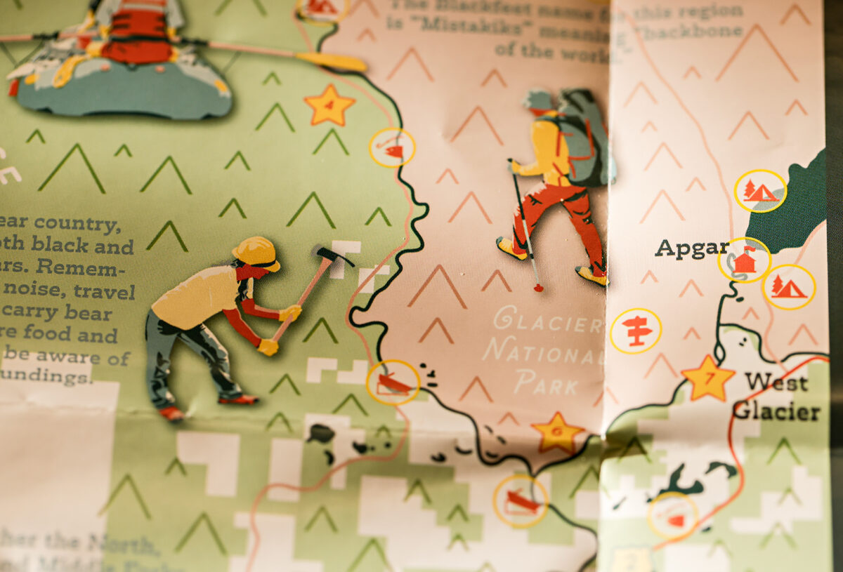
“I knew that we wanted to show people what is here, draw people towards places they haven’t been to before where there are trails,” she said. “It was also important to me to have the opportunity to weave in respect, ‘Leave No Trace,’ and other educational aspects as well. We all share these trails, whether hikers or cyclists or the non-human trail users. There’s no need to feel conflict or angst about it. There’s space for all of us here.”
“Hopefully these maps are a window of inspiration for what you can do and see around the Flathead,” Maloney continued.
The first batch of maps were printed a few weeks ago with help from a Discover Kalispell grant and distributed to FTA’s corporate sponsors and partner organizations to disseminate to the general public.
“This map feels like a way that shows how all these groups, even though they have different user bases and goals, are threaded together through shared goals,” Sankar-Gorton said. “It connects the dots across the Flathead, and does so in a tangible, visual and engaging way.”
To see a digital version of the Flathead Trails Association map, visit their website here.