Detailing a Proposed Route ‘From the Rockies to the Sea,’ USFS Releases Pacific Northwest Trail Management Plan
The comprehensive plan will guide future management, protection and use along 1,200 miles of trail connecting Glacier and Olympic national parks
By Micah Drew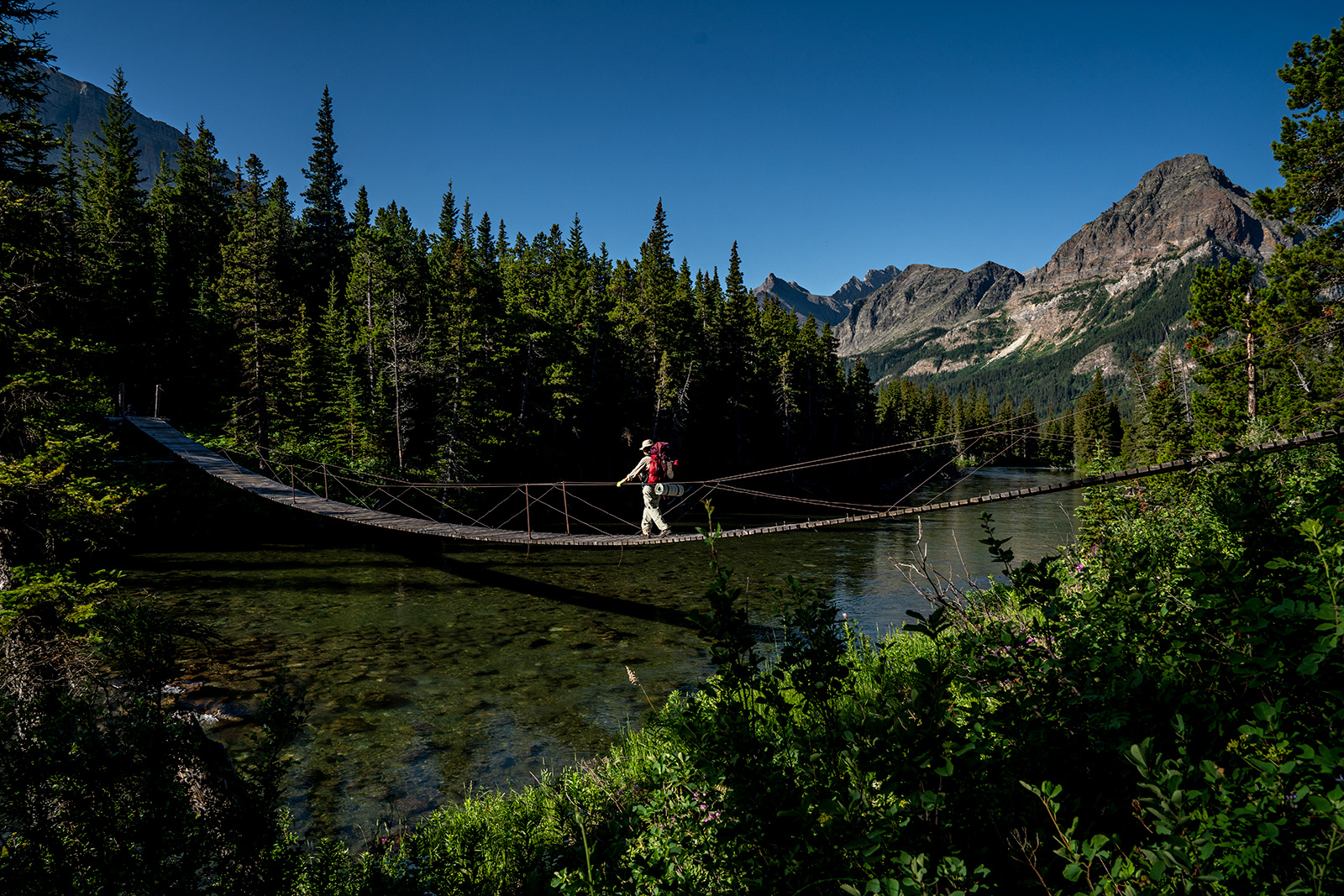
From the Chief Mountain port of entry on the Montana-Canada border, a dedicated hiker can follow a series of backcountry trails, bike paths, old rail beds, paved roads, bushwhacks, and cow paths, all the way to the beach of Cape Alava, Wash., the westernmost point in the continental United States.
This stitched-together route connecting Glacier National Park and Olympic National Park, known as the Pacific Northwest Trail (PNT), stretches 1,200 miles, “from the Rockies to the sea,” crossing seven National Forests, six wilderness areas, and three national parks, as well as tribal, municipal, and private lands in Montana, Idaho and Washington.
In December, the U.S. Forest Service released the final version of the PNT comprehensive plan, a document which outlines a vision for the non-motorized trail and provides guideposts for management, conservation and use into the future. The trail has only existed in its official capacity for 15 years, and like other early national scenic trails “much more work is needed to complete the optimal route from end to end,” the plan states.
“With the comprehensive plan in place, new trail locations can be studied, and new trail segments will be constructed as conditions allow,” Pacific Northwest Acting Regional Forester Liz Berger said in a press release. “This will enable the trail to evolve and adapt to changing needs and environmental considerations, ensuring its sustainability for future generations.”
The PNT was first proposed and completed in the 1970s but wasn’t officially designated as a National Scenic Trail by Congress until 2009, joining other long-distance hiking staples like the Pacific Crest Trail, the Appalachian Trail and the Continental Divide Trail, the latter of which also has a terminus on the Montana-Canada border in Glacier Park.

According to federal law, a comprehensive plan was supposed to be completed within two years of the trail’s official designation but the Forest Service delayed for many years, prompting a lawsuit by the Yaak Valley Forest Council, an environmental group concerned about the trail’s route through a delicate section of grizzly bear habitat. The lawsuit gave the Forest Service a Dec. 31, 2023 deadline for finalizing the comprehensive plan, and the 290-page document was made public on Dec. 12.
With the plan now complete, trail advocates and land management agencies have a blueprint for improving the existing trail, planning reroutes and acquiring additional land to secure the PNT’s future.
Due to both the trail’s primitive state and its remoteness, it is not a very popular long-distance designation for hikers. Jeff Kish, the executive director of the Pacific Northwest Trail Association, estimates that fewer than 100 people attempt the trail each year. By comparison, the Continental Divide Trail, the least-traveled of the three main long-distance national scenic trails in the country, averages around 200 thru-hikers a year while the Pacific Crest Trail Association issued 4,628 thru-hiker permits in 2022, though fewer than a quarter of hikers completed the trail in its entirety.
The accompanying environmental analysis for the PNT estimates a carrying capacity for thru-hikers is between 552 and 1,748 during the high-use season. For grizzly bear advocates, the most problematic segments of the trail pass through the Cabinet-Yaak and Selkirk Mountains grizzly bear recovery zones — the same sections the Yaak Valley Forest Council took issue with in 2019 and would like to see rerouted south of the Kootenai River.
“I have no real quarrel with another trail; I just don’t want it to traverse this last beleaguered patch of bear habitat,” Yaak Valley Forest Council Executive Director Rick Bass told the Flathead Beacon in 2019.
The newly finished plan is expected to increase collaboration between the trail’s stakeholders, according to the Forest Service press release. The umbrella document offers a blueprint for the trail’s completion and future trail-specific projects, and functions as a tool for conservation across the region.
Kish, the Pacific Northwest Trail Association executive director, said he expects to see heightened attention paid to the trail’s development over the coming months.
“With an authorized plan in place, 2024 will be the year we can begin the work to complete the PNT,” Kish said in a video posted to Facebook. “We’ll begin the optimal location review process, which will allow us to move the PNT off of roads into the breathtaking landscapes that were envisioned for the trail.”
“When I joined the inaugural PNT advisory council in 2015 and was asked to set the stage for the first meeting by giving a presentation about my PNT thru-hike, I couldn’t yet grasp that seeing this project through to completion would be one of the defining projects of my career,” Kish said. “Eight years and countless meetings later — from Washington State to Washington D.C.— I am so proud of what we’ve been able to accomplish and have never been more excited for what’s to come.”
To learn more about the PNT, visit www.pnt.org and www.fs.usda.gov/pnt.