Hydrologists Forecast Slightly Below Normal Streamflows in Northwest Montana
Snow water equivalent levels in the Flathead River basin are near normal at 99% while water supply on the Rocky Mountain Front is well below normal at 76%
By Maggie Dresser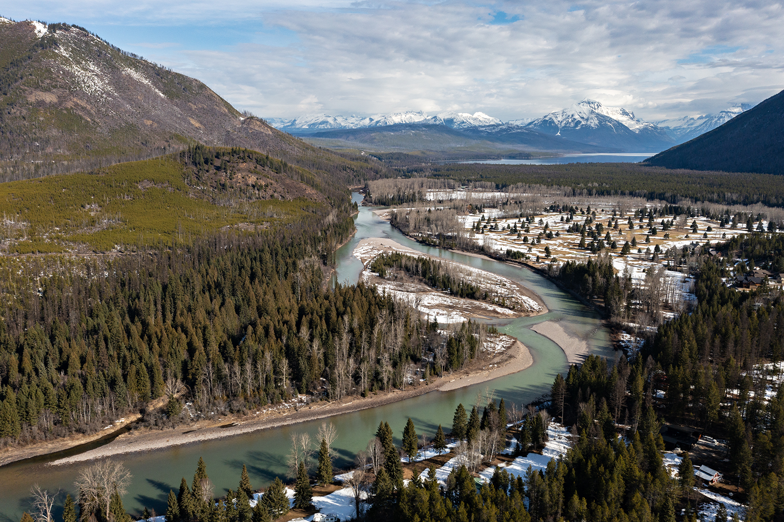
Following a wet March, most of northwest Montana’s river basins are expected to see slightly below-average streamflows while snowpack deficits on the Rocky Mountain Front will likely be below average from April to July, according to the USDA Natural Resources Conservation Service (NRCS) water supply outlook.
“The good news is precipitation was above normal across a majority of the state during March, with nearly all river basins receiving 110-140% of median total monthly precipitation,” NRCS hydrologist Eric Larson said in a news release.
Significant precipitation that included snowfall, snowmelt and rain across Montana helped boost the snowpack statewide, bringing more than a foot of snow to the highest elevations in northwest Montana.
In the Flathead River basin, March precipitation was well above normal with snow water equivalent (SWE) levels at 130%, boosting the seasonal accumulation, which measures levels from October to March, to 89% of normal. The Kootenai River basin was also well above normal at 136% in March, boosting the seasonal accumulation to 90% of median.
As of April 8, the Noisy Basin SNOTEL site in the Swan Range was 119% of normal while Grave Creek in the northern Whitefish Range was 116% above normal. But snowpack deficits persist on the east side of the Continental Divide with Many Glacier at 66% of normal.
While last month’s precipitation brought the Sun-Teton-Marias River basin on the Rocky Mountain Front to 123% in March, this year’s seasonal accumulation is only 76% of the median snowpack, as of April 8. SWE deficits in this region ranged from 3 to 8 inches below normal compared to 2019 and 2010, respectively.
“The Rocky Mountain Front needs several large winter storms during April and May,” Larson said.
SNOTEL sites with the highest total accumulation in March include Bear Mountain in the Kootenai and Lower Clark Fork basins with 14 inches, while Flattop Mountain in the Flathead and St. Mary basins received 9 inches. Sites with the lowest accumulation included Rocky Boy in the Bear Paw basin with 1 inch.
March’s precipitation helped northwest Montana recover from early season snowpack deficits, but hydrologists say the warm temperatures also contributed to widespread melting at low elevations.
Warm weather accompanied the wet conditions last month, with eastern Montana’s temperatures rising to nearly 10 degrees above normal while areas in the western part of the state saw up to 6 degrees above normal. The unseasonable temperatures influenced snowpack across the state, which led to early melting while hydrologists warn that near or below normal temperatures will be needed to delay high-elevation runoff this spring.
“Montana’s mountain snowpack conditions are better than last year at this time but we are not out of the woods yet,” Larson said. “Spring is generally a wet time of the year in Montana, hopefully that holds true this year.”
