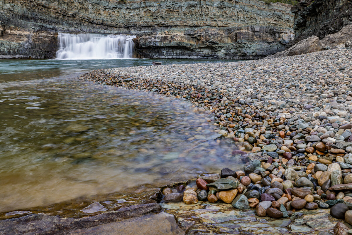
Driving along the Fisher River east of Libby offers a glimpse of what much of the Pacific Northwest looked like a century ago. The pristine Fisher River rushes through the mountainous landscape, unrestrained and free to carve its own path. Evergreen trees blanket the countryside, creating an endless carpet of green in some areas. While certain sections have been harvested for timber, it’s easy to look at the hillsides and imagine a time when few people roamed this territory.
Of course, there is some evidence of human influence here. Most notably, the one-lane U.S. Forest Service road you’re driving on and the railroad that occasionally makes appearances through the trees. Built in the 1960s, it’s a thoroughly modern rail line — mostly straight, with few curves, unlike those built in the late 19th and early 20th century — that often conveys endless lines of containers from places like the Port of Portland, about 500 miles west of here.
But aside from the road and the rails, this stretch of land, part of the Kootenai National Forest, is generally unencumbered by man.
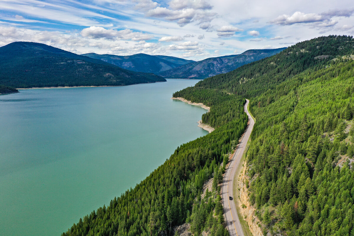
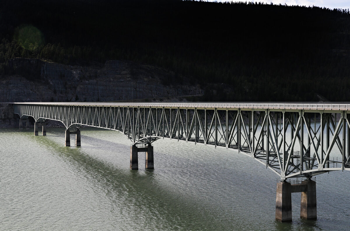
Yet drive a little further west, following Fisher River Road over the tracks to where it connects with Montana Highway 37, and you’ll soon see how dramatically humans have altered and controlled nature in the Pacific Northwest. The wild and free Fisher River, your companion on that twisting mountain one-lane, is now replaced by the wide and controlled Kootenai. Highway 37 is also wider in these parts, and high-power utility lines loom overhead.
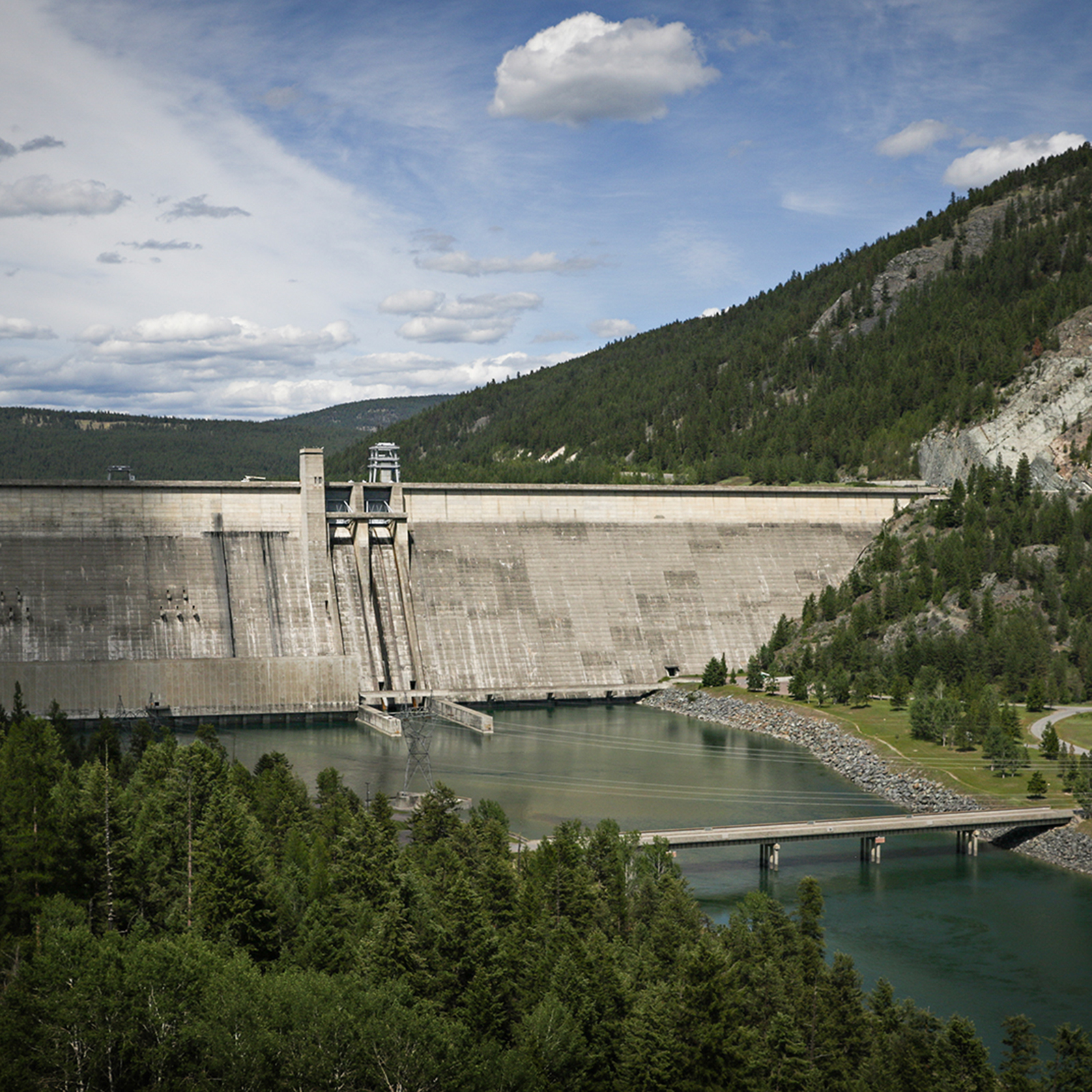
A few miles from where you traded in that lightly used Forest Service road for the blacktop, the Libby Dam comes into view. At 3,055 feet long and 422 feet tall, the gray mass of concrete dominates the landscape, making those evergreen-covered mountains appear small from certain angles. Even the most jaded visitor — the bored teenager who has listened to Dad drone on about every roadside attraction for the last 500 miles — has to be a little impressed by the structure before them. However, if they paused to listen to those interpretive sign factoids — the ones explaining how the dam was completed in 1975 and how it holds back 5 million acre-feet of water that stretches all the way into Canada — they would also learn that this dam is one of dozens across the Columbia River Basin that have shaped this region for nearly a century. They would discover that the Libby Dam — completed 50 years ago this summer — was one of the final pieces of the puzzle that helped shape life as we know it in the Pacific Northwest.
“If you look at all of the great civilizations in history, their success was based on their ability to control and use water,” said Adam Ratliff, a journalist, educator and content creator who has spent years studying the engineered landscape of the Northwest.
Before the Dams
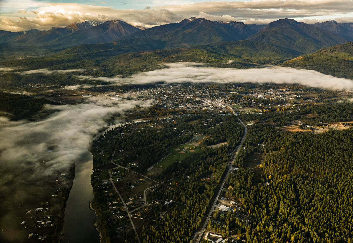
The Kootenai River stretches some 485 miles, beginning as a trickle in the mountains of British Columbia, where it’s spelled Kootenay. The river flows south through the aptly named Kootenay National Park before entering a wide valley near Canal Flats, B.C. From there, it continues south through Fort Steele and eventually into Montana. It passes near Eureka and through Libby and Troy before entering Idaho not far from Bonners Ferry. From there, it turns back north and reenters British Columbia, flowing through communities like Creston, Nelson, and finally Castlegar, where it meets the mighty Columbia River, the dominant waterway in the Pacific Northwest. The Kootenai is the second largest tributary to the Columbia, following only the 1,000-mile Snake River in Wyoming, Idaho, Oregon, and Washington. According to “Waters of Wealth” by Donald E. Spritzer, the Kootenai began to form some 25 million years ago, after the Rocky Mountains began to reach toward the heavens, but before ice sheets began to carve the landscape we know today.
While the Kootenai has flowed for millions of years, human interaction with it is a relatively recent development, at least in the grand scheme of things. The first evidence of people in the Kootenai Valley trace back millennia, with People first inhabited the Kootenai Valley around 4,000 BCE. The band of Indigenous people known as the Kootenai (also Ktunaxa) likely arrived in the area more than 6,000 years ago, according to archeological evidence, and their namesake river became an important means of transport and a source of food.
The Kootenai also brought some of the first Europeans to what would eventually become Northwest Montana when, in the early 19th century, Canadian explorer David Thompson surveyed the region. While Thompson’s American counterparts, Meriwether Lewis and William Clark, have long been celebrated figures in Montana history, it was actually the Canadian Thompson who put Northwest Montana on the map — literally. That trek down the Kootenai (called McGillivray’s River for one of his associates) resulted in the first trading post in Montana west of the Continental Divide. Thompson was particularly impressed with the Kootenai Valley, writing that the river “has a very smooth, easy current with a sufficient depth of water, and where we are camped, the points are of fine meadow and the first ground I have seen that has sufficient moisture to farm.” Despite the prospect of fine farming and plentiful timber, the Kootenai region remained uninhabited by Europeans for decades after Thompson explored it, primarily due to its remoteness. However, that began to change in the mid-to-late 19th century when valuable minerals were discovered in the region. By the turn of the century, branches of transcontinental rail lines in both the United States and Canada began reaching into the Kootenai regions of British Columbia, Montana, and Idaho to help harvest the bounty. Logging also became significant, with numerous mills in places like Libby. But minerals and timber wouldn’t be the only natural resources in the valley and the wider Pacific Northwest to be exploited by humans.
At the Mercy of Mother Nature
While the Kootenai Valley provided an abundance of natural resources, Mother Nature didn’t always forgive those who sought to harvest them. Perhaps the greatest threat to those living along the river was flooding. In the early 20th century, flooding frequently endangered not only residents of Northwest Montana but also those throughout the region. Perhaps no flood was more famous than the one in May and June of 1948. Cold temperatures lingered well into spring in the Pacific Northwest, resulting in an unusually deep snowpack. When the regional thermostat kicked on in mid-May, warm temperatures rapidly melted the snow in the mountains, which soon cascaded down into rivers and streams. Heavy rain compounded the flooding.
“Flood waters swept across a major portion of the Pacific Northwest Sunday, washing out a 31-foot dike at Bonners Ferry, Ida., and another dam in British Columbia,” the Associated Press reported on May 24. “As the water poured over 2,500 acres of farmland at Bonners Ferry, other swollen rivers were flooding lowlands, ripping out roads and forcing families to evacuate in sections of western Montana, north central Idaho and eastern Washington.”
“The Kootenai River caused the most spectacular flood when it cut through a rain-softened levee at Bonners Ferry,” the report continued. “The chocolate colored water swept into one district of 2,500 acres. Army engineers, helping farmers and townspeople in the battle against the river, dynamited another hole in the high dike. This will allow water to flood through faster and relieve pressure on an adjoining dike.”
In the days that followed, flooding continued to affect communities along the Kootenai and Columbia rivers, extending all the way to the Pacific Ocean. However, no community suffered more than Vanport, Oregon. Vanport was an accidental city. Nearly a decade earlier, shipbuilder Henry Kaiser began looking for workers for his Portland shipyard, which was busier than ever due to World War II. Unfortunately, Portland lacked sufficient housing, and many of his employees, African Americans who had moved to the area for shipbuilding jobs, were unable to reside in certain neighborhoods because of discriminatory real estate practices. Undeterred, Kaiser purchased about 600 acres of floodplain outside the city limits to establish what would become, at the time, the largest public housing project in American history. By 1944, roughly 40,000 people lived in Vanport (named that because it was sandwiched between Portland and Vancouver, Washington), a quarter of whom were Black, making it the second-largest city in the state and the most racially diverse.
While a floodplain is not an ideal location for a community, Vanport was protected by a series of dikes maintained by the U.S. Army Corps of Engineers. In late May 1948, this system was doing an admirable job of holding back the flooded Columbia, and officials were confident that Vanport would remain safe from flooding. Early on the morning of Sunday, May 30, a bulletin was issued assuring community members that their homes were safe: “Remember: Dikes are safe at present. You will be warned if necessary. You will have time to leave. Don’t get excited.”
That message was accurate. The dikes were indeed safe. However, officials had failed to consider the weakest link in Vanport’s flood control: an old railroad berm. In 1907, the Spokane, Portland & Seattle Railway (owned by railroad builder James J. Hill, perhaps best known as the man who constructed the Great Northern Railway across Montana) built a bridge connecting Vancouver and Portland. A few years later, that bridge was filled in with earth, creating an elevated berm between what would eventually become Vanport and Smith Lake. When Vanport was built, the U.S. Army Corps of Engineers assumed the railroad right-of-way was a perfectly adequate dike. But it wasn’t. On May 30, a few hours after the residents of Vanport were reassured that their city was safe, muddy water began to flow underneath the railroad. Throughout the morning and afternoon, firefighters and other workers filled sandbags in hopes of holding back what at the time was a small leak. But at 4:17 p.m., the railroad fill broke, and a wall of water entered Vanport. The city was thrown into chaos.
Beatrice Gilmore was a teenager in 1948, and she died at the age of 90 in December 2021. However, before she passed away, she provided one of the most detailed accounts of the Vanport flood to historians working on an oral history project about the event. When the dike broke, Gilmore had been at a nearby movie theater with friends.
“We lived within running distance of the theater, and I ran to our house,” she recalled. “(I) tried to put some things together so we could get all in the car to get out. I remember my brother wanted to get his holster that had his little toy guns in it, and I remember my mother wanted to bring her sewing machine. I don’t know how she stacked it in the car.”
“We got in the car and we were going up the hill. As the water was coming, we were driving as fast as we could. People were running and screaming, trying to keep up with their families … I looked back and I saw a wall of water behind the car and I realized how close we were to being washed away.”
At least 15 people were killed in the flood in Vanport, and more than 18,000 were left homeless.
Man vs. Nature
The 1948 flood was the most devastating event to strike the Columbia River Basin in generations, igniting a new conversation about how to control nature — a bold discussion, but one reflective of the era, said historian Jeff Gruber.
“That 1948 flood is what got the ball rolling for the Libby Dam,” he said. “We had just built an atomic bomb a few years earlier and had won a world war, so there was a perception that we could do anything — including controlling nature.”
Humans had been attempting to harness the water of the Columbia River Basin for years, aiming to prevent floods and utilize it for agriculture and energy production. In the 1920s, Congress requested a study on how to transform the Columbia River Basin into “the greatest system for water power to be found anywhere in the United States.” The resulting report recommended the construction of eight dams on the Columbia that could be operated as a unified system. A few years later, with the nation gripped by the Great Depression, President Franklin D. Roosevelt campaigned for the construction of the extensive dam system, not only as a means to harness the water but also to employ tens of thousands of people. Construction on the largest of the dams, Grand Coulee in eastern Washington, began in 1933 and was completed in 1941. At 550 feet tall (from its foundation below the water surface) and nearly a mile long, it stands as the largest dam in the Columbia River Basin and one of the largest in the world. In the following decades, additional dams were constructed throughout the basin, including the Hungry Horse Dam.
While the dams could effectively control floods in their immediate areas, additional water storage was necessary upstream. The 1948 flood made this painfully clear, and shortly after, the U.S. Army Corps of Engineers proposed a dam on the Kootenai near Libby. Two years later, Congress approved the construction of such a structure. However, one significant issue remained: building a major dam near Libby would necessitate flooding vast tracts of land in both the United States and Canada. As the governments sought ways to compensate those who would lose their land, the U.S. Army Corps of Engineers investigated what it would take to construct a new dam and where it should be situated. Just north of Libby, not far from where the Fisher and Kootenai meet, was identified as a prime location, though it would require relocating several small towns and the Great Northern Railway.
In 1961, President Dwight Eisenhower and Prime Minister John Diefenbaker signed the Columbia River Treaty, a groundbreaking international water agreement. As part of the treaty, the U.S. would construct the Libby Dam while Canada would build three dams in British Columbia. To compensate Canada for the land that would be flooded, the U.S. provided a one-time payment equal to half of the downstream power generated for 30 years. This payment, worth approximately $254 million in electricity, helped fund the construction of the three dams north of the border. After that portion of the agreement expired in 2003, the U.S. has been obligated to supply Canada with a certain amount of power each day, valued between $222 million and $359 million annually, known as the “Canadian Entitlement.” Although it’s costly, Ratliff, the educator and journalist, said the Columbia River Treaty has significantly benefited both nations.
“The Columbia River Treaty was a game changer,” he said. “There have been wars fought over water in other parts of the world, but here we have a system that benefits both countries.”
The construction of the Libby Dam began in 1966. Engineers started by channeling the river to the west and then starting construction on the east side of the valley. Meanwhile, the U.S. Army Corps undertook additional related projects, including moving the entire town of Rexford uphill and building 60 miles of new railroad track, which included the 7.01-mile Flathead Tunnel through Elk Mountain, one of the longest tunnels in the country.
While the Libby Dam and the Columbia River Treaty were praised as prime examples of international cooperation, not everyone was satisfied with the project. Although British Columbia was able to benefit from the “Canadian Entitlement,” some believe the residents of Lincoln County did not receive a fair deal. Even though the Army Corps assured residents they would be paid a fair price for their land, the government often offered them lowball figures. While some individuals attempted to sue, after paying legal fees, they rarely ended up with much more than the government’s original offer. “The Corps are the bad guys to a lot of people in Rexford,” a long-time resident would later say.
And while Rexford did survive — thanks to its residents banding together and incorporating in the late 1960s — other communities like Warland, Tweed, Ural, Volcour, and Yarnell simply disappeared beneath the water and off the map.
The dam’s structure was completed in 1972. The structure measures 3,055 feet in length and 422 feet in height, requiring so much concrete that it could have built a two-lane highway from New York City to Salt Lake City. Although the dam wasn’t officially finished — as the powerhouse, turbines, and generators still needed to be constructed — downstream communities quickly reaped the benefits of its construction. Near-record snowmelt in 1972 and 1974 would have likely devastated downstream communities had it not been for the dam. According to an estimate reported in the Bonners Ferry Herald, the dam prevented $32 million in flood damages during those two years alone.
By the summer of 1975, the powerhouse was completed, and the dam was ready to generate power. On Aug. 24, 1975, over 3,000 people, including President Gerald R. Ford and other high-ranking U.S. and Canadian officials, gathered for the official dedication. In his remarks, Ford commented that the Libby Dam not only benefited the people living in the Northwest but also improved the environment.
“The poet Tennyson once wrote, ‘Nothing in nature is unbeautiful.’ I believe that mankind has the responsibility of preserving that beauty,” Ford said. “Let us, therefore, take heart as well as pride in the creation of the Libby Dam. It will enhance the best we and our environment have to offer. It offers the message loud and clear, we are the defenders, not the despoilers of this great land.”
The Libby Dam would be the last major dam constructed in the Columbia River Basin and the final piece of a puzzle to harness the power of the Pacific Northwest’s waters. While flooding still occurs across the region, events like the Vanport flood of 1948 are generally a thing of the past.
“The water that used to flood communities in May and June is now used to irrigate crops in July and August,” Ratliff said.
Other dams were proposed after the construction of Libby, including one situated about 10 miles downstream. The reregulation dam would have produced more energy, but it also would have changed a cherished stretch of river into a reservoir, endangering an area known for its rainbow trout and big game. The cancellation of the Libby Reregulation Dam project (thanks in large part to Montana’s former U.S. Rep. Pat Williams) reflected the evolving values of the time; while there was no doubt about the advantages that projects like the Libby Dam provided, there were also trade-offs.
Regardless, Ratliff said projects like the Libby Dam and hundreds of others across the Pacific Northwest have transformed the region into what it is today: one with ample power, flood control, and agriculture in places once thought impossible. Ratliff said that without the Columbia River dams, the region could not support the population it currently does and that it would probably look a lot like central British Columbia: “Beautiful, heavily forested, and not a whole lot of people.”
“There are major parts of Portland that could not have been developed if we still had 1948-style floods every year,” he said. “And that’s just the biggest example; there are many other examples all across the region.”
“We live in the future that our great-grandparents could only dream of,” he continued. “An era of reliable food supplies and power supplies. To our great-grandparents, this is a Jetsons-like future, and I don’t know if we appreciate that enough for what it is.”
This summer, the Libby Dam and its significance in regional history will be celebrated. On Aug. 23, the 50th anniversary of the dam’s dedication, a special event will take place at the dam, featuring tours of the facility. Additionally, there will be an unveiling of a memorial honoring the 2,000 individuals who contributed to the dam’s construction and the 12 who tragically lost their lives. This summer, an exhibit about the dam and its construction is also on display at the Libby Heritage Museum.
Susan James is a park ranger at the dam and has been giving tours for more than a decade. She said what always impresses her the most about the dam isn’t its size or prominence in the landscape, but rather its impact on lives throughout the region and the thousands of people involved in its construction.
“It’s just amazing the number of lives that have been touched because of the Libby Dam,” she said.