State Land Managers Prepare for Prescribed Burn Season in Northwest Montana
Wildland fire officials with the Montana Department of Natural Resources and Conservation will burn 180 acres of state trust land to reduce fuel loading and promote forest health across the region. Smoke may be visible from Whitefish and the greater Flathead Valley.
By BEACON STAFF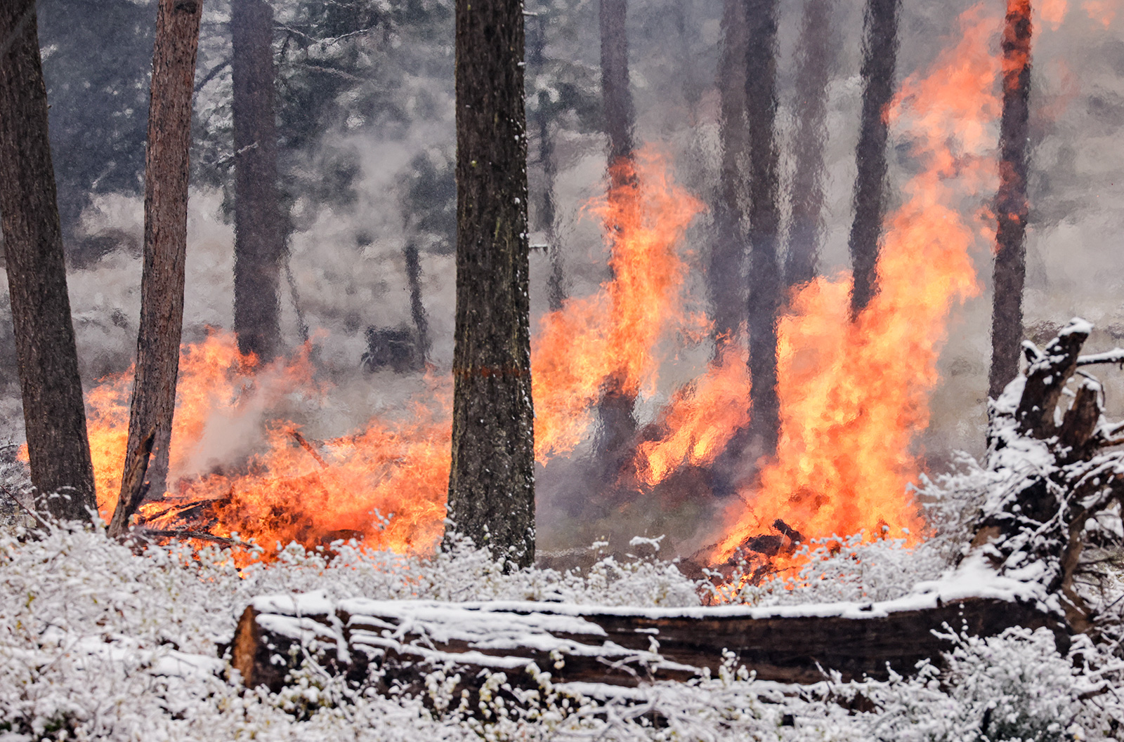
Land managers with the Montana Department of Natural Resources and Conservation (DNRC) are preparing to conduct fall prescribed burning operations on 180 acres of state trust lands spanning the Swan and Flathead valleys, according to agency officials, who warned that smoke may be visible to the public in the coming weeks and months.
According to DNRC officials with the Northwestern Land Office, the plan is to conduct burn operations and pile burns at a half-dozen sites within its regional jurisdiction from late September through the end of November, depending on seasonal conditions.
Temporary closures may be implemented during prescribed burning activities and notices will be posted in the area as appropriate. Residents should expect visible smoke from prescribed burning activities. The DNRC encourages the public not to call 911, but rather to call one of the agency’s regional offices.
All burning activities are coordinated with the Montana Department of Environmental Quality to reduce the impacts of smoke, officials said.
DNRC Fire Communications Specialist Cooper Fisher said the agency’s detailed prescribed burn plan incorporates a high degree of flexibility into its timeline to ensure that forest conditions can safely accommodate prescribed burn activities.
“We are not going to move forward with a prescribed burn if it’s not safe,” Fisher said, adding that fuel moisture, temperatures, wind, and weather systems are important factors that will determine whether conditions are safe to effectively meet project objectives.
The primary objective of the prescribed burn is to reduce slash generated from forest management activities, the release states. The prescribed burning creates planting sites and seedbeds for regeneration to promote nutrient recycling.
The DNRC is prescribed burns this fall in the following units and site locations:
Stillwater Unit
Antice Central – The prescribed burn will cover 20 acres of land located east of Stryker Ridge in the Stillwater State Forest. Smoke may be visible from the central area of the Stillwater State Forest.
Antice Point North – The prescribed burn will cover 7 acres of land located in the center of the Stillwater State Forest. Smoke may be visible from the central area of the Stillwater State Forest.
Johnson’s Yurt – The prescribed burn will cover 63 acres of land located along the east side of Stryker Ridge, northeast of Olney. Smoke may be visible from the central area of the Stillwater State Forest and from Highway 93, north of Whitefish.
Pile Burning – Logging slash piled by machine and/or by hand located across the Stillwater Unit will be burned from late September through the end of November. Smoke should be isolated to areas near burn piles.
Swan Unit
Swanwood – The prescribed burn will cover 90 acres of land located in the Main Woodward Drainage of the Swan River State Forest. Smoke may be visible from Highway 83.
Pile Burning – Logging slash piled by machine and/or by hand located across the Swan Unit will be burned from late September through the end of November. Smoke should be isolated to areas near burn piles.
Kalispell, Libby and Plains Units
Pile Burning – Logging slash piled by machine and/or by hand located across the units will be burned from late September through the end of November. Smoke should be isolated to areas near burn piles.
DNRC is tasked with managing Montana’s forested state trust lands to generate long-term sustainable revenue to benefit educational institutions, while also promoting healthy, resilient and diverse forests for future generations.