‘Arctic Intrusion’ to Bring Falling Temperatures, Heavy Snow to Northwest Montana Over Thanksgiving
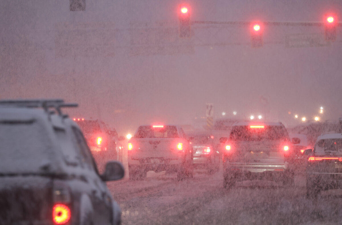
National Weather Service officials anticipate “difficult travel conditions" this week as falling temperatures and moisture impact the region, especially on U.S. Highway 2 from West Glacier to Marias Pass
By Maggie Dresser
A “backdoor cold front” on Monday morning passed through northwest Montana, with heavy snow expected along the Continental Divide while an “arctic intrusion” will likely bring falling temperatures, gusty winds and hazardous travel conditions over the Thanksgiving holiday.
Defined as a cold front moving south or southwest along the Atlantic seaboard and Great Lakes, National Weather Service (NWS) meteorologist Brian Conlan said the backdoor cold front will “enhance snow along the Continental Divide” tonight. Marias Pass on U.S. Highway 2 could see close to a foot of snow by tomorrow morning.
The NWS on Monday issued a winter weather advisory for the East Glacier Park region and the southern Rocky Mountain Front, with up to 10 inches falling tonight in the area’s highest peaks.
Since Sunday, Whitefish Mountain Resort and Flattop Mountain in Glacier National Park have each registered about a foot of snow, with both weather stations reading 24 inches. As of Tuesday afternoon, Stahl Peak in the northern Whitefish Range had a snow water equivalent – the amount of liquid in the snowpack – of 8.19 inches. In the Swan Range, Noisy Basin’s snow depth was 20 inches.
According to the NWS, a “modified arctic front” will slowly spill over the Continental Divide into Flathead County Monday night, bringing heavy snow, falling temperatures and “difficult travel conditions” on U.S. Highway 2 from West Glacier to Marias Pass.
After a break in the weather on Tuesday, a stream of sub-tropical moisture will enter the far northwest corner of the state, bringing light snow across the northern Rockies through Wednesday morning.

“When that slug of moisture comes in, it’ll start as snow at all levels and then snow levels will rise on Thursday,” Conlan said in a NWS weather briefing.
But cold temperatures could remain trapped in northwest Montana’s valleys until late Thursday morning along with up to five inches of snow on passes through Thanksgiving.
On Friday evening, meteorologists have “medium-to-high-confidence” that arctic air will bank along the Continental Divide, bringing possible single-digit temperatures.
According to the extended forecast, an “active northwest flow pattern continues,” along with the chance for more snow and “additional episodes of arctic air potentially spilling over the divide.”
“By [next] Tuesday, it’s kind of showing some overrunning moisture, so that could be a really interesting day if you’re looking for big winter to come,” Conlan said. “There are lots of question marks.”