Lincoln County Remains in State of Emergency as Flooding Closes Roads, Schools
The City of Libby yesterday issued a boil water order as an atmospheric river continues to drench northwest Montana and wash out bridges
By Maggie Dresser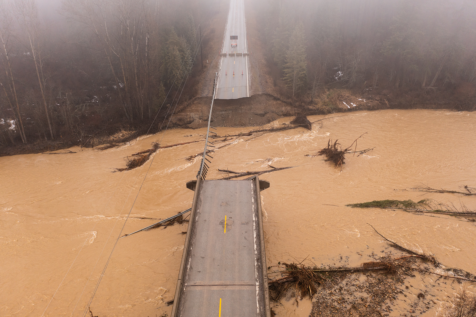
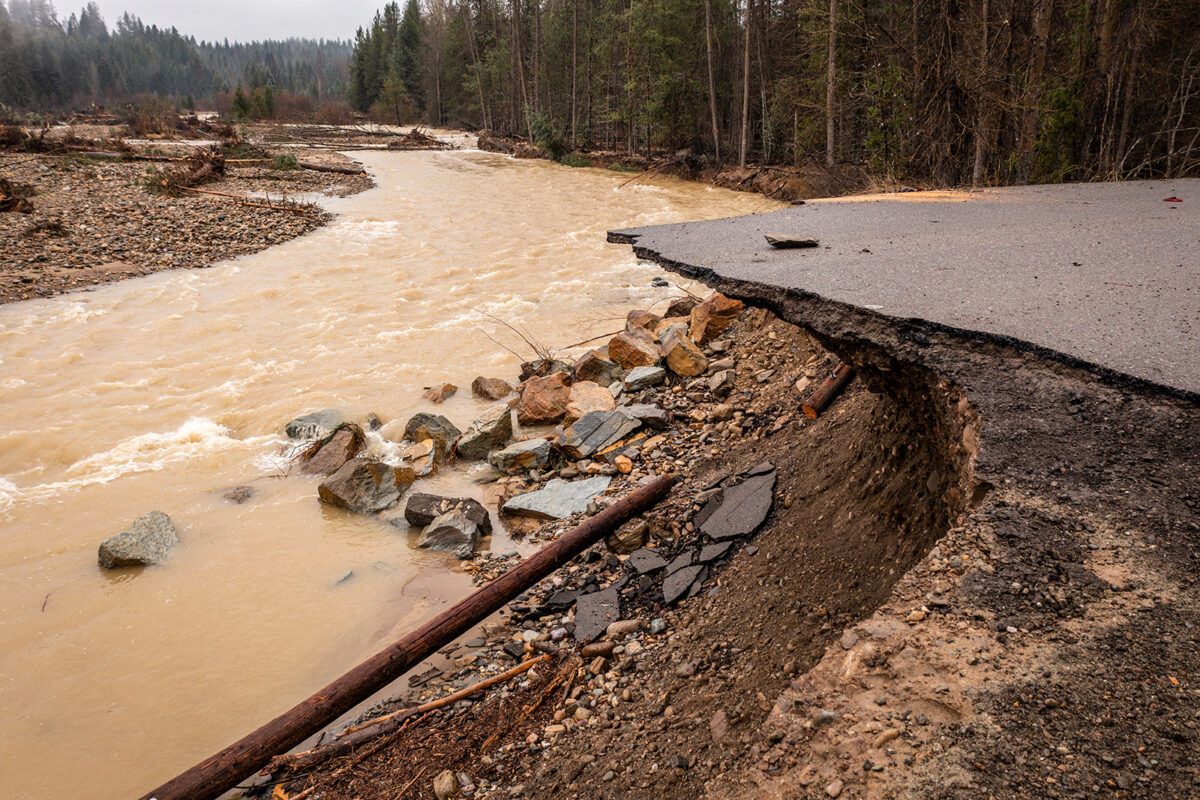
An atmospheric river that deposited inches of rain across northwest Montana and brought rivers to flood stage continues to cause hazardous conditions as Lincoln County remains in a state of emergency while a boil water order for the City of Libby is in effect.
Lincoln County Emergency Management officials in a Dec. 12 press release said at least five bridges have been damaged or destroyed while the Fifth Street Bridge remains closed and has been identified as a top priority. Meanwhile, multiple road closures are in effect and Libby Public School officials canceled classes Friday after sending students home early on Thursday.
The American Red Cross has established a shelter at the Libby Assembly of God at 105 Collins Avenue in Libby.
The Flower Creek Reservoir remains intact and fully operational, according to officials.
According to the National Weather Service (NWS), the Poorman Creek SNOTEL station south of Libby in the Cabinet Mountain Range received 12 inches of precipitation in the last six days, with nearly half of totals falling within a 24-hour period on Dec. 11. The Bear Mountain weather station on the Idaho-Montana border received 13 inches in that same timeframe and 6.5 inches on Dec. 11.
As of yesterday afternoon, the Kootenai Falls region received 5.62 inches within 24 hours while Noxon saw 5 inches. Near the Continental Divide, there was 2.04 inches west of Marias Pass, according to data collected from volunteer weather observers.
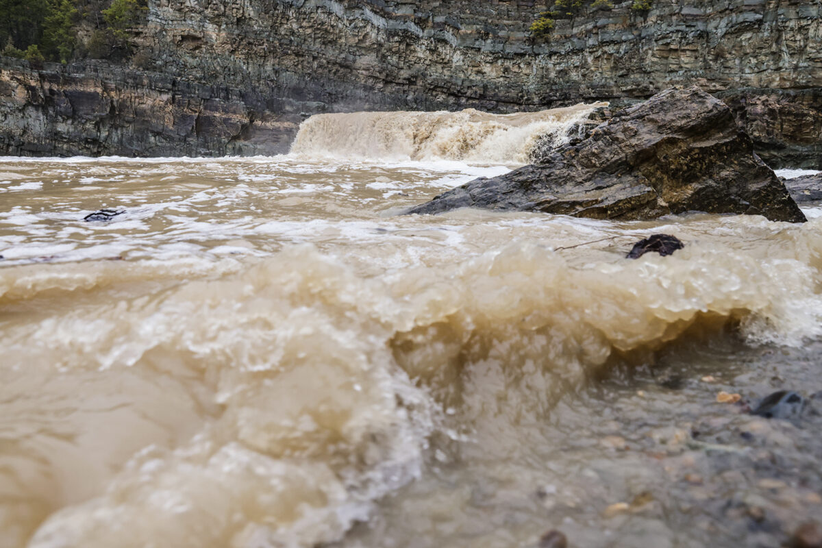
NWS officials warn that while flooding has improved in Lincoln County, rivers and streams will remain “extremely high” for another 24 hours, with afternoon rain totals forecast up to a quarter inch.
The Yaak River near Troy yesterday peaked at 8.3 feet, surpassing the flood stage of 8 feet and flowing at 7,940 cubic feet per second (cfs). Flows have since dropped to 4,500 cfs as of this morning but far exceed the median Dec. 12 flow of 192 cfs. The Fisher River yesterday peaked at 4,820 cfs compared to the median flow of 166 cfs.
Fisher River Valley Fire and Rescue authorities said in an update that despite the flooding, the localized area has not been drastically impacted as responders monitor the situation.
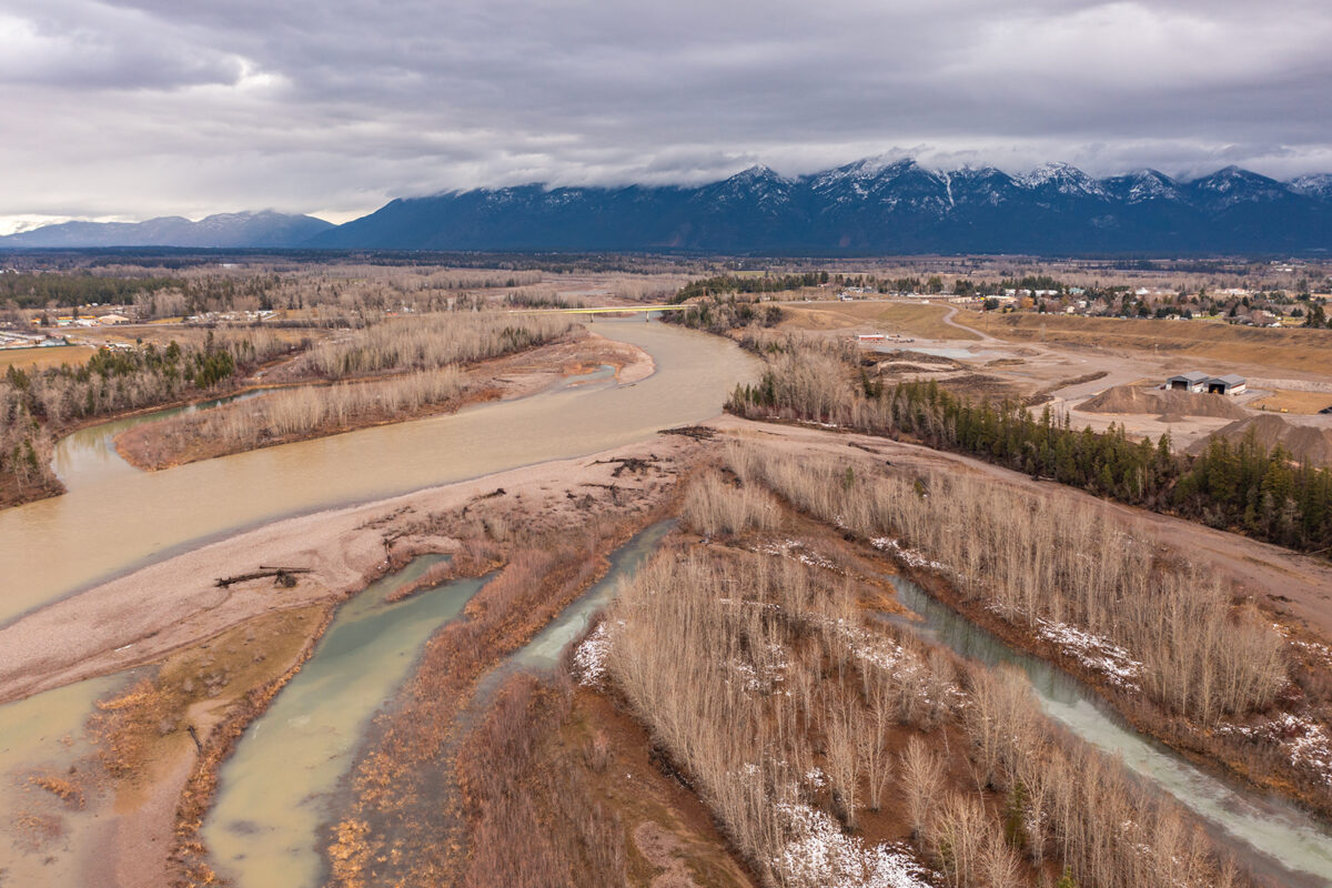
On the Middle Fork Flathead River, flows peaked early this morning at 20,700 cfs compared to the median flow of 728 cfs. The December crest was nearly double this year’s spring runoff peak of 12,100 cfs on May 12.
While temperatures on the west side of the Continental Divide remain well above freezing, a Canadian arctic airmass dropped into north-central Montana yesterday, dropping temperatures in Browning to 3 degrees Friday and prompting NWS to issue a winter weather advisory.
The arctic air is infiltrating over the Glacier National Park area, where snow levels have dropped to the valleys as single-digit air temperatures on Marias Pass move down the U.S. Highway 2 corridor toward West Glacier. Bursts of up to 1 inch of snow per hour are possible along the Middle Fork Flathead River, with 3 to 8 inches of snow and localized freezing rain continuing into Saturday morning.
A short-lived ridge of high pressure will build over the region this weekend, causing respite in precipitation with valley inversions and fog expected to develop due to the “extreme moist environment left behind.”
Another shot of moisture hits on Monday through Tuesday, with snow levels around 7,000 feet and widespread rain anticipated for the Northern Rockies, potentially bringing another round of “hydrological issues.” A cold front pushes through on Tuesday night into Wednesday, dropping snow levels to the valley floor with strong westerly winds lasting through the remainder of the week, according to NWS.
This story will be updated over the coming days.