Agency Releases Environmental Assessment for Granite Moccasin Logging Project
The project proposes treatment in roadless areas, recommended wilderness and along a Wild and Scenic-designated segment of the Middle Fork of the Flathead River. Proponents say it is needed to reduce the risk of wildland fire and restore forest health.
By Tristan Scott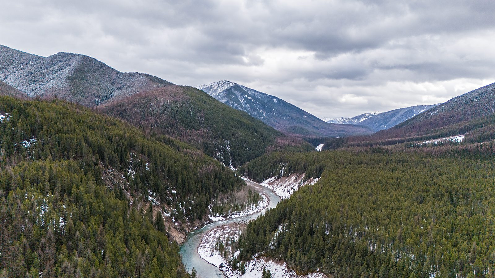
The Flathead National Forest on Tuesday released an environmental assessment (EA) for the Granite Moccasin Project, a logging proposal that has generated buzz among a range of local interests — from outdoor recreation and conservation groups to timber industry leaders and residents of remote, wildfire-prone communities — for its inclusion of sensitive and protected management areas along the southern border of Glacier National Park.
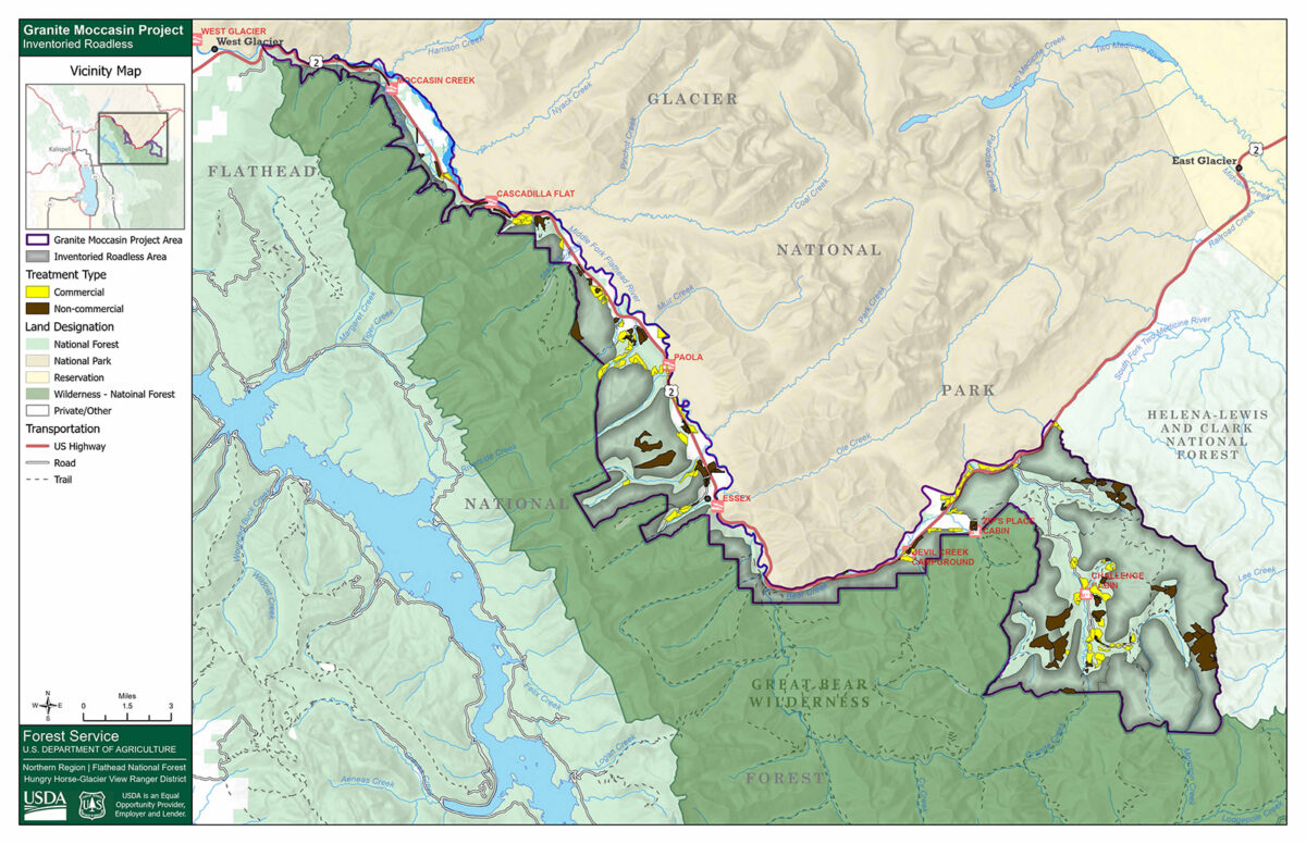
The EA covers the project’s entire 67,536-acre footprint spanning 40 miles along the Middle Fork of the Flathead River. Proposed logging and forest treatment work would occur across 4,737 acres of dispersed management units, including within roadless areas, recommended wilderness, core grizzly bear habitat, and along a Wild and Scenic-designated segment of the Middle Fork corridor, which is one of the most popular destinations for boaters in the region.
Flathead National Forest officials proposed the Granite Moccasin project as an authorized emergency action to mitigate the risk of wildfire and restore forest health. Although there is no formal public comment period, a press release announcing the EA urged people to submit feedback by July 1. Additional information about the project and instructions on how to comment is available on the Flathead National Forest project webpage.
Timber industry stakeholders and land managers say the project is necessary to mitigate the risk of wildfire in a densely forested corridor brimming with critical infrastructure and residential communities, as well as to clear out a backlog of dead and dying trees. The project is, proponents say, “designed to improve species composition and tree vigor” by reducing density and removing trees dying of root disease and beetles, which have caused widespread tree mortality across the project area.
In total, about 2,417 acres of the entire project area are proposed for commercial treatment, while 2,189 acres are proposed for noncommercial treatment. The project would also require the construction of 7.6 miles of new National Forest System roads.
Opposition to Granite Moccasin has mainly centered on its authorization of new road building, which conservation advocates say runs counter to the project’s intent to mitigate wildfire risk. A March 2026 study showed that the presence of roads increases the risk of wildfire by four times. That study, based on more than three decades of datas (1992-2024) spanning all eight contiguous U.S. Forest Service regions, revealed that wildfire-ignition density was lowest in designated wilderness areas, followed closely by Inventoried Roadless Areas protected under the Roadless Rule.
Although some critics of the project have raised concerns about its inclusion of sensitive management areas, the types of treatment in the majority of those zones is limited to whitebark pine restoration.
For example, all of the management activities proposed within recommended wilderness areas are limited to about 344 acres of hand-planted whitebark pine restoration near Puzzle Creek. The project would not authorize mechanized or motorized equipment inside of the recommended wilderness areas, including chainsaws.
The project would also authorize 2,250 acres of forest management in Inventoried Roadless Areas with the objective of reducing the risk of wildfire near communities. However, more than 86% of the treatment activities proposed in roadless areas are noncommercial hand treatments that would reduce fuels within the wildland urban interface or restore stands of whitebark pine with blister rust-resistant seedlings. About 300 acres are proposed for commercial treatment in roadless areas due to their proximity to communities within the wildland-urban interface. The project would also authorize roughly 330 acres of non-commercial forest management in roadless areas, including understory removal, hazardous fuels reduction, thinning, and prescribed burning.
The aim of the whitebark pine restoration activities, which includes prescribed burning, is to replace stands of competing conifers with a strain of whitebark pine that is less susceptible to outbreaks of blister rust disease and wildfire. For whitebark pine restoration outside of recommended wilderness but within roadless areas, chainsaws would be used in some units, according to the EA, which says that all treatments would comply with the 2001 Roadless Rule.
The project also includes about 400 acres of treatment within a segment of the Wild and Scenic River corridor classified as recreational and within the wildland-urban interface (WUI). The proposed treatment would occur away from the riverbank and would not be visible from the river, according to the EA.
Although some members of the public have criticized the project’s inclusion of roadless lands, recommended wilderness and a congressionally designated wild and scenic river corridor, others frame it as an example of how environmental protection measures can dovetail with active forest management. The decades-old Roadless Rule policy, which the Trump administration has taken steps to rescind, generally restricts road building and timber harvests on national forest lands, but it allows some logging to reduce fire risk, improve habitat or aid in the recovery of endangered species, including whitebark pine.
“We are pleased to see that vegetation management is proposed on up to 2,250 acres in roadless areas, including prescribed fire, commercial thinning, noncommercial thinning, and white bark pine restoration treatments,” Tom Partin, of the American Forest Resource Council (AFRC), said.
“No road construction would occur in roadless areas to accomplish these activities,” which Partin added “will be consistent with the Roadless Rule.”
Partin said the Flathead National Forest’s analysis of the project under a newly designated emergency authorization determination was appropriate due to its proximity to essential infrastructure. That includes the BNSF railroad, power lines operated by Flathead Electric Cooperative and Glacier Electric, gas lines managed by Northwestern Energy, and multiple Department of Transportation maintenance facilities. In public comments, Partin and the AFRC encouraged the Flathead National Forest to expand the volume of commercial treatment it’s proposing and “reexamine additional acres that might be suitable for commercial harvest.”
But Keith Hammer, chair of the Swan View Coalition, said the emergency determination was another effort by the agency to “fast track” a project while bypassing a more rigorous tier of environmental analysis. Road building and culvert failures have already contributed to increased sedimentation in westslope cutthroat and bull trout habitat in the project area, he said, which should hold the project to a higher level of analysis under the National Environmental Protection Act (NEPA). He encouraged agency officials to select a higher tier of review and prepare a full environmental impact statement (EIS).
Bordered by Glacier National Park to the north and the Great Bear Wilderness to the south, the project area spans the length of the John F. Stevens Canyon along U.S. Highway 2. It is named for two prominent tributaries of the Middle Fork, which bookend the project area and serve as popular access sites for boaters. The project area also includes the communities of Essex, Pinnacle and Fielding, and provides a “vital transportation corridor” between the Flathead Valley and the northern plains of eastern Montana, according to forest officials, with the narrow canyon providing the only vehicle-accessible route.
Historic buildings, such as the Izaak Walton Inn and the Walton Ranger Station of Glacier National Park serve as key tourist attractions and preserve valuable regional history. The concentration of infrastructure, private property, and historic sites contributes to the area’s designation as wildland-urban interface.
Referencing the proposal to conduct vegetation treatment in a Wild and Scenic River corridor, which includes about 102 acres of utility corridor expansion, AFRC pointed out that timber harvesting is allowed for “multiple-use purposes and to achieve the agency’s desired vegetation conditions.”
“AFRC believes that those who enjoy the Wild and Scenic areas in this project area would rather see green thinned and managed forests than burnt black areas of devastation as they float on these bodies of water, and actions should be taken to prevent devastating wildfires in these areas,” the trade group said.
Comments on the project will be accepted through July 1 and may be submitted electronically through the project website, mailed or hand delivered Monday through Friday, 8 a.m. to 4:30 p.m., excluding holidays, to the Hungry Horse Ranger Station, located at 10 Hungry Horse Drive, Hungry Horse, Mont., 59919.