DEQ Completes Libby Creek Stabilization After December Flood Damage
The flooding washed out a portion of an asbestos-contaminated creek bank the U.S. Environmental Protection Agency had remediated in August 2009
By Tristan Scott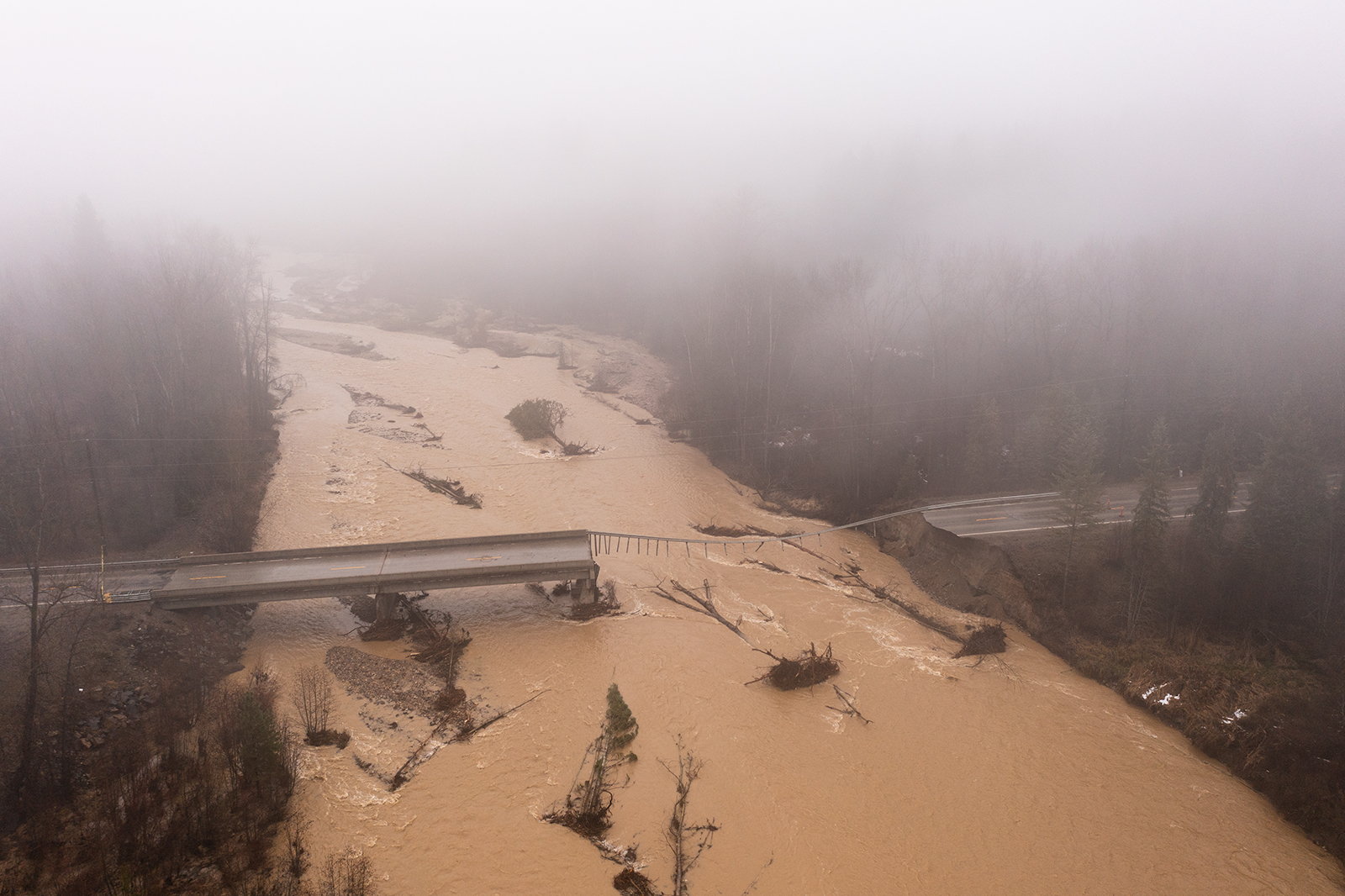
The Montana Department of Environmental Quality (DEQ) has finished stabilizing a stretch of embankment along Libby Creek that washed out during catastrophic flooding in Lincoln County last December. The flooding compromised a portion of an asbestos-contaminated creek bank the U.S. Environmental Protection Agency (EPA) had remediated and reconstructed in August 2009.
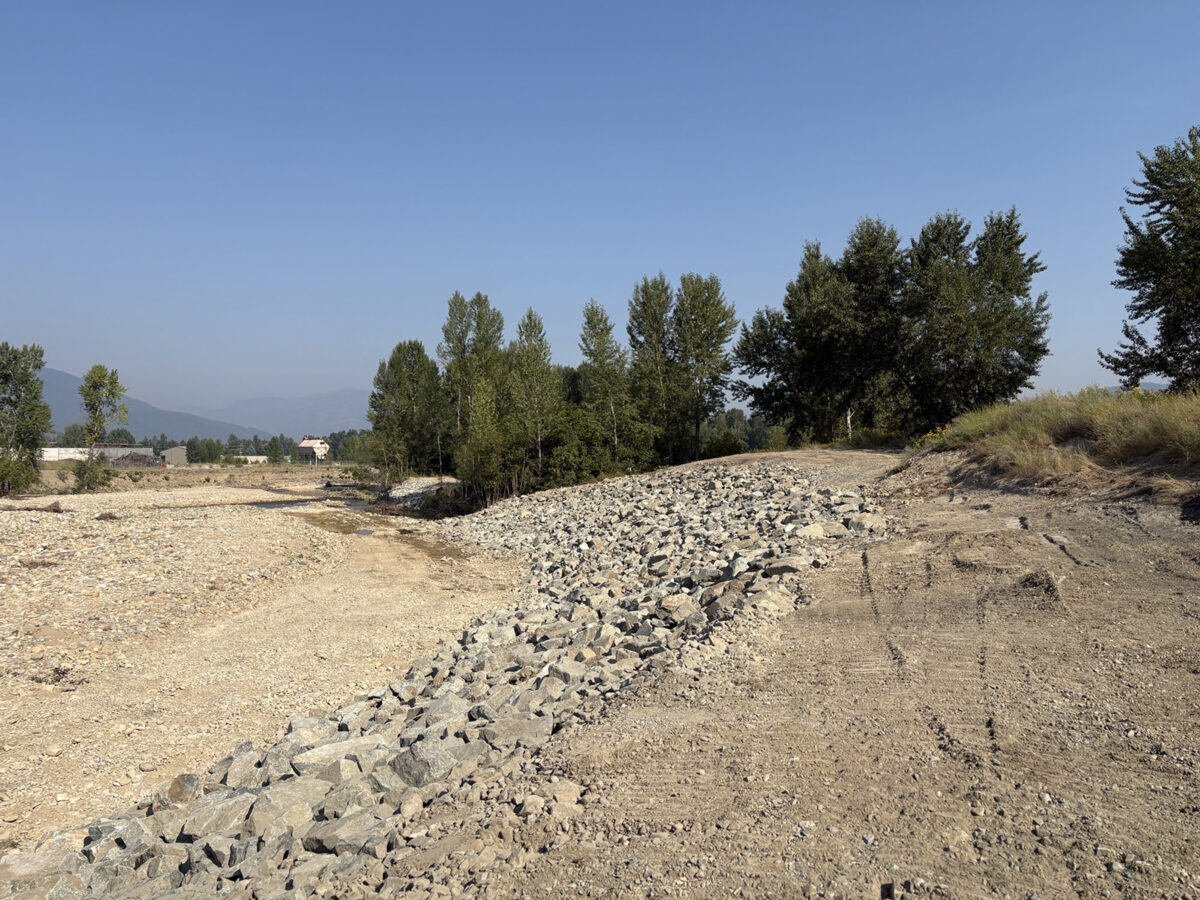
Working with the Lincoln County Asbestos Resource Program and contractors Weston Solutions and Olympus Technical Services, DEQ wrapped up construction of the embankment on Aug. 3. The project had originally been estimated to cost around $1.2 million but came in at under $500,000, DEQ officials said in a press release Friday. The state of Montana plans to seek partial reimbursement from the Federal Emergency Management Agency (FEMA).
The flooding stemmed from an atmospheric river that swamped the Pacific Northwest in early December, bringing warmer temperatures and delivering more than 12 inches of rain to parts of the Cabinet Mountains on Dec. 11. Combined with snowmelt, the storm caused “tens of millions of dollars in damage across the region,” according to Lincoln County Disaster and Emergency Services.
Among the damage was significant destabilization of a constructed embankment along Libby Creek located on Lincoln County Port Authority property near the Champion Haul Road. The EPA had previously remediated the site in August 2009 to remove rock and soil contaminated with Libby amphibole asbestos.
To repair the bank, contractors placed more than 1,300 cubic yards of large rock and geotextile fabric across two sections for erosion control, regraded the top of the bank, and reseeded it with native grasses and wildflowers. New signage and traffic control measures were also installed to keep the public out of the area while the new plantings establish themselves.
Separately, DEQ and its contractors are surveying private properties — with owners’ consent — for possible contamination deposited by the floodwaters. So far, crews have completed 56 visual inspections of private yards. Of those, 27 have been identified as needing further sampling and 36 require additional review. According to DEQ spokesperson Nolan Lister, the visual inspections began in mid June and were mostly complete by July. There are two remaining properties where DEQ will conduct a visual inspection.
“There were some properties where we wanted to do some additional review. In this case, that means looking through the records for any previous sampling or cleanup,” Lister said in an email. “At this time DEQ’s investigation has recommended 27 properties for follow-up soil sampling.”
Lister said the department plans to complete sampling by October.
“We’ll be sending out information to property owners regarding the visual inspections and next steps soon,” Lister said.
Where contamination is confirmed, DEQ will cover the cost of removing affected material and replacing it with clean backfill. The agency says the effort depends on cooperation from private landowners, since crews need permission to access and survey private land. Residents interested in having their property surveyed are encouraged to contact the Lincoln County Asbestos Resource Program at (406) 283-2442.
Since 2000, Lincoln County has been the epicenter of one of the largest Superfund cleanups in American history. Hundreds of people died and thousands became ill during decades of exposure to asbestos from the former W.R. Grace mine, where workers dug asbestos-laced vermiculite ore out of the earth and carried the dust home on their clothes. The mine closed in 1990 and the site was placed on the EPA’s priorities list in 2002 due to high levels of asbestos in and around the communities of Libby and Troy. The site is divided into eight operable units spanning hundreds of acres.
The EPA has partially deleted five of the operable units and billed the community as the cleanest it has been in years, but the shuttered mine site and the contaminated forest around it are still potential sources of exposure. Because asbestos is still found in the soil, the forest floor duff and in the bark of trees there, local, state and federal authorities have long worried about what would happen if a large wildfire started near the old mine site, possibly releasing asbestos-laden ash into the air.
Flooding could also disturb and mobilize asbestos-laced ore that had been dormant in the soil, officials said, potentially raising new exposure pathways and public health hazards.