Nestled in the Pleasant Valley floodplain and flanked by rolling foothills, the Lost Trail National Wildlife Refuge is located west of Kalispell in the Salish Mountains, near the unincorporated community of Marion.
Nearly 30 years ago, the 8,000-acre Lost Trail Ranch was purchased by the Montana Power Company, which transferred ownership to the U.S. Fish and Wildlife Service (FWS) as part of a mitigation deal to offset wildlife impacts and habitat loss resulting from Seliš Ksanka Qĺispe Dam (formerly Kerr Dam) and its damaging effects on the wetlands surrounding Flathead Lake.
In 1999, the property joined the roster of federally managed lands under the National Wildlife Refuge System and was officially designated the Lost Trail Wildlife Refuge.
While the transition from ranch to refuge was a heavy bureaucratic lift, the mass restoration of an entire ecosystem — the rewilding of a landscape — presented another complex set of eco-engineering challenges, including a large-scale effort begun in 2017 to restore drained wetlands.
Located near the tiny community of Marion on U.S. Highway 2, the glacially carved refuge cuts a dramatic expanse. Its high mountain ridges subside to low-bottom wetlands of browsing moose and sweeping prairies of creeping coyote.
Its centerpiece is Pleasant Valley Creek, which drains a watershed that spans 53 square miles, originating in the Salish Mountains to the north. It is joined by Meadow Creek, which drains from Dahl Lake, and eventually meets the Fisher River at its headwaters.
It is home to boreal toads and bugling elk, trumpeter swans, sandhill cranes, massive flocks of mountain bluebird, and a diverse suite of waterfowl.
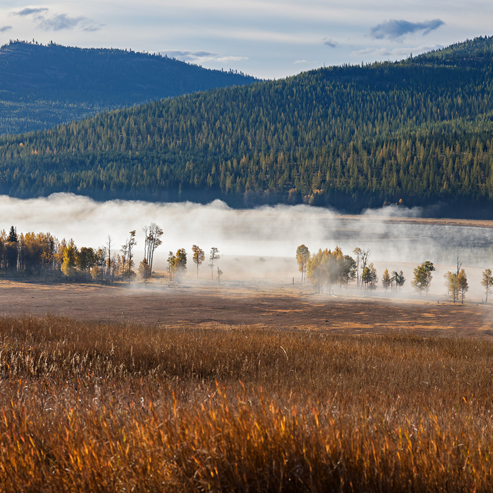
Dahl Lake spans more than 1,000 acres, having recently returned to its historic size after work crews filled a massive drainage ditch, which for 50 years reduced the lake to a mere 180 acres in order to supply the ranchers’ cattle with more grass to graze.
Once managed for livestock, Lost Trail is now managed for wildlife, and recharging Dahl Lake was the first order of business. On a recent autumn morning, rafts of ducks and geese drifted across the lake’s glassy surface, which reflected golden stands of larch on the ridge above.
How to get there: Heading west from Kalispell on U.S. Highway 2, drive approximately 20 miles to Marion. Turn right at Marion onto Pleasant Valley Road. After approximately 1.3 miles, the blacktop road will fork — stay right. The blacktop road eventually turns to gravel. Continue on the main gravel road approximately 13 miles. The refuge headquarters will be on the right approximately 4 miles from the east entrance.