Incident Management Team Takes Command in Lincoln County as Flood Watch Continues
Authorities are working to protect infrastructure as flood damage compromises roads, bridges and municipal drinking water
By Maggie Dresser
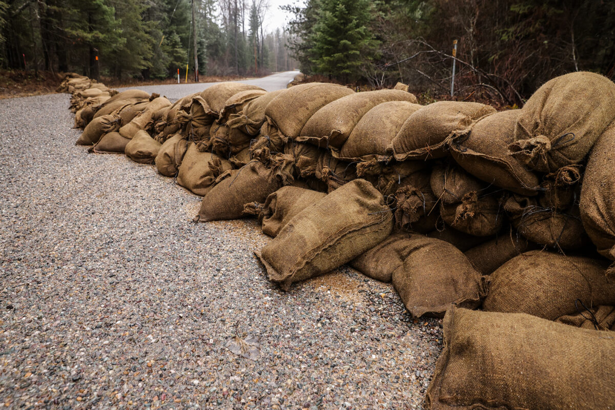
Lincoln County emergency personnel continue working to protect infrastructure and assess damages after an atmospheric river last week surged through the region and brought more than a dozen inches of rain that sent waterways above flood stage, compromising more than 10 bridges along with the drinking water supply.
This morning at 8 a.m., the Western Montana Type 3 All Hazard Incident Management team took command of the flood incident, according to public information officer Nick Holloway.
Comprising emergency managers from Lewis and Clark, Missoula and Broadwater counties along with fire personnel from Missoula, the team is working with local agencies and is in the process of building a website that will provide the “sole source of information.”
“There’s a lot of damage that goes with a flood,” Holloway said. “We are concerned about windy and rainy weather coming in. The current forecast is not enough precipitation to raise the rivers to flood stage in part because the snow level is going down.”
Holloway said threats to the local drinking water have been a source of community concerns in the wake of the floods, adding pressure to the Lower Flower Creek Diversion Structure, which is the municipal water source in Libby. Management of the infrastructure has recently been taken over by the Montana Department of Natural Resources (DNRC).
A boil water order has been in effect since the flooding began last week and the Red Cross has established an emergency shelter at the Libby Assembly of God at 105 Collins Avenue in Libby.
Lincoln County Sherrif Darren Short said while there are two reservoirs for Libby’s municipal water supply, he describes the Lower Flower Creek structure as “more of a dike with a spillway” that is designed to slow the streamflow from the upper reservoir before it feeds into the water treatment plant.
Short said officials conducted a controlled water release to reduce pressure on the structure.

“There’s very little left in that settling basin,” Short said. “It just means the danger of potential failure has very much decreased. The pressure on that structure should be decreased as much as we can at this point.”
More than 10 bridges have been compromised following last week’s floods, according to Short, as officials work to repair road infrastructure and shore up dikes and levies while monitoring streamflows. So far, assessed damage is in the “tens of millions of dollars.”
“We are still working on final assessments of damage and we’re hoping the next storm front doesn’t hit us too hard,” Short said. “We have a lot of things in place and we’re doing a lot on bridge protection and trying to armor the bridge abutments. Everyone is on high alert.”
While flooding is not uncommon in the far northwest corner of the state, Short said the storm system was “a little out of the ordinary,” dumping most of the moisture on the south side of U.S. Highway 2 in the Cabinet Mountain drainages.
Historically, storms are usually more widespread across the county and are concentrated to the north, he said.
“I have never seen anything this fast and to this extent,” Short said. “We’ve had floods in January before, we’ve had floods in March, April and May; but this is very unusual to have this kind of rain event in December that pretty much melted most of our snowpack and dumped this amount of precipitation in a short time.”
According to Eric Larson, a hydrologist with the U.S. Department of Agriculture’s Natural Resources Conservation Service, the Poorman Creek weather station in the Cabinets received 13 inches of precipitation while the Bear Mountain station received 14 inches between Dec. 5 and Dec. 12.
The warm temperatures and heavy rain have reduced the median snow water equivalent (SWE) levels at Poorman Creek from 91% on Dec. 9 to 54% on Dec. 15.
“The Cabinets were the epicenter,” Larson said.
The Yaak River near Troy on Thursday peaked at 8.3 feet, surpassing the flood stage of 8 feet and flowing at 7,940 cubic feet per second (cfs). Flows have since dropped to 1,720 cfs as of this morning but far exceed the median Dec. 15 flow of 201 cfs. The Fisher River on Thursday peaked at 4,820 cfs compared to the median flow of 166 cfs.
While the area’s medium to large waterways like the Fisher and Yaak rivers hit normal spring-time peaks last week, Larson said the smaller tributaries that are used to a gradual release flooded rapidly.
After a weekend of respite from the rain, Short said the rivers and streams have begun receding, but emergency officials are monitoring another weather system entering the region today.

The National Weather Service (NWS) has issued a flash flood watch and a high wind watch through Dec. 17 along with a wind advisory in effect early Tuesday morning with 50 to 70 mph gusts by Wednesday and a power outage threat.
Another atmospheric river returns today through Wednesday, with rain falling on saturated soil and potentially causing a rapid rise in streams and creeks.
While snow levels will begin at 7,000 feet at the start of the storm, a “potent” Pacific cold front will move through the Northern Rockies on Wednesday, plunging temperatures abruptly as winds shift to the west-northwest, gusting up to 60 mph in the valleys and higher in the mountains with bursts of snow.
Residents are encouraged to sign up for alerts at the Lincoln County Emergency Management webpage.
Meanwhile, state environmental regulators are closely monitoring the flooding in Lincoln County to identify and address public health risks associated with the impacts of floodwaters on the Libby Asbestos Superfund site, where the former W.R. Grace and Co. vermiculite mine churned out asbestos-laced ore for decades.
According to a Montana Department of Environmental Quality (DEQ) spokesperson, agency officials anticipate that “some amount of mine waste and vermiculite may be exposed by the flooding, particularly on road surfaces and riverbanks.”
“People should stay out of flood waters and avoid washed out roads. Water within the Libby Asbestos Superfund boundary may mobilize mine waste or vermiculite,” the spokesperson, Nolan Lister, said in an email.
Melody Kraayeveld, DEQ’s Superfund project manager, said officials are monitoring the situation as more precipitation is forecast in the region; however, the extent of the disturbance to mine waste will be better understood once the floodwaters recede, she said.
“Right now we do not know of any material being exposed, but as the water recedes we will be going in doing inspections of washed out areas along Libby Creek, on area roadways and throughout the communities of Libby and Troy,” Kraayeveld said Monday.
Since 2000, Lincoln County has been the epicenter of one of the largest Superfund cleanups in American history. Hundreds of people died and thousands became ill during decades of exposure to asbestos from the former W.R. Grace mine, where workers dug asbestos-laced vermiculite ore out of the earth and carried the dust home on their clothes. The mine closed in 1990 and the site was placed on the U.S. Environmental Protection Agency’s (EPA) priorities list in 2002 due to high levels of asbestos in and around the communities of Libby and Troy. The site is divided into eight operable units spanning hundreds of acres.
Kraayeveld encouraged anyone who encounters vermiculite or other mine waste to contact the Asbestos Resource Program, a local entity, to organize inspections and remedial actions for affected property owners in Lincoln County. If there are immediate concerns about a release of mine waste or exposed vermiculite, notify ARP at (406) 291-5335.
“We’re hoping to go out and do initial inspection work as soon as those waters start to recede. That will help identify any areas of high concern and we will focus on those areas immediately,” Kraayeveld said.
The likelihood of flooding disturbing asbestos-laced vermiculite doesn’t necessarily place the public at immediate risk, Kraayeveld said, explaining that the most harmful exposure pathways for asbestos are when it becomes airborne and is inhaled. In the case of winter floodwaters, the dampness and subsequent snowfall could help prevent disturbances in the short-term.
“I anticipate this will take several months depending on weather so we can get in and see everything. The good news is that, with winter coming, that material will likely stay in place. I don’t have significant concerns about community exposure, but we are going to keep an eye on monitoring.
Flathead Beacon Managing Editor Tristan Scott contributed reporting.