New Logging Project Proposed in Recommended Wilderness, Roadless Areas Along Wild and Scenic Flathead River
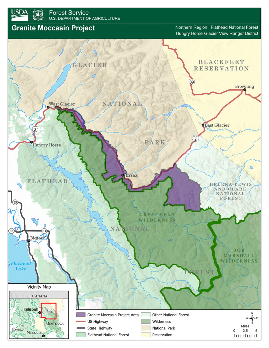
The 67,536-acre Granite Moccasin project area borders Glacier National Park and the Great Bear Wilderness, stretching about 40 miles along U.S. Highway 2 and the Middle Fork Flathead River. Forest officials say it is needed to reduce the risk of wildland fire.
By Tristan Scott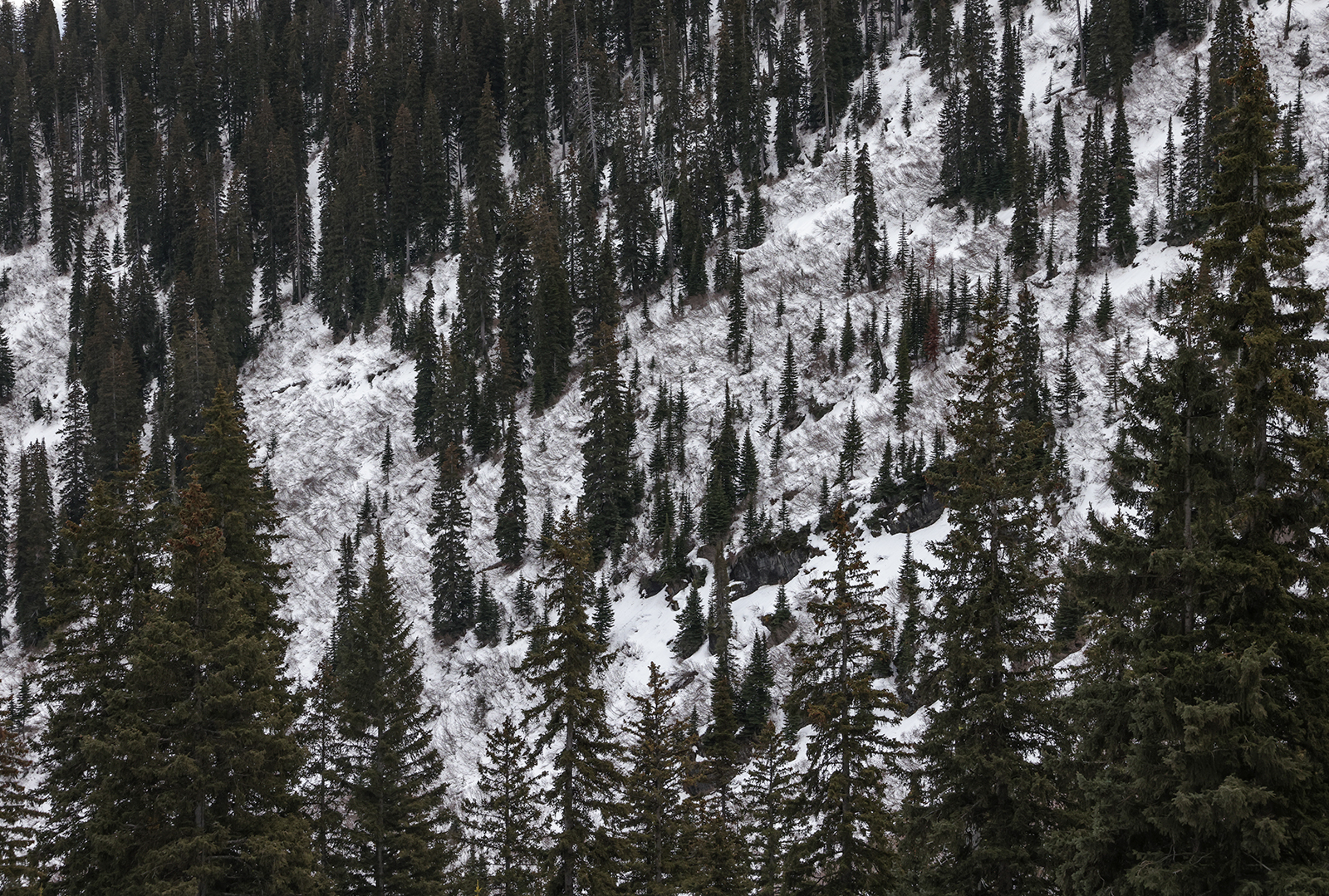
The Hungry Horse Ranger District of the Flathead National Forest has proposed a logging project that agency officials say would reduce the risk of wildland fire and promote forest health in a 67,536-acre area located south of Glacier National Park.
If approved, the project would occur in recommended wilderness areas, although the scope of that work would be confined to whitebark pine planting and restoration. Other project activities would occur in inventoried roadless areas, where much of the work also centers on whitebark pine restoration, as well as in a congressionally designated wild and scenic river corridor and in core grizzly bear habitat.
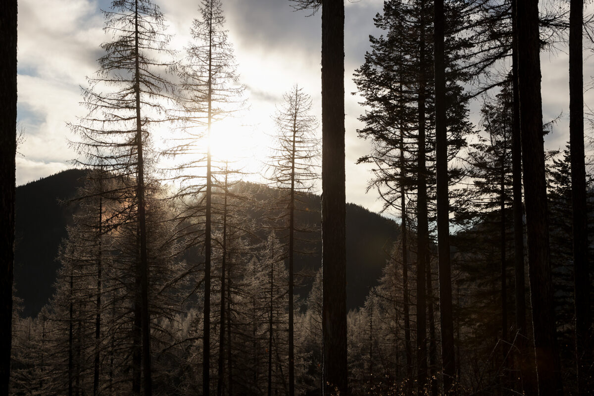
Forest officials say the project is necessary to mitigate the risk of wildfire in a corridor bristling with critical infrastructure, as well as to clear out a backlog of dead and dying trees. The project is, they say, “designed to improve species composition and tree vigor” by reducing density and removing trees dying of root disease and beetles, which have caused widespread tree mortality across the project area.
About 2,364 acres of the entire project area is proposed for commercial treatment, while 2,325 acres is proposed for noncommercial treatment. The project would also require the construction of 7.6 miles of new National Forest System roads.
Bordered by Glacier National Park to the north and the Bob Marshall Wilderness Complex to the south, the project area spans the length of the John F. Stevens Canyon along U.S. Highway 2. Called the “Granite Moccasin Project,” it is named for two prominent tributaries of the Middle Fork Flathead River, which bookend the project area and serve as popular access sites for boaters. The project area also includes the communities of Essex, Pinnacle and Fielding, and provides a “vital transportation corridor” between the Flathead Valley and the northern plains of eastern Montana, according to forest officials, with the narrow canyon providing the only vehicle-accessible route.
“Due to its remote and strategic location, the canyon hosts a linear network of essential infrastructure, including the Burlington Northern-Santa Fe railroad, power lines operated by Flathead Electric Cooperative and Glacier Electric, gas lines managed by Northwestern Energy, and multiple Department of Transportation maintenance facilities,” according to the proposal.
Officials said the rugged terrain surrounding the canyon heightens the vulnerability of the infrastructure during wildfires, particularly given that nearly 70% of the project area falls within a “stand-replacing fire regime,” meaning that while large fires are infrequent, “they tend to burn with higher intensity, replacing mature forest stands with younger trees,” according to the proposed action.
Hungry Horse District Ranger Rob Davies said historical fire records show a pattern of intense activity followed by a long lull and recent resurgence: over 21,000 acres included in the project area burned between 1893 and 1929, followed by minimal activity until 1998, when over 6,000 acres burned. Subsequent large fires, including the Sheep (2015) and Paola Ridge (2018) fires, consumed over 5,000 acres and posed significant threats to local communities and infrastructure.
Historic buildings, such as the Izaak Walton Inn and the Walton Ranger Station of Glacier National Park serve as key tourist attractions and preserve valuable regional history. The concentration of infrastructure, private property, and historic sites contributes to the area’s designation as wildland-urban interface (WUI).
Forest officials say the Granite Moccasin Project would concentrate timber harvests and fuel thinning in the WUI as a way to “enhance ecosystem diversity and resilience, and support sustainable timber production,” according to a Dec. 29 letter announcing the proposed action by Davies.
The proposed actions include commercial timber harvests; road building, maintenance and management to facilitate timber harvests; noncommercial thinning; post-harvest fuels reduction activities; and whitebark pine restoration — “all aimed at reducing wildfire risk to communities, infrastructure, and assets while improving forest health and resilience,” according to Davies, who said the Granite Moccasin project is likely to be analyzed through environmental assessment.
“I am also planning on using the emergency authorities authorized by the Secretary of Agriculture under section 40807 of the Infrastructure Investment and Jobs Act (IIJA),” Davies wrote in the letter. “This document serves as public notice of this authorized emergency action.”
While there is no formal comment period for this project, Davies said public input is most helpful if it’s shared by Jan. 15. Information about the project is available on the Flathead National Forest project webpage.
About 4,620 acres qualify as old growth within the project area, but only 42 acres is proposed for treatment. This treatment will create small openings by removing dead or dying trees as well as smaller trees of shade tolerant species that are likely to be lost to root disease or other pathogens, which are currently widespread within the stand. White pine and western larch will be planted within the openings to establish root disease resilient species within the high use recreation area where this treatment is proposed
Vegetation management is proposed on up to 2,250 acres in roadless areas, including 1,600 acres of whitebark pine restoration, such as prescribed burning and other treatments. No road construction would occur in roadless areas to accomplish these activities, which forest officials say would be consistent with the Roadless Rule.
Actions are proposed on about 402 acres in wild and scenic river corridors, which includes about 102 acres of utility corridor expansion.