Forever Free-Flowing
For 50 years, the Flathead River system has been designated under the Wild and Scenic Rivers Act, serving as the legislation’s inspiration after wildlife biologists John and Frank Craighead spearheaded the watershed’s protection stemming from the Spruce Park dam proposal on the Middle Fork
By Maggie Dresser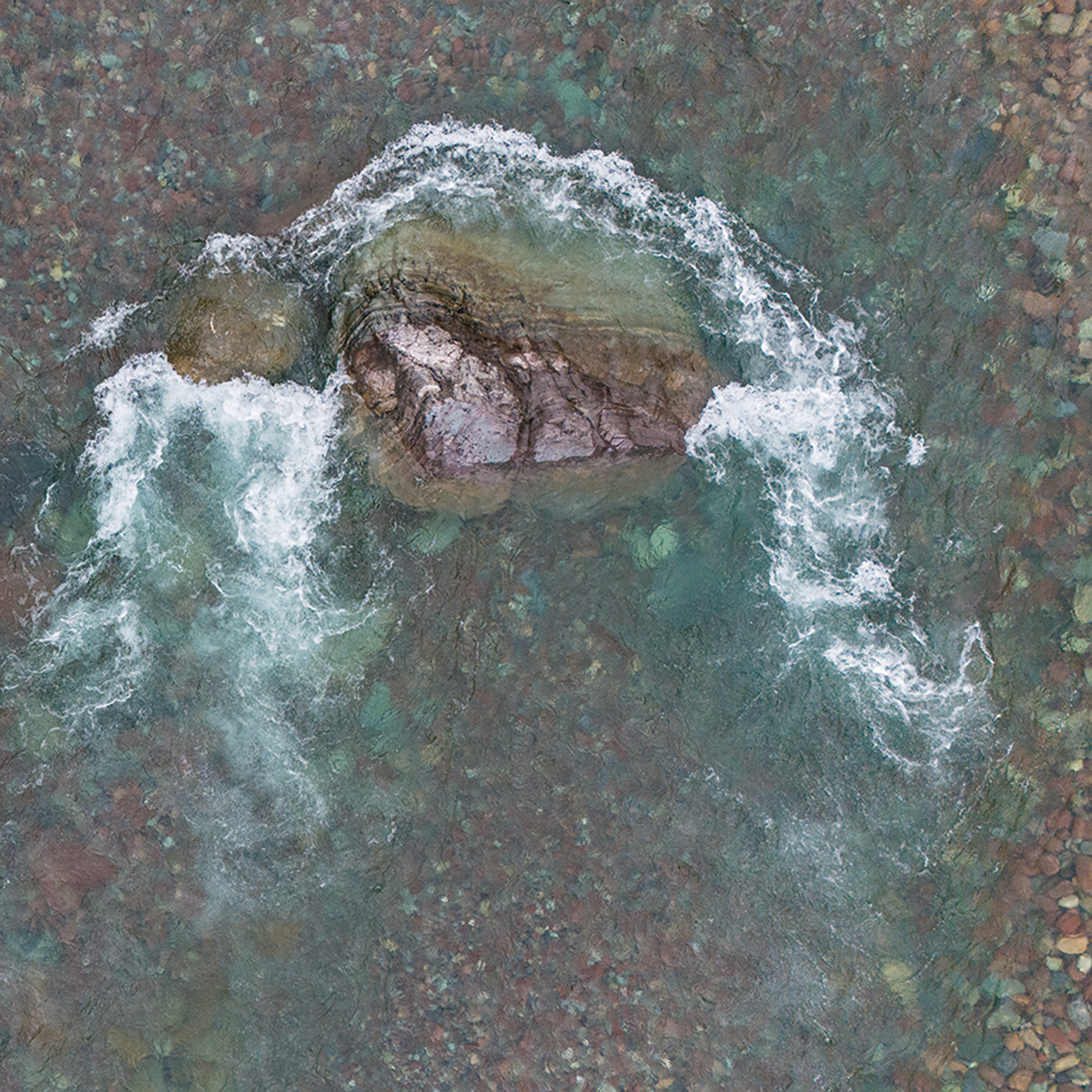
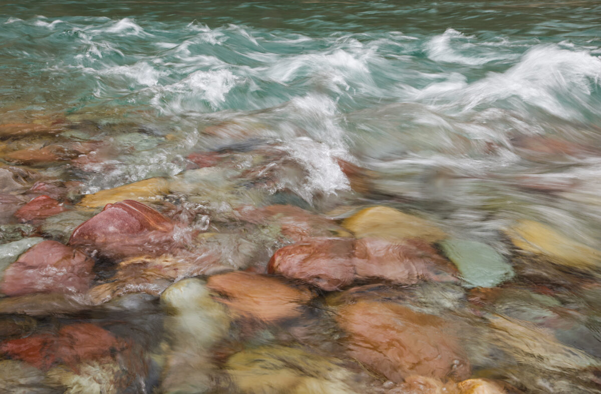
On Oct. 23, 1956, a crew of geologists and specialized equipment operators traveled five miles south of U.S. Highway 2 from the Bear Creek confluence along the upper Middle Fork Flathead River where they drilled four test holes roughly 150 feet into the sedimentary argillite. Situated just above a two-mile series of whitewater rapids known as Spruce Park, in what is now the Great Bear Wilderness, Bureau of Reclamation geologist Rondo Birch described the Precambrian bedrock as “excellent,” according to newspaper archives.
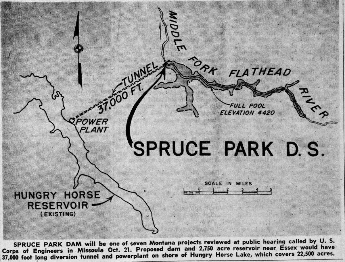
For six weeks, a team of geologists and engineers with the Bureau of Reclamation conducted field studies on the feasibility of a diversion project for the proposed Spruce Park dam, a 405-foot-tall earth-filled structure that would back 360,000 acre-feet of water with a 2,760-acre reservoir, the size of Wild Horse Island on Flathead Lake. A 38,000-foot-long transmountain pressure tunnel would be excavated to divert flood waters to Hungry Horse Reservoir, where a 21,000-kilowatt powerplant would be constructed on the South Fork Flathead River near Hoke Creek. The additional water would add a surplus of hydropower to the Hungry Horse dam, an infrastructure project that had been completed three years earlier.
The Spruce Park dam proposal was officially introduced in June of 1957 and would take center stage at public meetings on-and-off for the next two decades. Proponents of the dam saw economic prosperity associated with the project, bringing in “construction payrolls” for residents of Columbia Falls, Hungry Horse and Martin City.
But there was widespread opposition from conservationists, sportsmen and federal wildlife agencies, who rallied against the dam arguing its beauty, wildlife habitat and free-flowing status must be preserved.
Among those conservationists, Missoula wildlife biologists John and Frank Craighead became the voice for the Middle Fork over the subsequent years, writing letters to the editor, speaking in opposition of the dam at public meetings while John led the Montana Cooperative Wildlife Research Unit. In addition to his appreciation of the Middle Fork’s habitat as a grizzly biologist, the brothers made some of the earliest whitewater rafting descents down the waterway starting in 1956.
“I have rafted most of the large fast-water rivers of the mountain west. My interest in the Middle Fork trip was to make a personal evaluation of its recreational potential. There is no doubt in my mind that this is one of the most scenic ‘wild’ rivers in the Northwest; one which conservationists should strive hard to save,” John Craighead wrote in Montana Wildlife in 1957.
With the help of the Craighead brothers, conservation advocates and U.S. Sen. Lee Metcalf, Congress designated the Middle Fork along with the North and South forks under the Wild and Scenic Rivers Act, which protected 219 miles of the Flathead River system and ensured they would remain free-flowing forever.
“Much of what we cherish today through the nation, national parks, wildlife refuges, wild rivers, wilderness, better forest management laws, came about because Lee Metcalf cared – and did something about them,” Dale Burk wrote in his 1977 book, “Great Bear, Wild River.”
The Spruce Park dam was one of three proposals introduced in the 1940s and 1950s on the three forks, two of which were planned for the North Fork.
In 1947, the U.S. Army Corps of Engineers unveiled the Glacier View dam proposal, which would have spanned the North Fork below Dutch Creek northwest of Lake McDonald, flooding the valley near the outlet of Kintla Lake to form a 3-million-acre-foot reservoir, according to Frederick H. Swanson in his 2015 book, “Where Roads Will Never Reach.”
Introduced as an alternative, the Smokey Range dam was proposed north of Canyon Creek and south of Fool Hen Hill, backing water to Polebrige and storing 1.6 million acre-feet of water that would flood 15,100 acres.
But widespread opposition from North Fork residents and the National Park Service killed the proposals, leading to a pressurized campaign to dam the Middle Fork.
The Spruce Park dam was introduced to complement the 564-foot-tall Hungry Horse Dam, which holds 3.5 million acre-feet of water and was completed in 1953 on the South Fork with extra capacity to divert water from the Middle Fork, which was part of the design plan from the start.
If the Spruce Park dam had materialized, the water would have flowed through the proposed diversion tunnel, draining the river below.
“When you’re driving up Highway 2 and you’re looking at the river, you would only see the amount of water that comes in from the little creeks — there really wouldn’t have been a river because the water was going to be completely diverted to the Hungry Horse Reservoir,” said Colter Pence, the Wilderness, Wild and Scenic Rivers, and Trails Program Manager at the Hungry Horse-Glacier View Ranger District of the Flathead National Forest.
The Hungry Horse dam, as well as the two proposals on the North Fork and Spruce Park, were part of the post-World War II era when the United States centered economic growth around industrial development and job creation for returning servicemen. As dams sprouted across the country, the Bureau of Reclamation saw opportunity in the three forks while the Eisenhower administration was focused on employing enlisted personnel coming home from World War II.
“All across the Northwest of the United States, there was intensive dam building — primarily for electrical generation,” Pence said.
Locally, dam proponents included the Columbia Falls Chamber of Commerce, Martin City state representatives and Hungry Horse News publisher Mel Ruder. While Ruder acknowledged that recreation and wildlife were important on the North and Middle forks, he believed high-paying construction jobs outweighed the losses.
“We don’t know of a better way to make lasting jobs for men,” Ruder wrote in 1955, referring to job growth stemming from dam construction.
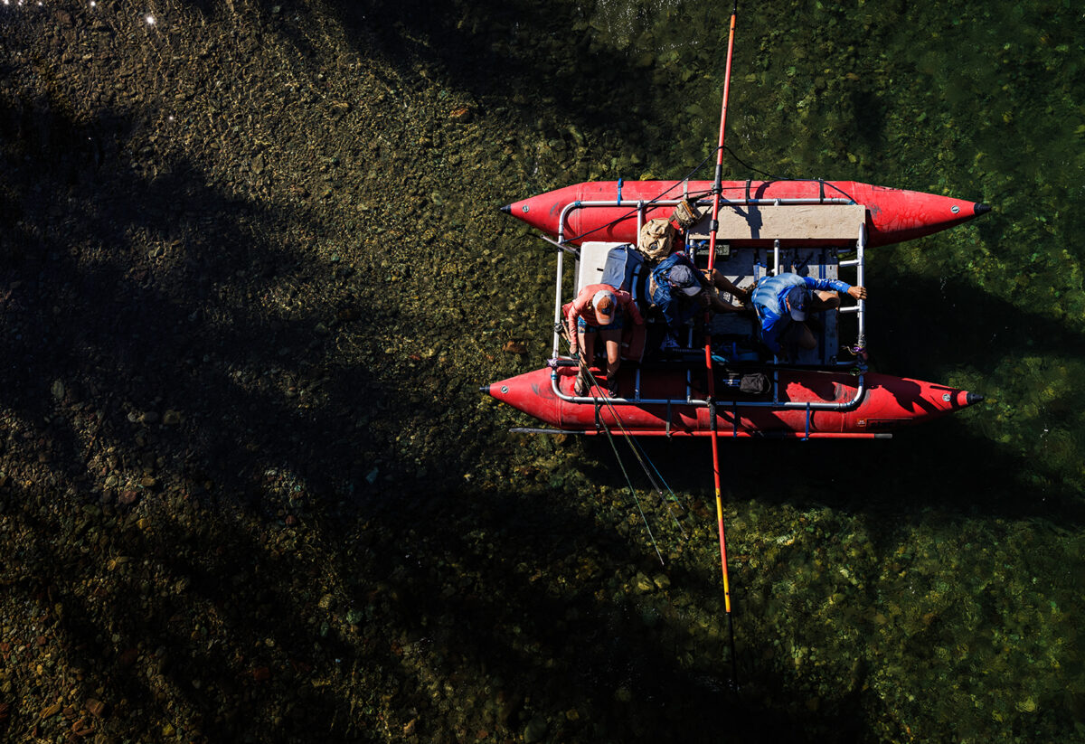
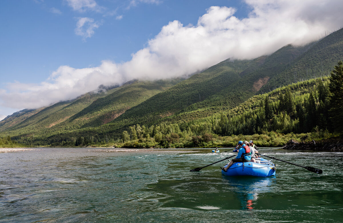
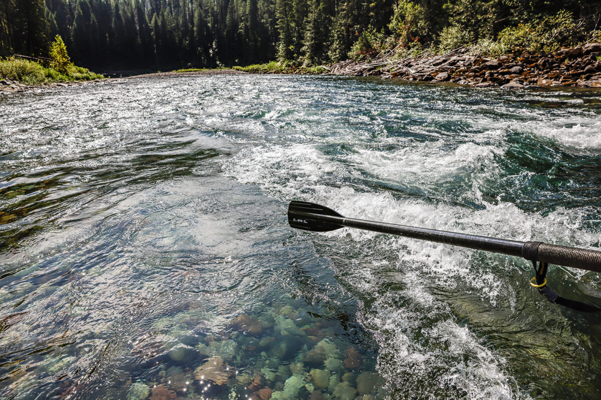
As the Spruce Park dam project gained steam, the Craighead brothers and their friend Clif Merritt, who was based out of the Flathead Valley, were busy rafting down the upper Middle Fork catching bull trout while plotting ways to save it.
Starting in 1956, the Craigheads and Merritt began regular float trips down the Middle Fork, flying 35 miles in a single-engine plane from Kalispell over the Hungry Horse Reservoir and landing at the Schafer Meadows airstrip. After carrying their raft gear 500 yards to the launch, they began a trip of wildlife viewing, rapid running and fishing on the wild stretch of river.
One of their primary objectives on these trips was tagging fish to prove to the Montana Fish and Game Department that Dolly Varden, which are now referred to as bull trout, made long spawning runs from Flathead Lake up the Middle Fork, according to Swanson. With a fish trap installed below the proposed Spruce Park dam site, the biologists tagged and released bull trout, including one caught a month later at the southern end of Flathead Lake.
During a 1956 trip, John Craighead proposed recognizing wild rivers with a classification system for protection, similar to the categories employed in the Wilderness Act, which was gaining momentum around this time but had not yet received congressional approval. In the idea’s early stages, “wild,” “semi-wild,” “exploited,” and “semi-exploited” were proposed, eventually evolving into “wild,” “scenic,” and “recreation.”
Those classifications eventually became the structure for the Wild and Scenic Rivers Act of 1968. But despite the Middle Fork’s inspiration for the historic Congressional policy signed by President Lyndon Johnson, the river was not designated at the time it was passed.
When the Wild and Scenic Rivers Act was signed, the destructive flood of 1964 that decimated highways, homes and property in northwest Montana was still a recent memory for Montanans, along with Sen. Lee Metcalf, who despite his support for wilderness conservation was a proponent of dams at the time.
While the Democratic senator was a staunch conservationist who supported The Wilderness Act of 1964, he wondered how much of the flood destruction could have been mitigated if there were more dams.
“He saw how devastated many communities were after the 1964 floods, and it did speak to him that if there had been dams, maybe people wouldn’t have been as impacted,” Pence said.
As a progressive politician, Metcalf also saw dams as a means of energy independence, leading him to propose electric cooperatives in every community to reduce dependence on large corporations.
Metcalf wound up supporting the Wild and Scenic Rivers Act of 1968, but he was reluctant to designate the three forks of the Flathead River system. Instead, he granted the U.S. Forest Service 10 years for a study.
During the study, officials determined the three forks met each criteria of Outstandingly Remarkable Values (ORV) as specified in the Wild and Scenic Rivers Act, with each segment of the North, Middle and South forks representing a wild, scenic or recreational segment.
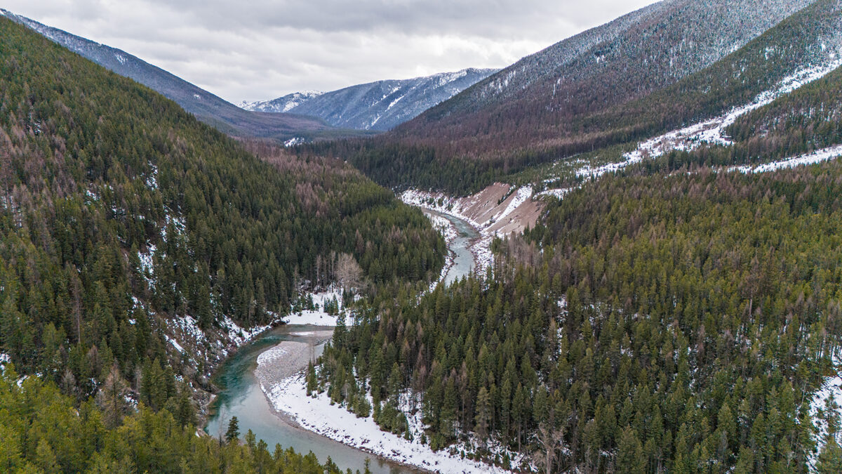
For example, the upper Middle Fork and the upper and central South Fork are now considered the wild sections, while the lower sections are designated recreational. The North Fork is designated as scenic before turning into recreational at Camas Bridge.
As the study continued into its eighth year, the memory of the 1964 flood faded and conservationists continued advocating for the designation, Metcalf had a change of heart as his health slowly began to fail.
“He knows he’s probably not going to be in office much longer and one of the last things he did was sponsor legislation to add the three forks to the Wild and Scenic river system,” Pence said.
While the Spruce Park dam had already been sidelined in the previous years due to economic infeasibility, it had never left the drafting board at the U.S. Army Corps of Engineers. But the Wild and Scenic designation ensured the Middle Fork would remain free-flowing and protected forever.
Two years later, the land surrounding the Middle Fork was designated for wilderness protection, safeguarding both the river and the land north of the Bob Marshall Wilderness and south of Glacier National Park, in what we now know as the Great Bear Wilderness.
“The Middle Fork, specifically, became a protected river — a wild and scenic river — before it was wilderness,” Pence said. “That’s how much people cared about protecting the river. Usually there will be a wilderness area and then a politician will say, ‘Let’s add a wild and scenic river and chalk it up to conservation.’ But in this case, it was in reverse. Let’s protect the river and then people were worrying about the land, too, and it happened afterwards. So that’s kind of a special thing.”
In the early 1980s, Rachel Schmidt, who works as the Northern Rockies dam remover specialist for the nonprofit American Rivers, remembers rafting down the lower Middle Fork section below the Bear Creek confluence as a kid with her dad, not long after the Flathead River system’s designation.
“I hung out with my dad who was a raft guide and he took all of these people from all over the world down rivers and it didn’t take me long, and I wasn’t very old, when I realized, we’ve got something special,” Schmidt told an audience at the Bob Marshall Wilderness Foundation Speaker Series in February.
Growing up rowing her dad’s boat down the three forks, she eventually became a raft guide herself and later had two sons who she introduced to the river when they were still in diapers.
“That’s how I got to raise my kids,” Schmidt said. “Being able to grow up on this river system, it afforded my boys the opportunity to bond in a space that was abnormal. They got to experience this together, and they have a brotherly bond around rivers. That is something that you just can’t fabricate.”
As Schmidt passes the river knowledge she learned from her own father on to her sons, she’s grateful the landscape has gone unchanged thanks to the Wild and Scenic designation. With the promise that dams will never wash out rapids or destroy fish habitat, the next generation can experience similar conditions.
“And that’s how you get three generations who get to experience the same thing,” Schmidt said. “The Wild and Scenic designation made sure that I was able to train my kids on the sticks on the same rapids, the same eddy lines and the same pools. It’s all the same.”
And while the river system itself has gone largely unchanged over the years, recreationists now point to the dramatic rise in river use since 1976 as northwest Montana’s population grows and gear accessibility increases.
Despite the change in population growth, which has doubled in Flathead County in the last 40 years, the river system is still being managed with the same Comprehensive River Management Plan (CRMP) that was launched in 1980.
The CRMP offers guidance that Flathead National Forest and Glacier National Park officials use to protect the river system using ORVs as a rubric to quantify values like water quality and fisheries.
For example, Hungry Horse-Glacier View District Ranger Rob Davies describes the three forks’ fisheries as “outstanding” and “remarkable” compared to other regional fisheries, emphasizing the healthy bull trout population on the South Fork.
Other ORVs include things like wildlife, with bear encounters possible on each fork while mountain goat sightings are common in the Goat Lick area of the Middle Fork.
The added pressure has contributed to capacity issues on all three forks, and as the agencies work to update the CRMP, which has been in the works since 2017, officials are proposing an “unrestricted, unlimited” permit system to collect user-capacity data. Other highlights include the prohibition of motor vehicle camping, limiting group sizes and requiring solid human waste containment.
“The obvious change is the Flathead Valley is growing, and people are discovering the Flathead River and it’s getting more and more well known,” Davies said. “We’ve noticed some increase in use and having capacity and some triggers and thresholds to help us as managers, take some actions — if necessary — to keep those values outstanding and remarkable.”
Determining capacity numbers will remain a priority for officials as boaters and recreationists train their concentration on river pressure.
“Since we wrote that original plan, we know that we now need to have a total capacity … but I think the connection between the three forks story — inspiring the Wild and Scenic Rivers Act and then ultimately being designated and protected to now — is that it is a special river and it’s already received protection and extra effort to keep it a quality place. And updating the river management plan is in line with that,” Pence said.
At the Flathead Rivers Alliance, Executive Director Sheena Pate launched the nonprofit in 2019 in response to a spike in river use and the anticipated release of the CRMP. Through stewardship initiatives like the River Ambassador and Citizen Science programs, she aims to educate the public and encourage their involvement in its management.
“We really picked up that torch that they started 50-plus years ago and provided opportunities for citizens to have a voice and feel like their voice was being heard by providing and ensuring additional participation in the government process in the management of the river,” Pate said.
River recreation and fishing pressure have intensified due to population growth and accessibility, which are top concerns for stakeholders involved in Flathead Rivers Alliance.
“For the most part, the scenery is the same. [What’s changed] is just how the river user has engaged with the resource,” Pate said.
Today, the only obvious artifact left over from the dam proposal on the upper Middle Fork is the Spruce Park cabin, which is now property of the U.S. Forest Service, housing staff and volunteers with the Bob Marshall Wilderness Foundation working in the area. But the cabin is unlike other structures across the wilderness.
The Spruce Park cabin was built in the aftermath of the 1964 flood with its sole purpose of temporarily housing engineers and surveyors who were conducting field work at the dam site, according to Pence. But the facility was built out of stacked pieces of two-by-fours out of mill ends leftover from Plum Creek Timber Company with the expectation that it would be destined for destruction once the dam was constructed.
But since the dam never materialized, the cabin still stands.
“It’s like a ghost of a different time,” Pence said.
Pence says on either side of the river, there’s also remnants of concrete block pilings where the surveyors used a cable car to move back and forth across the Middle Fork during their field work.
Hiking on the trail along the Middle Fork, Pence says somebody with a fine eye will notice a small segment of an old road built before the area was part of the Great Bear Wilderness and before the river was designated Wild and Scenic.
“If you’re hiking on the trail, you wouldn’t notice it — but I’ve stopped there many times,” Pence said. “You can see an old roadbed right here so that prevailing thought was ‘well, this is bound to happen.’”