Below Normal Streamflows Forecast in Northwest Montana Amid Variable Snowpack and Early Runoff
Hydrologists forecast streamflows to be about 80% of normal on the three forks of the Flathead River following a wet but warm winter while a spring flood risk remains low
By Maggie Dresser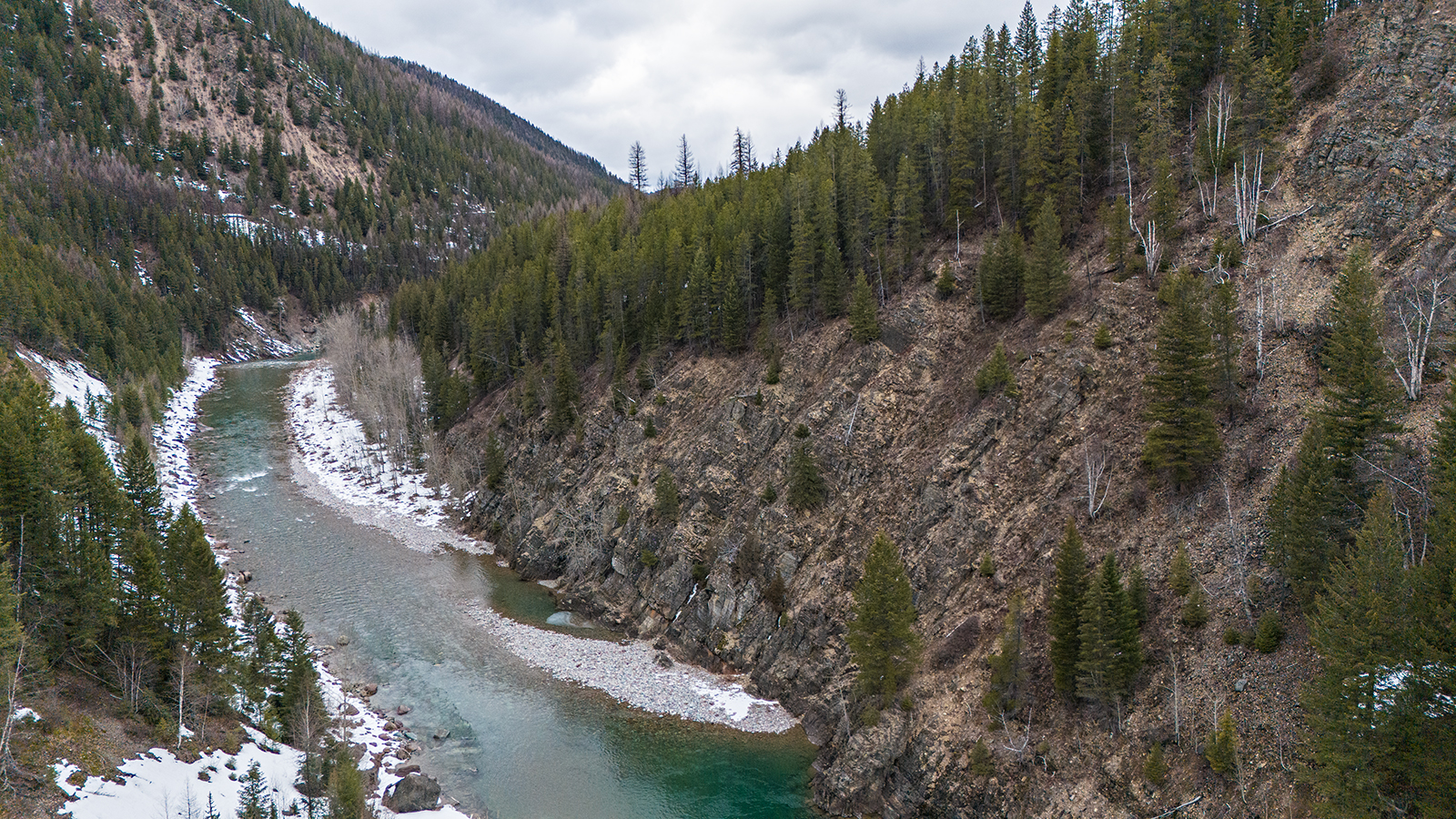
Despite April precipitation that helped boost snowpack in northwest Montana’s high elevations, hydrologists forecast below normal streamflows across the state while the three forks of the Flathead River is expected to hover around 80% of normal, according to the USDA Natural Resources Conservation Service (NRCS) water supply outlook report.
While last month’s storms helped stunt snowmelt runoff, NRCS hydrologist Florence Miller said the precipitation “fell short” of meaningful snowpack improvement following a warm winter.
The Northern Rockies received above average precipitation in April with the Noisy Basin SNOTEL station in the Swan Range, for example, receiving the most precipitation statewide with 9.6 inches while the Flathead River basin’s snow water equivalent (SWE) were 114% of normal. But Miller said the above normal precipitation did not recover snowpack deficits.
“Spring precipitation and cooler temperatures could help improve these forecasts, though in most regions, full recovery to normal streamflows is unlikely,” Miller said in a news release. “Current predictions of warm temperatures and below normal precipitation could result in more severe streamflow deficits, with rivers reaching well below normal volumes. Additionally, with snowmelt occurring earlier than normal, runoff volumes are likely to be shifted earlier in the season.”
As of May 8, the Flathead River basin SWE levels were 88% of normal, while the Sun-Teton-Marias River basin was at 63%. The Kootenai River basin’s levels were at 54%.
Despite the below average snowpack this spring, the Northern Rockies received an above-average precipitation of 118% throughout the water year, which runs from Oct. 1, 2025 through April 30, 2026.
In a winter defined by warm temperatures and variable precipitation, experts said the snowpack varied dramatically based on elevation, with many weather stations recording above average SWE levels while 32 SNOTEL stations recorded their earliest melt-out date, triggering early runoff.
For example, the 6,040-foot Stahl Peak SNOTEL station in the northern Whitefish Range on May 8 recorded 88% of normal SWE while the nearby 4,350-foot Grave Creek station had completely melted out, according to NRCS data.
“It’s a tale of two different snowpacks,” National Weather Service (NWS) hydrologist LeeAnn Allegretto said in a spring water supply outlook and flood report briefing.
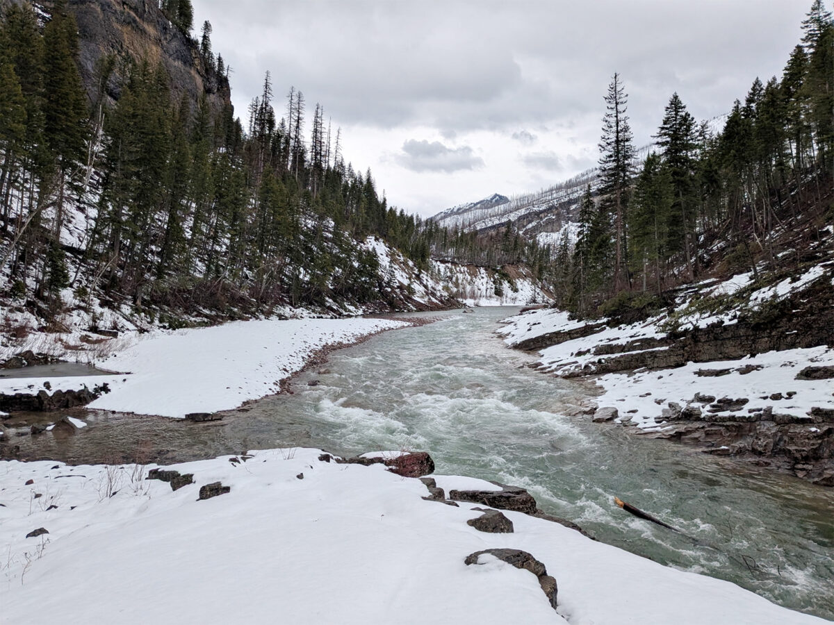
Allegretto said across the Northern Rockies, elevations below 6,500 feet as of early May had very little snow, while the snowpack above that elevation is normal to above normal but has already begun melting. Allegretto said the lack of snow at mid and low elevations means the waterways in northwest Montana pose a very low risk of flooding this spring.
“So what does this mean? What would it take to flood a river or stream with this scenario? The answer is a combination of warm temperatures, especially at night, heavy and/or persistent rainfall in addition to snowmelt from those high elevations,” Allegretto said. “Overall, there’s just not enough there. We just don’t have enough mid-elevation snow to really contribute to a lot of high streamflows.”
Despite the atmospheric rivers that swept through the region in December and March, Allegretto said consistent above-normal temperatures and inconsistent precipitation resulted in a shallow snowpack below 6,500 feet.
For example, the weather station at Glacier Park International Airport saw the fourth-warmest winter with an average of 30.6 degrees — a few degrees below the record of 32.5 degrees during the winter of 1933-1934 since Kalispell’s data collection began in 1899. The season ended 5.7 degrees warmer than average, according to NWS data.
“We got weather systems here and there, but for the most part without those atmospheric rivers that hit our area, we would have been in much rougher shape,” Allegretto said. “Overall, widespread above normal temperatures really set our region back for snowfall and was a major factor in how our winter panned out.”