Skillet Fire Prompts Evacuation Warning in Areas Near Olney
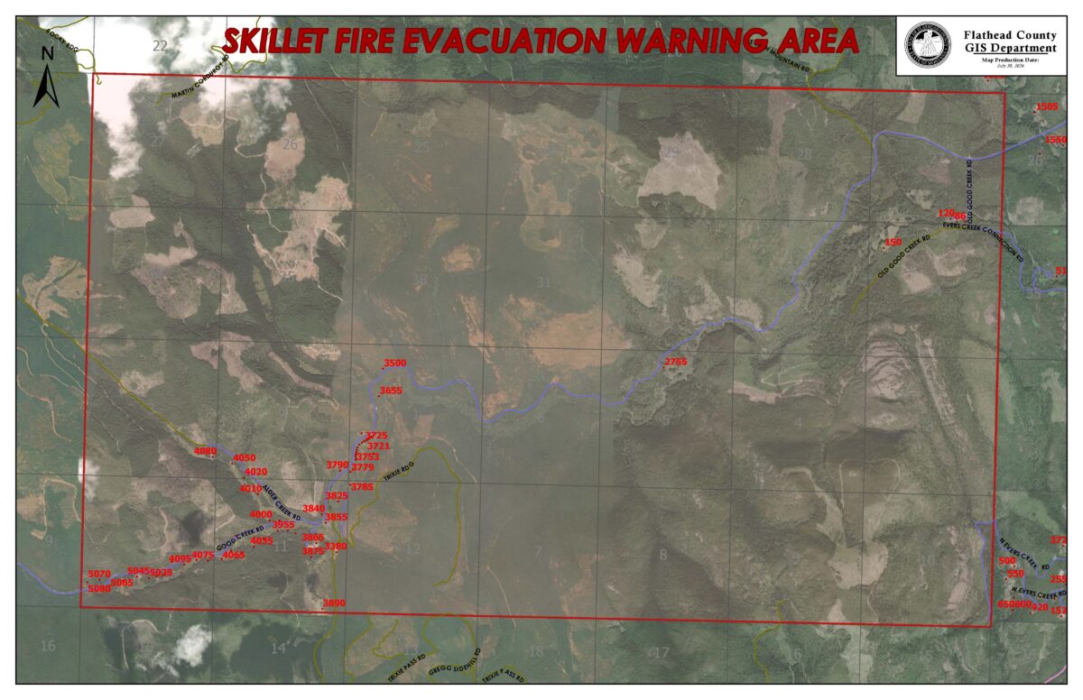
The warnings were issued for Good Creek Road, Alder Creek Road, Gregg Road and Old Good Creek Road as the blaze grows to 945 acres
By Maggie Dresser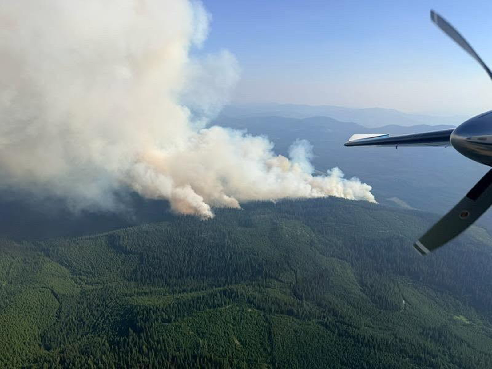
This story was updated Friday afternoon with the latest information.
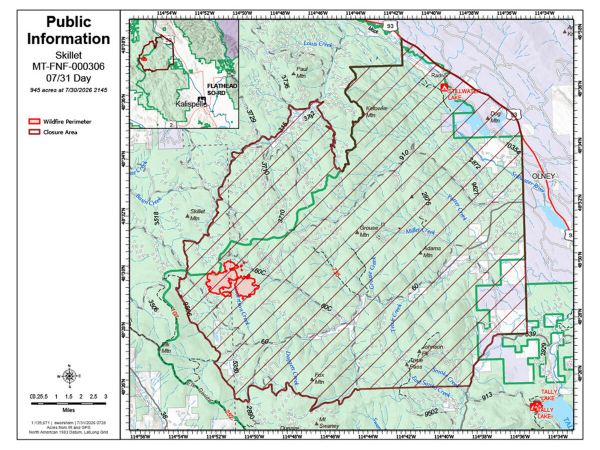
Officials have issued evacuation warnings for several roads in the Olney area as the Skillet Fire straddling the Kootenai and Flathead national forests grows to 945 acres, according to the Flathead County Office of Emergency Services (OES).
Evacuation warnings have been issued for Good Creek Road; on Alder Creek Road; Gregg Creek Road; and Old Good Creek Road.
An evacuation warning means a hazard may threaten a specific area and people in that area should be prepared to leave if conditions worsen or an evacuation order is issued, according to Flathead County OES.
The Skillet Fire located 15 miles west of Olney in the Tally Lake Ranger District was first reported on July 29 at 4:30 p.m. and grew approximately 650 acres in size overnight, according to Kootenai National Forest officials.
A Type 3 incident management team with a heavy equipment task force was ordered to respond to the blaze, which is burning in dead and down trees and thick timbers.
The fire continues to burn in dense timber spreading west from the Flathead National Forest over Martin Divide into the Kootenai National Forest. Young trees and harvested areas did not carry the fire and slowed its spread.
Firefighting aircraft delivered buckets of water and retardant to the fire throughout yesterday while hand crew continues working to secure roads in the Good Creek area to use as control lines, which is being aided by heavy equipment.
Crews today are focusing on anchoring on the south and southeast flank of the fire while ground crews are working with heavy equipment to open up blowdown areas for firefighters to engage with the blaze.
A fire weather watch has been issued Saturday as a cold front is forecast to bring strong, shifting winds while crews prepare for increased fire and rapid growth.
Firefighting aircraft will continue operations with water and retardant delivery and assisting ground crews.
Flathead and Kootenai national forest officials have closed the following roads:
Good Creek Road (60); Alder Creek Road (60C); Martin Creek Road (910); Plume Creek Road (2890); West Plume Road (2883); Keith Mountain Road (2875); Miller Creek Road (9650); West Advent Creek Road (3710); Alder Slope Road (3512); Twin Meadows Road (3520); Martin Divide Road (3708).
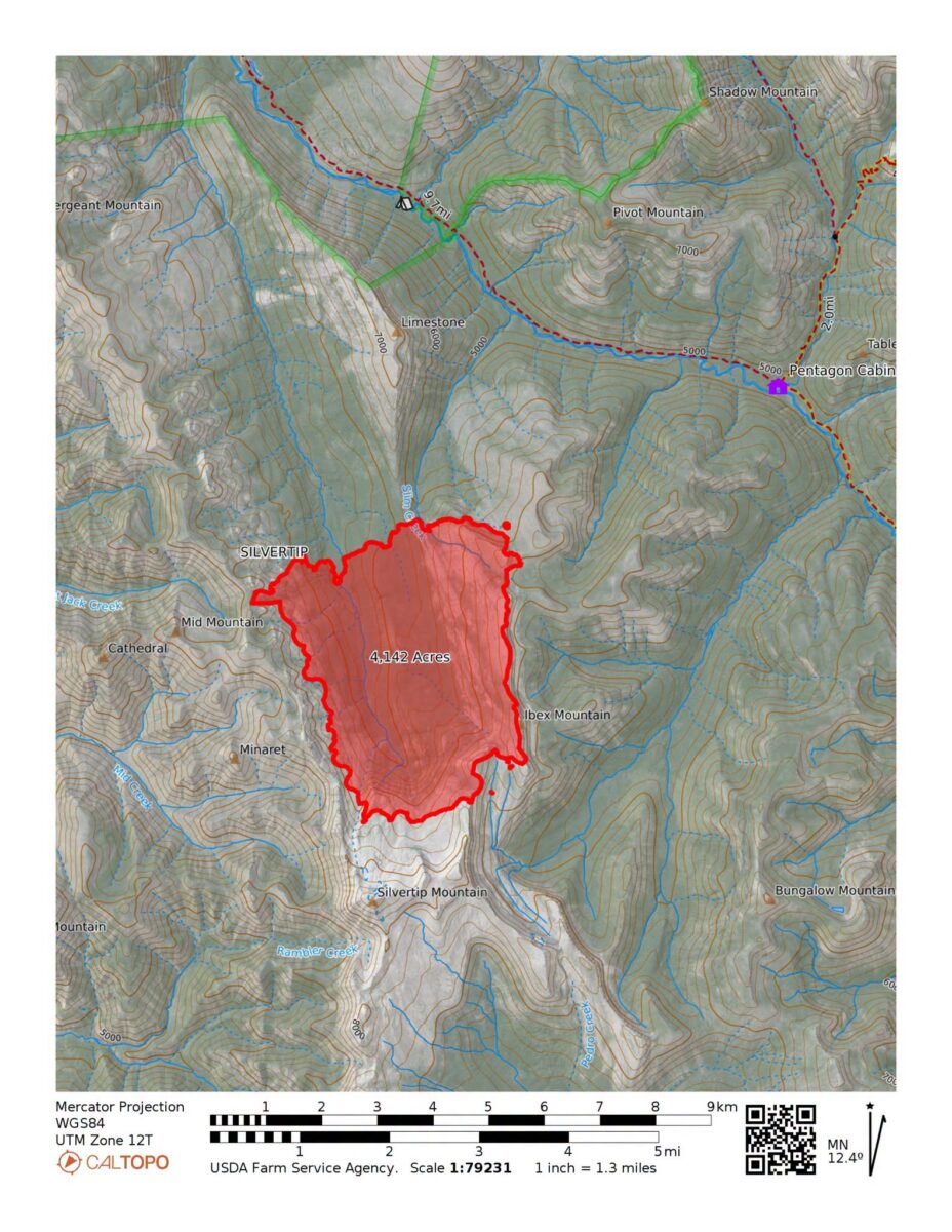
In the Bob Marshall Wilderness, the Silvertip Fire as of this afternoon was burning 4,142 acres since lighting ignited the blaze last Friday.
The fire is located 13 miles southeast of Spotted Bear Ranger District and approximately 5 miles southwest of Pentagon Cabin in a high-risk and remote area, presenting challenging conditions for firefighters and limiting personnel due to difficult access and the potential for critical fire conditions in the forecast.
Crews yesterday successfully inserted a remote-start pump into the Pentagon Cabin area to help protect critical value at risk. A lookout is posted to monitor fire activity.
While the Silvertip Fire has experienced minimal growth over the past two days, pockets of fire continue to burn in the upper sections of Silvertip Creek and are gradually decreasing in those areas. Additional pockets of fire are slowly moving along he head of he West Fork of Wall Creek while fire remains active on the west aspect of Silvertip Creek and is progressing northward toward the saddle at the head of Slim Creek.
Officials are canceling Silvertip Cabin reservations starting Aug. 2 for the remainder of the rental season due to ongoing fire activity. Reservation holders will be receiving further details via email.
The following trail closures have been issued.
Sergeant Creek–Corporal Creek Trail (Trail 88)
Closed from Spotted Bear River to its junction with Trail 584 (Harrison Creek Trail).
Harrison Creek Trail (Trail 584)
Closed from its junction with Corporal Creek Trail 88 to its junction with Trail 103 and Trail 89.
Trail 103
Closed from its junction with Trail 524 to its junction with Trails 89 and 584.
Silvertip Trail (Trail 89)
Closed in its entirety.
Spotted Bear River Trail (Trail 83)
Closed from its junction with Silvertip Trail 89 to its junction with Wall Creek Trail 90.
Wall Creek Trail (Trail 90)
Closed from its junction with Trail 83 to its junction with Trail 229.
West Fork Wall Creek Trail (Trail 229)
Closed in its entirety.