The Latest
– Lake McDonald area of Glacier National Park under evacuation order
–Shelters opened in Hungry Horse, Libby, Plains and Eureka
–Homes threatened in Lincoln, Sanders counties
Updated: Sept. 3, 6:30 p.m.
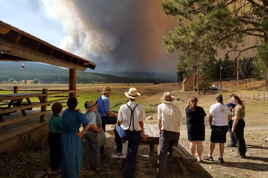
A large section of Glacier National Park is being evacuated today as the Sprague Fire continues to grow east of Lake McDonald.
Park officials announced Sunday morning that an evacuation order was in effect at 10 a.m. for the area from the south end of Lake McDonald all the way to Logan Pass. It is unclear how long the evacuation will be in effect.
The Apgar area is not included in the evacuation warning at this time and will remain open, according to park officials.
Logan Pass remains accessible from the east side of the park.
As of Sunday morning, the Sprague Fire had burned more than 5,100 acres just east of Lake McDonald. Fire managers said the blaze was active all day Sunday and that they had not be able to get an accurate measurement of how much it has grown, although it was expected be significant.
Firefighters spent most of Sunday doing structure protection around the Lake McDonald Lodge. Sprinklers were set up around the lodge and late in the day art and other removable artifacts were being taken out of the building for safe keeping. Earlier this week, the fire destroyed the historic Sperry Chalet.
The Red Cross will open a shelter at 5 p.m. at Canyon Elementary School in Hungry Horse for people displaced by the Sprague Fire.
A Red Flag Warning is in effect for Glacier National Park until 9 p.m. on Sept. 4. The National Weather Service is forecasting sustained winds from the east of 10 to 20 miles per hour with gusts up to 30 miles per hour through Monday.
Firefighters across the region are bracing for what could be a hectic day on the fire line with a Red Flag Warning in effect for nearly all of western Montana until 9 p.m. and a cold front tonight that is expected to bring a dramatic change in wind.
As of Sunday morning, there are at least 15 large fires burning in Northwest Montana stretching from the Canadian border all the way into the Bob Marshall Wilderness.
The Caribou Fire west of Lake Koocanusa doubled in size on Saturday to more than 13,000 acres. The fire has forced the evacuation of the small community of West Kootenai, located just west of Lake Koocanusa and south of the Canadian border. According to fire managers, some structures have been lost to the fire but firefighters have not been able to get close enough to assess the damage.
The Gibralter Ridge Fire has burned more than 6,000 acres east of Eureka and a number of evacuation warnings are still in effect.
A Red Cross Shelter has been set up at the First Church of God, 1295 Second Ave. East in Eureka for people impacted by either the Caribou or Gibralter Ridge fires.
The West Forks Fire north of Libby has burned 1,600 acres in the Quartz Creek and Bobtail Ridge area in the Libby Ranger District. An evacuation warning has been issued by the Lincoln County Sheriff’s Office for the upper end of Bobtail Road north of Bobtail Cutoff, Hutton Drive, Bobtail Cut-off, including Winter Road and Whitetail Road, Pipe Creek Road from Forest Way, including Lodge Pole Road, Blue Mountain Lookout Road and Doak Creek Road, and Creekside Road to 17 Mile Road.
A Red Cross Shelter has been established at the Libby Assembly of God Church, 105 Collins Ave. in Libby for anyone impacted by the West Forks Fire.
A public meeting will be held for the West Fork Fire on Sunday at 4:00 p.m. at the Libby Middle/High School at 150 Education Way.
In Sanders County, six new fires in the Plains and Thompson Falls area are being managed as the Highway 200 Complex. The Sheep Gap Fire west of Plains is firefighters’ top concern after scorching more 4,700 acres since it started on Aug. 28. As of Sunday morning, at least 70 homes threatened by the fire and are under mandatory evacuation. The Reader and Reader 2 Fires have burned a total of 144 acres on the south side of the Clark Fork River between Plains and Thompson Falls. Further south, the Cub Creek Fire has burned more than 1,000 acres in a remote part of Sanders County. The Deep Creek Fire north of Highway 200 has burned 2,225 acres and is threatening a nearby fire lookout. Two other fires — the 637 acre Moose Creek Fire and the 188-acre Miller Creek Fire — are currently unstaffed due to limited resources.
A Red Cross Shelter has been set up at the Plains Alliance Church at 505 West Fifth Street for those impacted by the Highway 200 Complex fires.
A public meeting is scheduled to discuss the fires at the Plains High School at 1 p.m. on Sunday.