Forecasted Winds Prompt Evacuation Warning for Apgar, West Glacier
Additional evacuations in Plains as crews await cooler, wetter weather
By Beacon STaff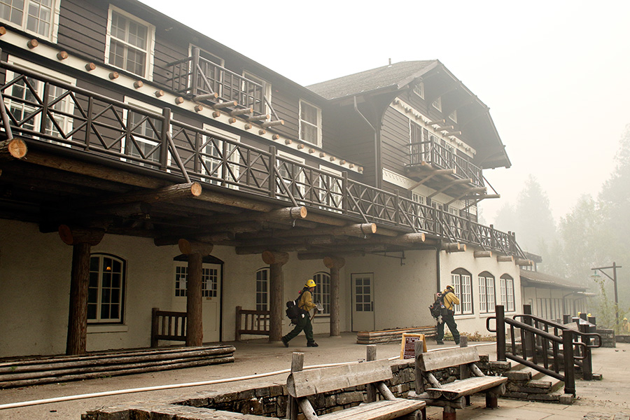
The Latest
— Pre-evacuation notice issued for West Glacier, Apgar
— Residents along Black Jack and Mountain Roads near Plains issued pre-evacuation warnings
— U.S. Sen. Daines to host teletownhall on fires at 6:15 p.m. Wednesday
Updated: Sept. 13, 12 p.m.
Authorities are issuing pre-evacuation warnings for Apgar and West Glacier as firefighters battling the Sprague Fire in Glacier National Park prepare for a dramatic shift in winds later this afternoon.
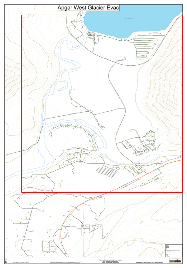
Flathead County Sheriff Chuck Curry said law enforcement would begin going door-to-door at 12 p.m. alerting residents to prepare for the potential need to evacuate at a moment’s notice. The warnings are being issued to people in the Apgar area, including the campground and Apgar village, as well as portions of West Glacier, including West Glacier village, the Highline Boulevard neighborhood, the golf course neighborhood, the Wild River Drive and Grouse Ridge Road neighborhood, and west toward the Sloan Lane neighborhood.
Concerns are centered on erratic winds that could drive the fire southwest over Snyder Ridge and toward populated areas around the west entrance of Glacier Park and U.S. Highway 2.
Evacuation orders remain in place from Lake McDonald to Logan Pass, and crews have continued their structure-protection work at the Lake McDonald Lodge with sprinklers and road spraying to create humidity and a micro-rainforest climate around the lodge. Pump and hose systems have also been installed at the Avalanche Creek Campground, Trail of the Cedars, and the North McDonald Lake area.
Fire activity was light on Tuesday for the Sprague Fire, which has burned 14,795 acres about five miles northeast of West Glacier. The blaze continues to flank to the north of Mt. Brown and make its way down toward the lake.
Three water-dropping helicopters kept hot spots in check on Mt. Brown near the lookout and on Snyder Ridge. Aircraft will be used on Wednesday to battle the fire’s southwestern flank to decrease intensity and prepare for the shift in winds.
Crews expect increased activity on Wednesday evening as the weather changes.
Adair Peak Fire, located 19 miles north/northwest of West Glacier, has burned 2,890 acres and continues to burn in conifer stands along Logging Lake. Structure protection around patrol cabins continue.
Due to the Adair Peak Fire, the Inside North Fork Road is closed from Polebridge Ranger Station south to Camas Creek. This closure also includes the Logging Creek and Quartz Creek campgrounds.
The Elder Creek Fire, burning 2,261 acres, 282 of which are in Glacier Park, showed little movement on Tuesday as the winds blew the fire back into itself.
The following trails are closed due to fire activity: Kishenehn Trail from the road to the Canadian border; Kishenehn Creek Trail from the Patrol Cabin to the border; and the Kintla Trail from Kishenehn Creek to Boulder Pass Trail (over Starvation Ridge).

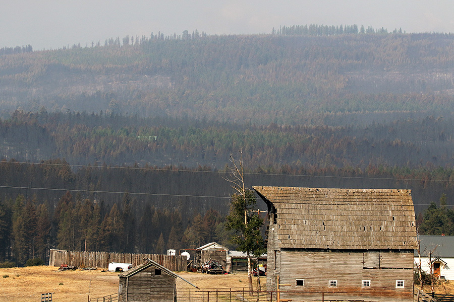
Fire activity across Northwest Montana roared back to life on Tuesday as gusty winds and warm temperatures fueled flames at several existing fires, including a blaze in Plains that forced renewed evacuations.
Heavy smoke is once again blanketing the Flathead Valley and the state Department of Environmental Quality listed the air quality conditions as “unhealthy” on Wednesday.
Fire crews are preparing for another shift in wind and potentially beneficial weather as a cold front is expected to make its way into the region in the coming days.
The National Weather Service predicted a “dramatic change” in weather as a cold front makes its way into the valley, with snowfall expected at 6,000 feet elevation and higher in western Montana. The agency also said conditions could moderate on Saturday and Sunday with frost and freezing potential possible Sunday morning.
A late-night evacuation order prompted residents of Swamp Creek Road in Plains to leave their homes as the Sheep Gap Fire whipped up activity due to increased winds.
At 9 p.m. on Sept. 12, the Sanders County Sheriff’s Office closed the area. Anyone found in this area, on property not their own, will be arrested for trespassing, authorities say. Residents along Black Jack and Mountain Roads have been issued pre-evacuation warnings. Affected residents are being contacted individually by law enforcement officials.
The Sheep Gap fire, part of the Highway 200 Complex, has burned 13,414 acres and is 40 percent contained, and firefighters continue to provide structure protection along the east flank of the fire.
Wednesday was expected to bring increasing clouds with a chance of isolated showers or thunderstorms. This potential weather change could help to moderate fire behavior but the winds could hamper efforts, according to fire managers.
The Northern Rockies Eastern Montana Type II Team will assume command of the Highway 200 Complex Fires at 6 p.m. on Wednesday. More than 300 firefighters are assigned to the incident.
The Deep Creek Fire is zero percent contained and has burned 5,733 acres, with pre-evacuation orders still in effect east of the Clark Fork River in the Blue Slide area. The fire continues to back downhill toward Graves Creek, and crews continue to hold the fire at existing lines.
The Cub Creek Fire is zero percent contained and has burned 4,034 acres, with pre-evacuation orders for an area west of Highway 200 from White Pine Creek to Cherry Creek. The north and east sections of the fire threaten to overrun the holding lines and are challenging the crews.
The Miller Creek Fire made a significant run east on Tuesday and crews continue to monitor and patrol the fire growth. It is zero percent contained and has charred 892 acres.
The Reader Fires are both 95 percent contained, having burned 152 acres total. Mop-up activities continue and resources are shifting to the Cub Creek Fire.
The Caribou Fire continues to burn 21 miles northwest of Eureka and has scorched more than 23,000 acres. Hand crews continue to control lines and await cooler temperatures. Firefighters and equipment operators will build direct and indirect fireline along the north side of Marias Mountain from Young Creek west to Lime Creek.
Fire progression on the southwest side of the fire has been slowed by existing timber harvest units and roads in the area. Heavy equipment completed the contingency fireline in the Blacktail Creek area north to the Canadian border.
Helicopters and Canadian CL-415 water scoopers will be used again today to help slow fire growth. On Tuesday, four scooper planes dropped a total of approximately 140,800 gallons of water on active fire areas.
Pre-evacuation warnings remain for all areas in West Kootenai. This includes West Kootenai North and South of Tooley Lake, Spring Creek, Dodge Creek, and Basin Creek.
East of Eureka, the Gibralter Ridge Fire was active on Tuesday with short-range spotting, short crown runs, and wind-driven runs, progressing south and east to the Whale Creek Basin and south and west to the Williams Creek drainage.
Crews expect forecasted winds to increase growth in the basin and drainage areas, though lower temperatures could moderate fire growth.
A pre-evacuation warning remains in effect for the Sherman Creek, Griffith Creek, Therriault Pass Road, Stevens Creek, Glen Lake and Sinclair Creek (south/east of West Road) areas.
Grave Creek Road and the Ten Lakes Recreation area are closed above the Grave Creek/Foothills Road junction.
The Scalp Fire, located three miles south of Gooseberry Cabin on Bow Mountain in the Bob Marshall Wilderness, continues to move down Park Creek and toward Bowl and Strawberry creeks. To the west, the fire is slowly moving uphill towards Dean Lake and the Trilobite Range. Minimal growth occurred to the northeast with the frontal passage Saturday evening. Crews continue to monitor the fire from Gooseberry and Wrong Creek Cabins.
Public information meetings about the fire are scheduled for Wednesday, Sept. 13 at 6 p.m. at the Heart Butte School-Multi-Purpose Room and Thursday, Sept. 14 at 6 p.m. at the Dupuyer Community Hall.
The Strawberry Fire was quiet on the Flathead National Forest side on Tuesday, with some growth in the head of Strawberry Creek near Badger Pass. The area closure was expanded to include the Cox Creek drainage.
Due to increased late afternoon activity on Sept. 11, the Pondera County Sherriff issued evacuations for dam keeper and the four or five ranches in the Swift Reservoir area. A pre-evacuation notice was issued for Heart Butte and down Swift Dam Road toward Dupuyer. Additional evacuations are possible.
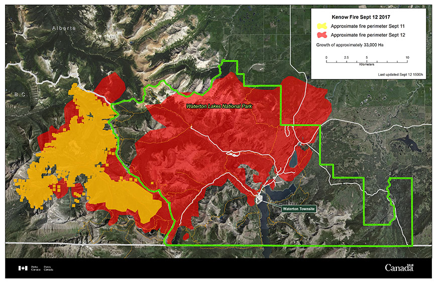
North of Glacier Park in southern Alberta, the Kenow Kire is firmly established in Waterton Lakes National Park and threatening the townsite of Waterton, including the Prince of Wales Hotel. The wildfire has quadrupled in size in recent days, burning more than 108,000 acres and demonstrating extreme fire behavior due to high winds and critically dry fuels. The fire is moving northeast down the Cameron Valley along the Akamina Parkway. On Monday the fire began to move north at a high rate of spread through the grasslands along the park’s Entrance Road.
The Parks Canada Visitor Information Centre, located on the Entrance Parkway just before the townsite of Waterton, burned down overnight and the trailhead to Bear’s Hump was also severely charred. Details of additional damages remain limited at this time, according to parks officials.
“At this time, the majority of the townsite appears to be intact,” fire officials said in a statement. “Extensive fire protection measures were effective in safeguarding the majority of infrastructure and facilities within the community and at the Prince of Wales Hotel.”
—
U.S. Sen. Steve Daines, R-Mont., announced that he will host a teletownhall on Wednesday, Sept. 13 at 6:15 p.m. to discuss the wildfires raging across the state. Daines said he would answer questions about the fires and what can be done on a federal level. Montanans can join Daines’ teletownhall by texting “SenatorDaines” (one word) to 828282 or by calling any of Daines’ offices to get registered for the event. Office locations and phone numbers are available here.
The teletownhall will be livestreamed on Daines’ Facebook page, available here: https://www.facebook.com/SteveDainesMT/