For more than two decades, every river and creek that David Thompson found ran east, carrying snowmelt from the Rocky Mountains to Hudson Bay. That all changed on June 22, 1807.
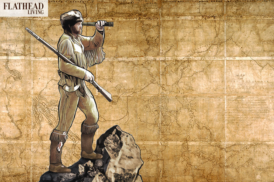
Thompson, a Canadian fur trader, surveyor and explorer, had spent his entire life exploring the North American wilderness that extended far beyond the edges of 19th century civilization. Through it all, he had one goal that overshadowed the rest: to find and document the land that lay between the Rockies and the Pacific Ocean.
On a late spring day in 1807, Thompson departed an encampment at Kootenay Plains, Alberta (about 60 miles north of Lake Louise) and headed into the mountains. After a day and a half, his party was stalled by mud and snow left over from a long winter. Thompson sent almost everyone back to the safety of Kootenay Plains and stayed in the mountains for three weeks. While waiting for winter to release its grip on the mountains, Thompson and a few assistants chopped wood and gathered other items they would need to complete their journey. Finally, on June 22, the snow had cleared, and they continued west, farther than any other European had traveled into the Canadian Rockies.
By midday, they reached a meadow between two peaks where spring waters rose from the earth. But unlike all the other water Thompson had found in the rugged North American interior, this water flowed west. Thompson had reached the Continental Divide. Later that day, he recorded in his journal the beginning of what he knew would be an epic journey: “May God in his mercy give us to see where its waters flow into the ocean and return in safety.”
Over the next five years, Thompson would explore, survey and map the Northwest from the mountains of modern Alberta to the coast. He would also spend a lot of time in what would eventually become Montana, establishing the state’s first-ever trading post west of the Rockies and exploring everything from the Kootenai region to the Mission Valley. While Thompson’s American counterparts, Meriwether Lewis and William Clark, have long been celebrated characters in the state’s history, it was actually the Canadian Thompson who put Northwest Montana on the map — literally.
««««««««««•»»»»»»»»»»
David Thompson was born in London in 1770. His father died when he was 2 years old, and his family struggled to get by. Thompson attended the Gray Coat School, a royally supported institution to educate poor children, where he excelled at mathematics. Historians have said Thompson would have likely ended up in the Royal Navy had the Hudson Bay Company not come calling. The fur trading company, established in 1670 to harvest the bounty of a North American continent that was still mysterious to Europeans, frequently called upon the Gray Coat School for apprentices, and Thompson was an ideal candidate. In 1784, Thompson finished school and prepared to head to the New World. For successfully completing his schooling, he received a Hadley’s quadrant, a gift that would prove useful in life. He soon boarded the Prince Rupert and set sail across the Atlantic, arriving at the desolate outpost of Churchill, Manitoba, described by historian and author D’Arcy Jenish as a “miserable cluster of wooden buildings.”
Thompson soon realized just how isolated his new life would be in the New World, later writing, “While the ship remained at anchor, from my parent and friends it appeared only a few weeks’ distance, but when the ship sailed and from the tip of the rocks I lost sight of her, the distance became immeasurable.” Thompson never saw his mother or his native England again.
The young apprentice would spend the next few years learning the fur trade and embarking on expeditions deep into the wilderness. In that position, he often spent time with the region’s native inhabitants, learning their various languages and dialects, another tool that would come in handy in later years.
Thompson’s life took yet another dramatic turn in 1788 when he broke his leg cutting firewood. According to company records, Thompson fell down a river embankment and broke his thigh bone after his right leg got stuck between a log and a sled. Thompson was bedridden for months, and it would take him more than a year to recover from his injuries. But the injury turned out to be a blessing in disguise. Looking to entertain himself during his recovery, he would often pester surveyor and cartographer Philip Turnor with questions about his trade. Because the Hudson Bay Company was always looking for more surveyors and mapmakers, Turnor decided to teach the young man everything he knew. Thompson would often stay up late into the night doing astronomy calculations by candlelight. The work paid off, and in a 1790 letter to company officials back in London, Turnor vouched for Thompson’s abilities: “Should he ever recover his strength far enough to be capable of undertaking expeditions I think Your Honors may rely on his reports of the situation of any place he may visit.”
Thompson eventually recovered from his injury and finished his apprenticeship in 1791. Traditionally, the Hudson Bay Company gave its apprentices a suit when they completed their tour, but Thompson had another idea: he wanted surveying instruments instead. The company complied with his request, and Thompson put them to use making maps of the region. While most of the fur traders and surveyors working in the wild were driven by money, Jenish, the author and historian, wrote in his book “Epic Wanderer” that Thompson was different. “Thompson was driven by an uncommon desire and iron resolve to see new lands.”
The Hudson Bay Company was not the only outfit working in the wilderness, as the North West Company had been established in Montreal in 1789 as a direct competitor. The North West was rapidly expanding when, in 1797, it lured Thompson away from the Hudson Bay Company with an assignment he couldn’t refuse. Thompson would become the company’s lead astronomer and surveyor tasked with finding the source of the Mississippi River while also mapping the 49th parallel, which had recently been designated as the border between British and American territories.
The late 1790s and early 1800s were an exciting time for Europeans in the North American wilderness. As Thompson pushed west across the Canadian Shield, American-backed explorers Meriwether Lewis and William Clark were setting out to map the newly acquired Louisiana Purchase. Both countries had their sights set on the Pacific Northwest, a disputed swath of land dubbed Oregon Country by the Americans and the Columbia District by the British. Thompson’s bosses at the North West also had their own economic reasons to explore the Pacific Northwest. The Hudson Bay Company long had the best shipping port along the west coast of its namesake bay, whereas the North West had to transport its furs all the way east to Montreal for shipment back to Europe. If the North West Company could find a western outlet — like the Columbia River, the mouth of which was discovered by an American in 1792 — it could better compete with its rival. But at the time, the land from the Continental Divide to the Pacific Ocean was unknown by European settlers.
Thompson pushed west into what would eventually become Alberta, establishing a trading post called Rocky Mountain House at the confluence of the Clearwater and North Saskatchewan Rivers. In the summer of 1807, after Thompson and his team reached the Continental Divide, he founded a trading post called Kootenae House, located near present-day Invermere, British Columbia, that would become the first North West trading post in the Columbia Basin.
The establishment of a post within the Columbia Basin irked the Americans. In September 1807, a U.S. Army lieutenant wrote to Thompson urging him to stop his march west, and that if he did not, the military would “regretfully apply force.” Thompson dismissed the threat.
Over the winter, Thompson learned that the Cree Indians had gone to war with the Bloods and the Blackfoot. The latter tribes had a reputation for being hostile toward Europeans — during Lewis and Clark’s journey west a couple years earlier, they had gotten into a now well-known and fatal fight with the Blackfoot’s southern counterpart, the Blackfeet. The incident was the first bloodshed between a western tribe and Americans. Thompson knew if the Blackfoot and Bloods were preoccupied with war, he could push south and west uninterrupted.
Thompson and his crew headed down what would eventually be called the Kootenai River — then known as McGillivray’s River, named for one of Thompson’s early associates, Duncan McGillivray — into modern Northwest Montana and Idaho. Thompson spent time near today’s Bonners Ferry before pushing south to a large lake that would eventually be known as Lake Pend Oreille. In the fall of 1809, Thompson and his men started building a trading post near the lake, dubbed Kullyspell House.
Kullyspell House became Thompson’s homebase for the fall as he explored the region. In November, he and his team headed southeast along the Clark Fork River into Montana. The late-season trip took more than a week, and, according to Jenish, they ran out of food during the final two days of the journey but still pressed forward. Near present-day Thompson Falls, they found a spot where the river bent east and decided to stop. Their first duty was to spend a few days hunting to feed themselves after the long river journey. With wild game in their bellies, they turned their attention to building yet another trading post, this one named Salish House. The trading post was Montana’s first such establishment west of the Rockies.
During his time at Salish House, Thompson got to know many of the local native tribes, who gave him an Indian name, Koo Koo Sint, which means “The man who looks at stars.” The Salish Indians came to respect Thompson because of his high moral code. In one instance, one of Thompson’s men had tried to seduce the daughter of one of the tribe’s leaders. The leader told Thompson that the punishment for such conduct was death, but Thompson could not afford to lose another man. Thompson said that if the tribal members killed the culprit, he would have to leave the area and camp with members of an enemy tribe. Instead, Thompson said he would warn the man to stop making advances on the young woman. If the man did not stop, Thompson said the tribe could “geld,” or castrate, the man.
By 1810, Thompson was due for some well-deserved time off, but fate had different plans. At about the time Thompson was going to return to Montreal to spend time with his wife and children, John Jacob Astor, a German-born merchant who emigrated to America, was preparing to send two expeditions to the Pacific Northwest: one by sea and another by land. Astor had initially reached out to the North West to see if they could work together, but the company was concerned about being a minority partner in the effort. Astor, who established a new fur company, and the North West went their separate ways, and the latter decided to send Thompson back to the Pacific Northwest immediately to establish the route from the Columbia’s headwaters all the way to the mouth of the great river. While the North West’s owners were thinking purely of economics, Thompson knew the trip would be his greatest yet, according to Jenish.
“(Thompson) realized that he had been given an opportunity to complete a survey of the great river of the west,” Jenish wrote. “He would soon have the last piece he needed to create a map stretching from Hudson Bay to Lake Superior to the Pacific.”
Thompson and about two dozen men headed back west in late 1810 and spent a rough winter in the Canadian Rockies. In the spring of 1811, they were back in the heart of the Pacific Northwest and were heading west down the mighty Columbia River. When Thompson reached the mouth of the river in mid-July 1811, he found that Astor had already established a fort from sea, but the Canadian explorer had become the first white man to ever travel the entire Columbia River, from its headwaters to the Pacific Ocean. The trip helped secure North West’s place in the region.
After spending a few days on the coast, Thompson and his team returned east. He spent the next year managing the North West’s trading operations while also exploring new territory. In March 1812, Thompson traveled east on the Clark Fork and Flathead rivers and then overland to the body of water that would eventually be called Flathead Lake.
In 1812, Thompson returned east with years’ worth of notes and drawings of the Inland Northwest, all the ingredients for what would be his greatest work yet: a map of the wildlands that lay beyond civilization. The map of the Northwest became the basis for all future atlases of the region and was used for decades after it was created.
Thompson spent the rest of his life in eastern Canada. Due to a number of bad investments, Thompson died penniless in 1857 at the age of 86. Despite that undignified ending, Thompson left his mark on North America, and is known for mapping vast swaths of the continent, including Northwest Montana. In his 28 years exploring the North American wilderness, Thompson covered more than 55,000 miles, more than any of his contemporaries.
Read more of our best long-form journalism in Flathead Living. Pick up the winter edition for free on newsstands across the valley, or check it out online at flatheadliving.com.